Significantly warmer weather for Seattle ahead
Even though temperatures are below average this weekend, we're forecasting a significant rise in temperatures by next weekend.
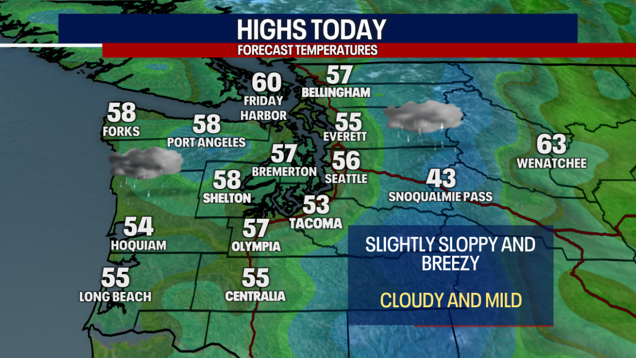
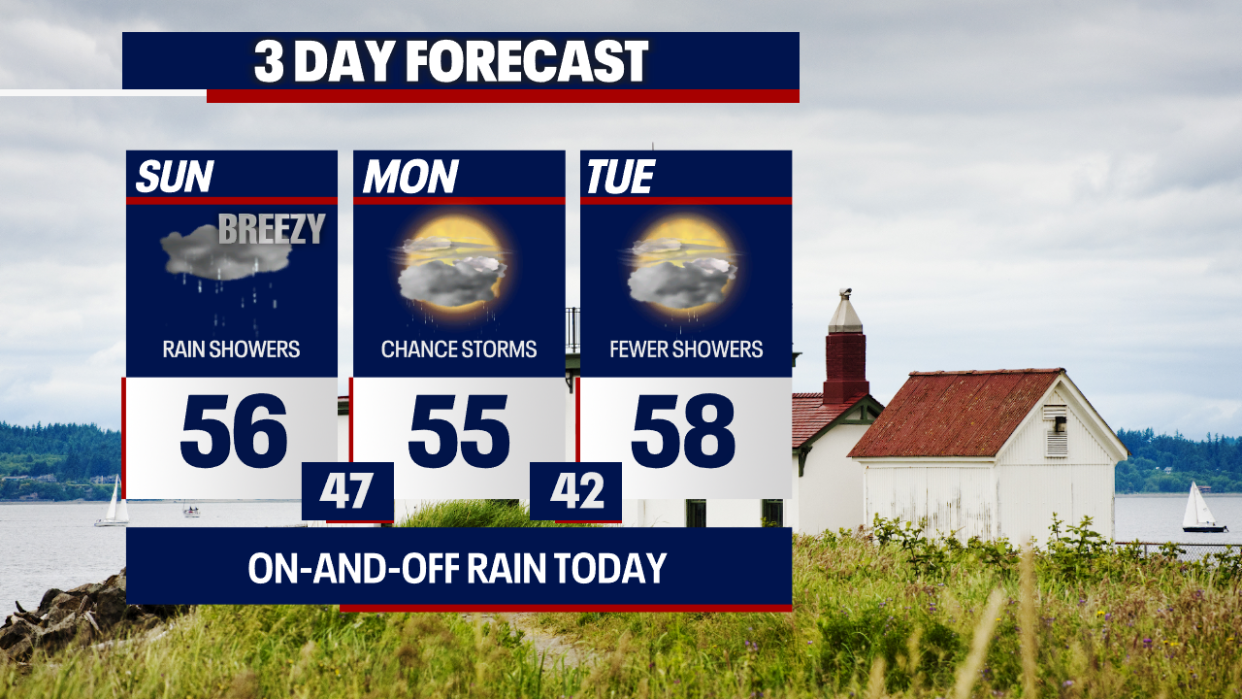
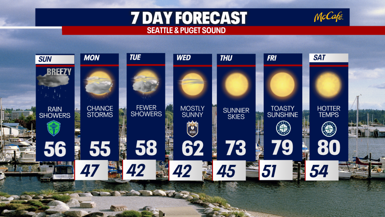
For today, highs will only lift into the mid to upper 50s for most. Cloudy skies, slightly breezy weather and on-and-off showers are expected.
At times Monday and Tuesday, there may be periodic mountain snow. Right now, it seems possible that Stevens and White Passes could accumulate between two and six inches (or more) of snow. A rain/snow mix is possible for Snoqualmie Pass. It'll be a little more challenging for snow to stick to I-90 at Snoqualmie Pass simply because road temperatures are mild going into this event. Stay with us for updates because this forecast will likely change!
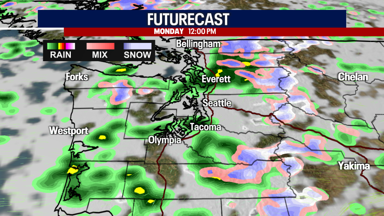
Monday, we'll alternate between showers and sunbreaks. There may be a few isolated lightning strikes, but any thunderstorms would be relatively weak.
Even sunnier skies are on the way for Tuesday, but we can't guarantee an entirely dry day.
Shower-free weather takes over on Wednesday as temperatures rebound into the low 60s. The low 70s return on Thursday. Due to a ridge of high pressure, temperatures boost to the upper 70s on Friday, skyrocketing to the low 80s on Saturday!
The warm wave lingers into Mother's Day as well. Hope you enjoy the sunshine!
An important note: water temperatures remain dangerously cold. Practice water safety if you're heading to a river, lake or Puget Sound this weekend. Be extra careful!
Take care,
Meteorologist Abby Acone
Follow me on Facebook (Meteorologist Abby Acone), Instagram @abbyaconewx and TikTok @abbyaconetv
