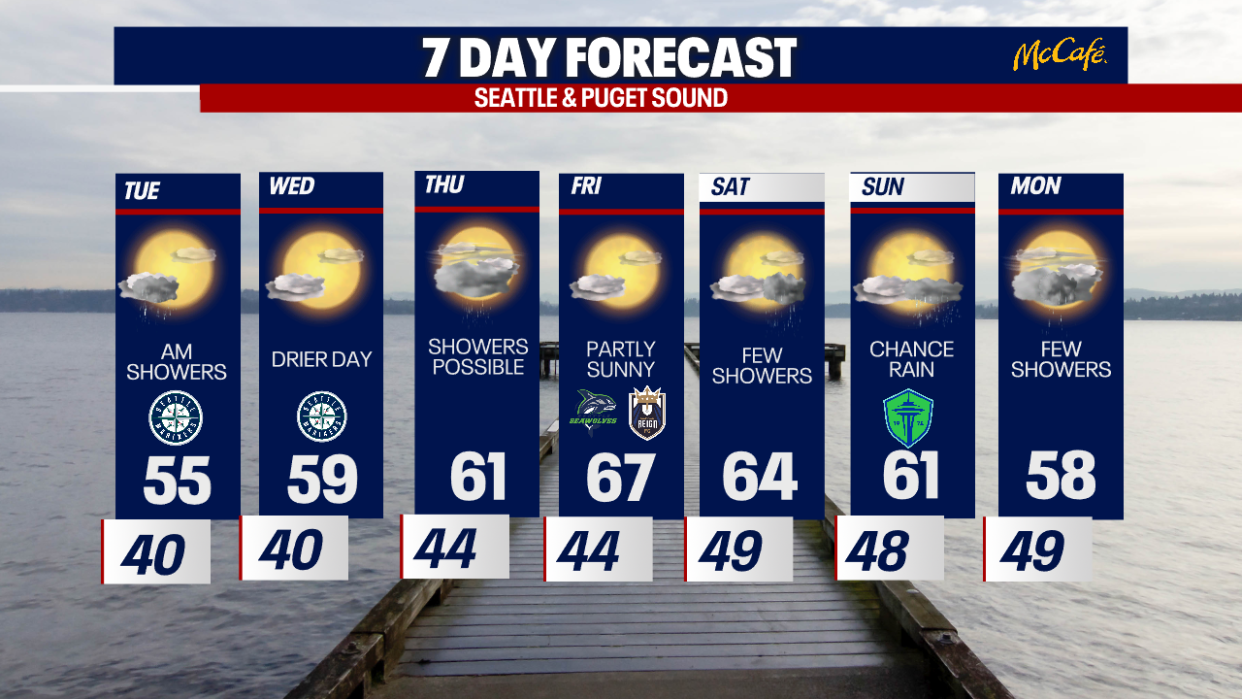
Seattle Weather: Showers to start Tuesday, drier afternoon
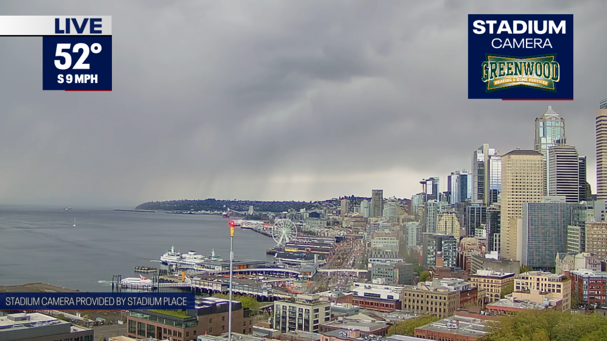
It was a cool day with rounds of showers and sunbreaks. The chances of thunderstorms continue this evening.
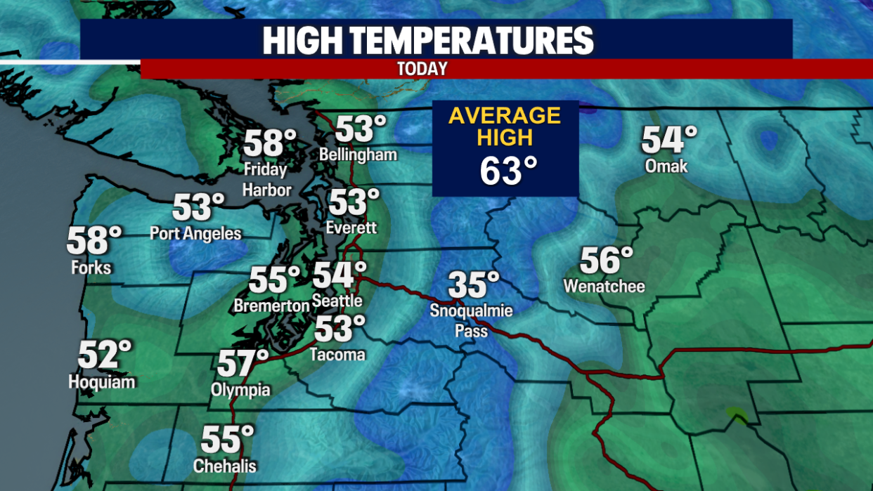
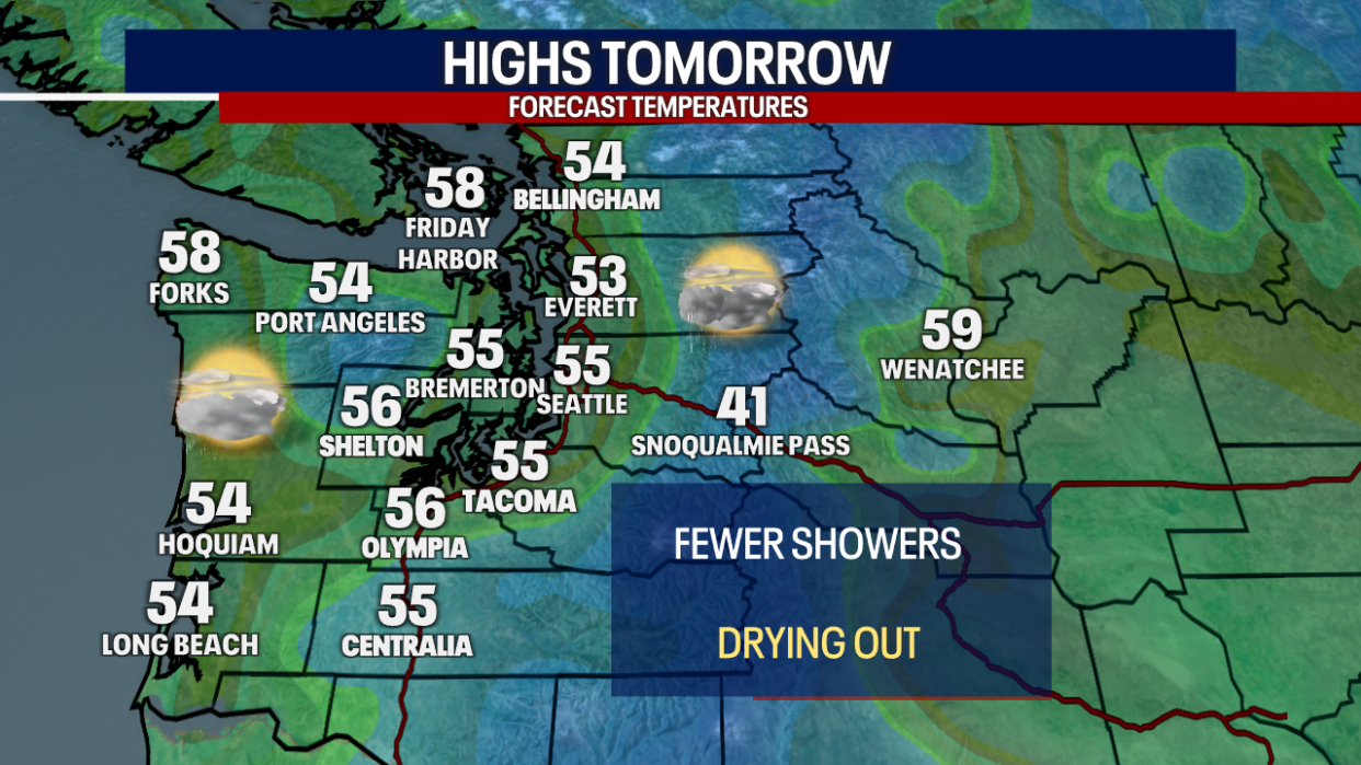
Highs today were well below the seasonal average, only in the mid 50s. It was10 degrees below what we usually see this time of year.
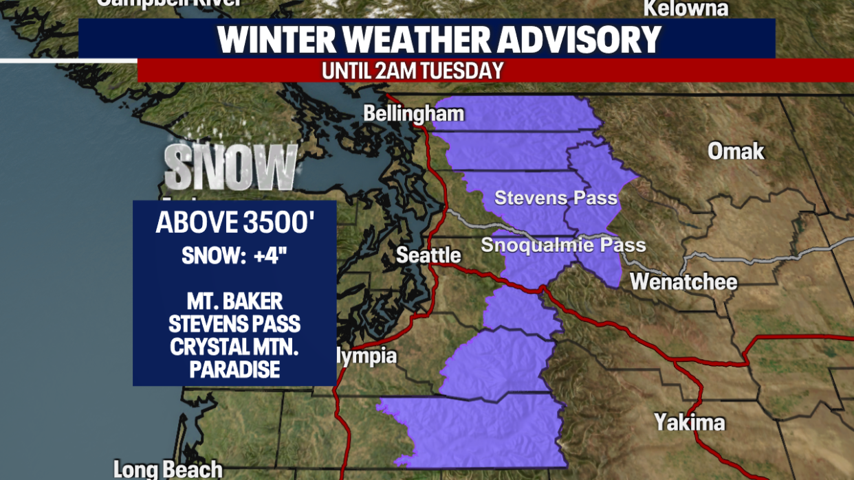
With the cooler showers, we saw several inches of new snow for the Cascades in the last 24 hours.
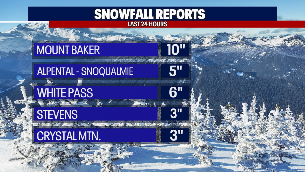
The Winter Weather Advisory remains in effect this evening through 2 a.m. on Tuesday morning. Up to 4 new inches of snow is possible above 3500'.
Scattered showers, thunderstorms and cooler temperatures stick around this evening.
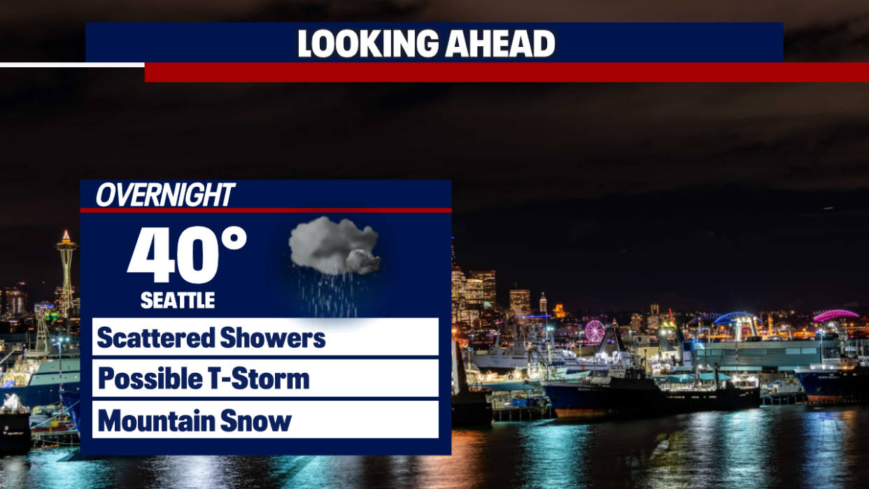
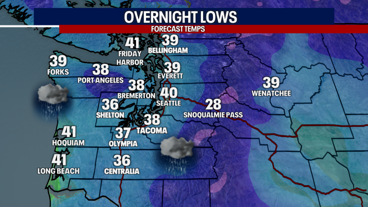
Overnight lows will be chilly, dropping into the upper 40s to low 40s.
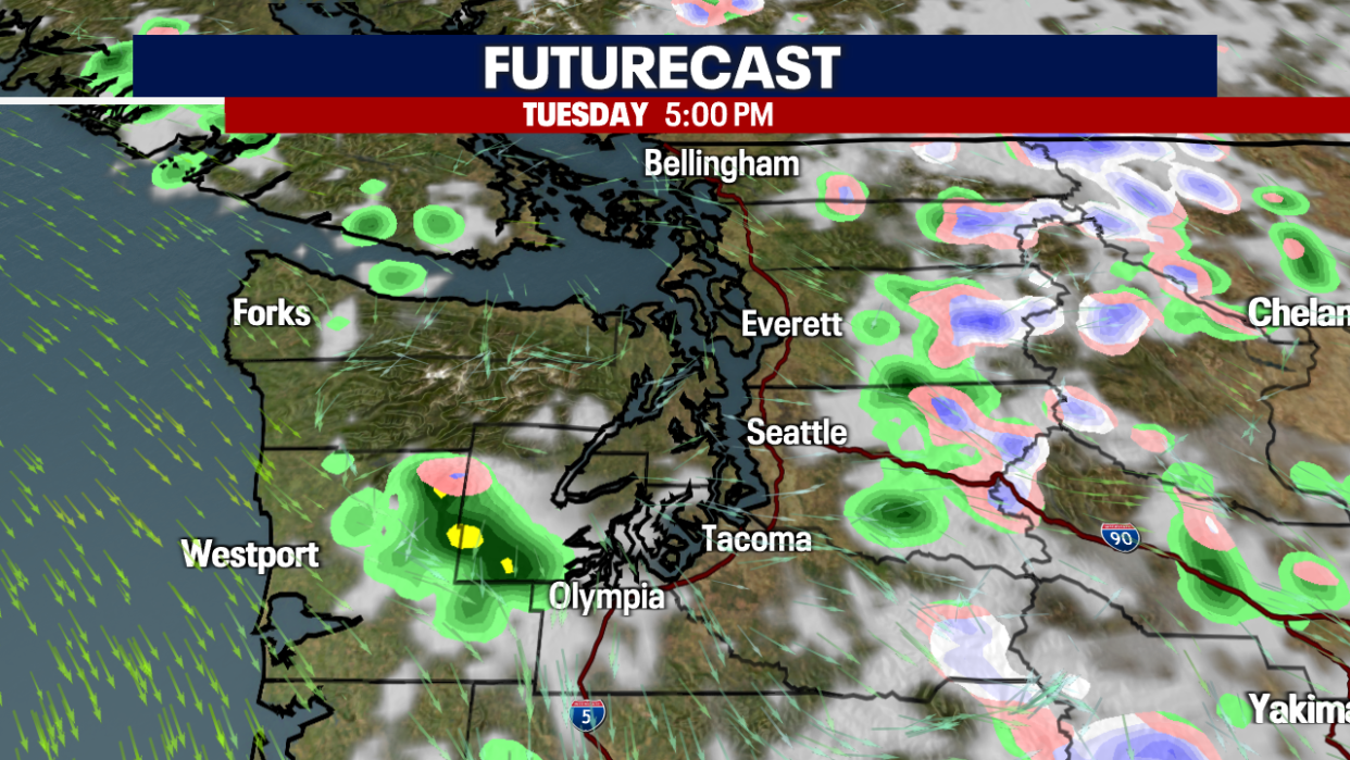
Scattered showers will bead around early Tuesday morning. Most of the rain will be from Seattle southward, with even rumbles of thunder possible.
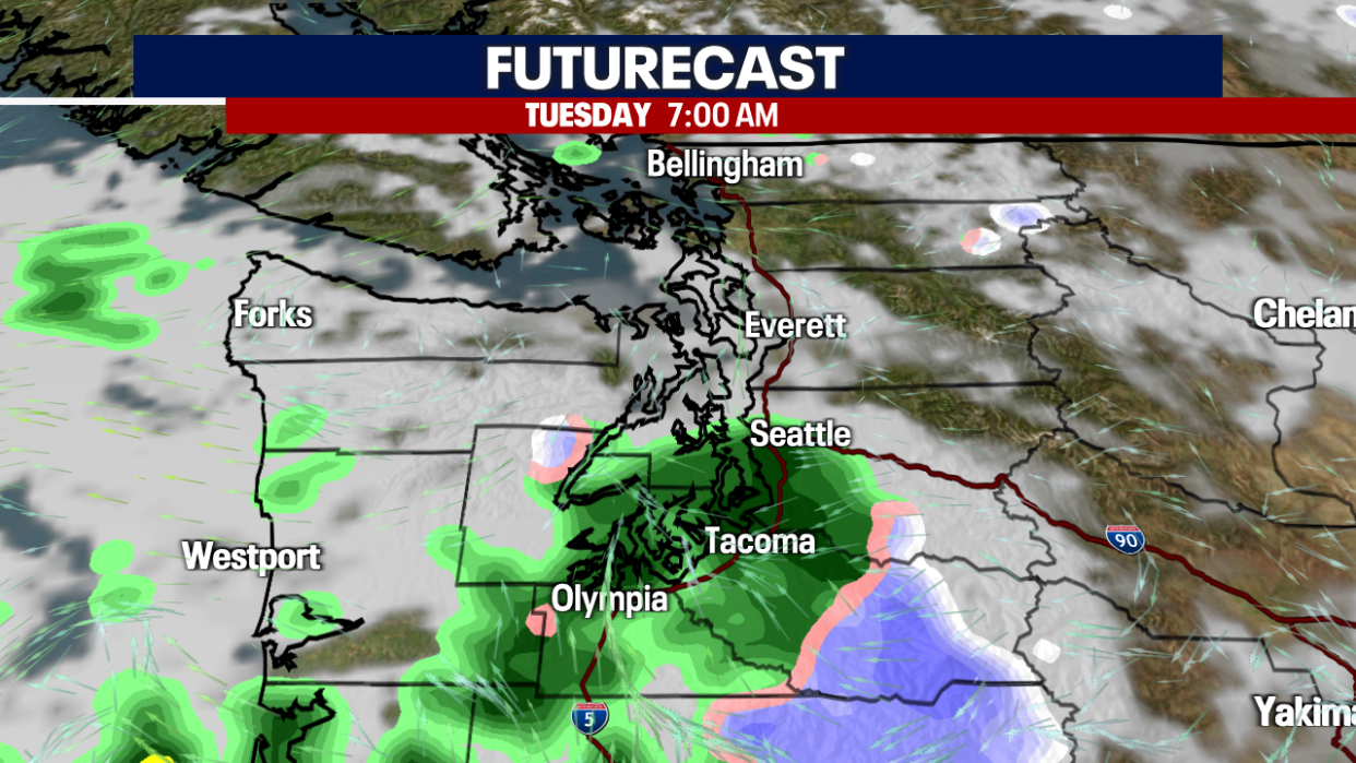
Scattered showers will taper by midday, with more sunbreaks into the afternoon.
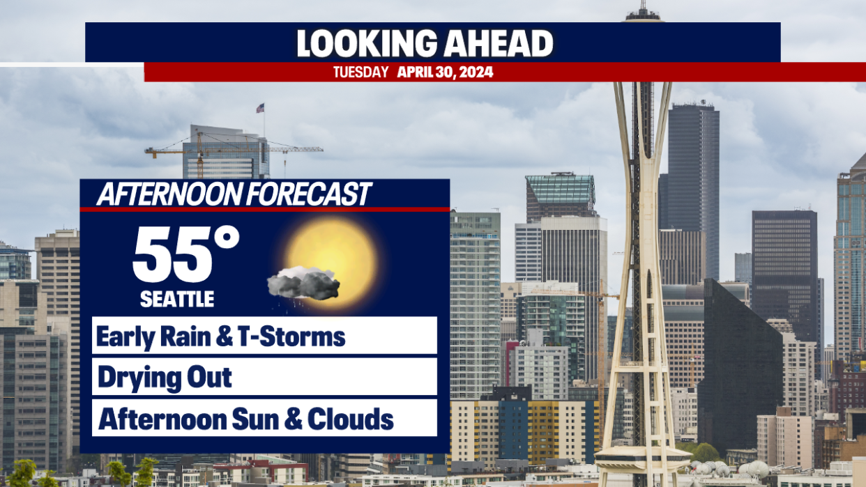
Highs on Tuesday will still be below average with highs only in the mid 50s.
Skies will be drier by Tuesday afternoon, but we still will see a few clouds and showers in the higher elevations.
Looking at a drier day for Wednesday with a weak upper-level ridge of high pressure. A few showers are possible on Thursday, but temperatures will get closer to average. Mainly dry on Friday, but still chance of showers heading into the weekend. Welcome to spring in the Pacific Northwest!