Seattle Weather: Lingering showers Tuesday, slightly warmer
Showers, sunbreaks and cooler temperatures this afternoon for the Pacific Northwest. A chance of thunderstorms is still in the forecast through this evening.
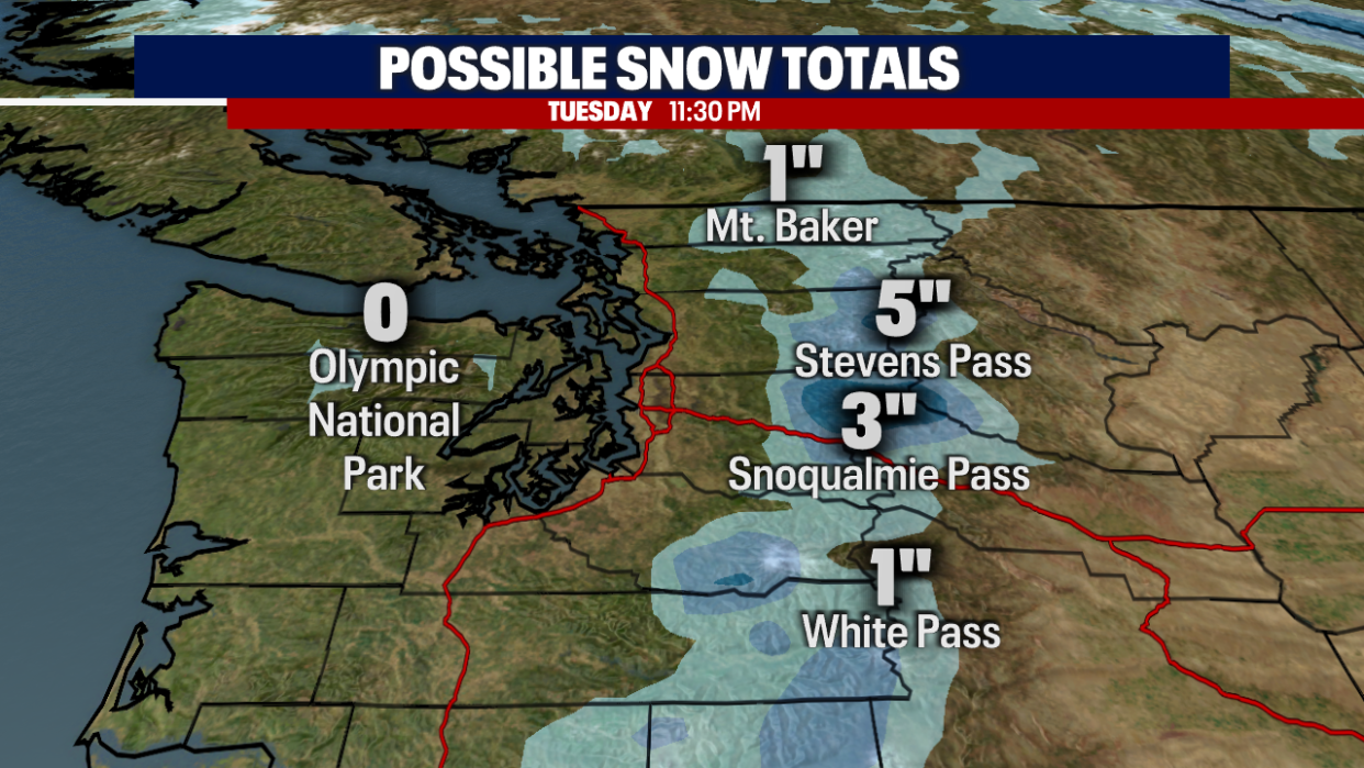
A Puget Sound Convergence Zone is expected this evening, bringing heavier rain, hail and even lightning. We will also see more mountain pass snow through Tuesday morning.
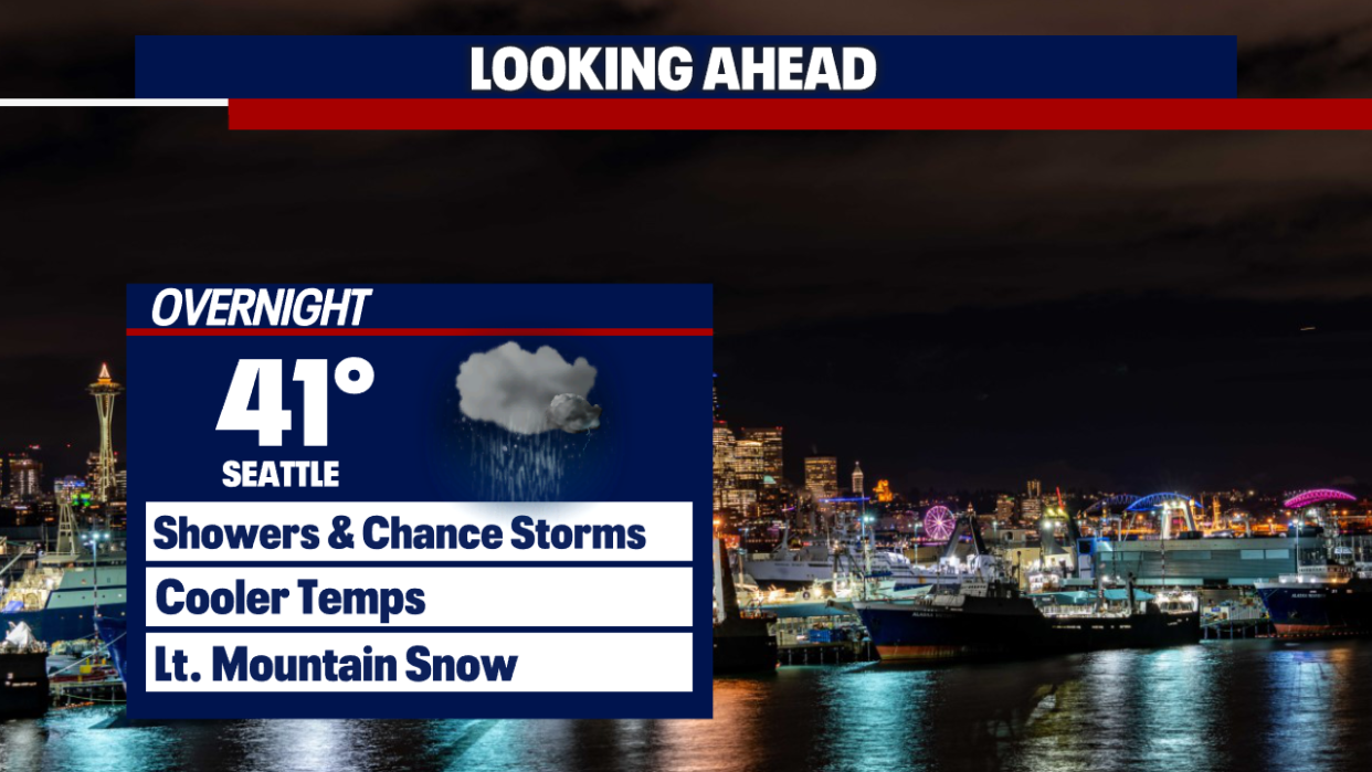
Tonight's lows will be chilly again and below seasonal average, dropping into the upper 30s and low 40s.
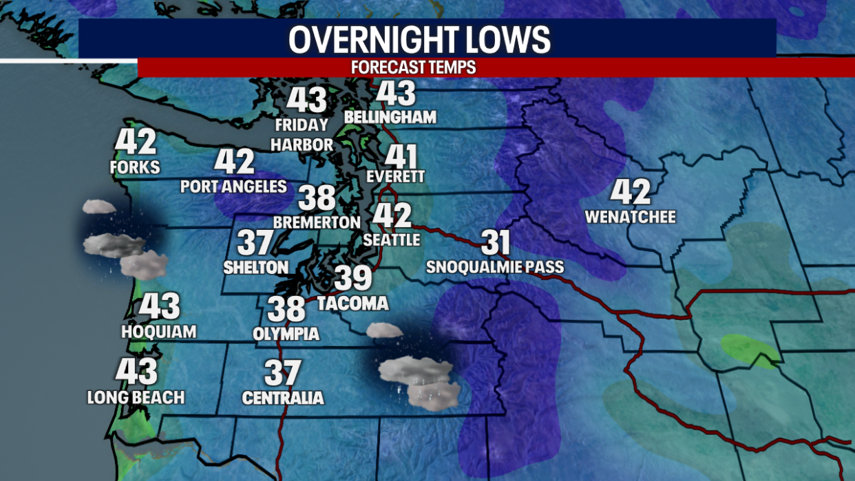
With the convergence zone and more cool air in place, snow levels will drop to 2500' by Tuesday morning. We are looking at a few more inches of snow for the mountain passes.
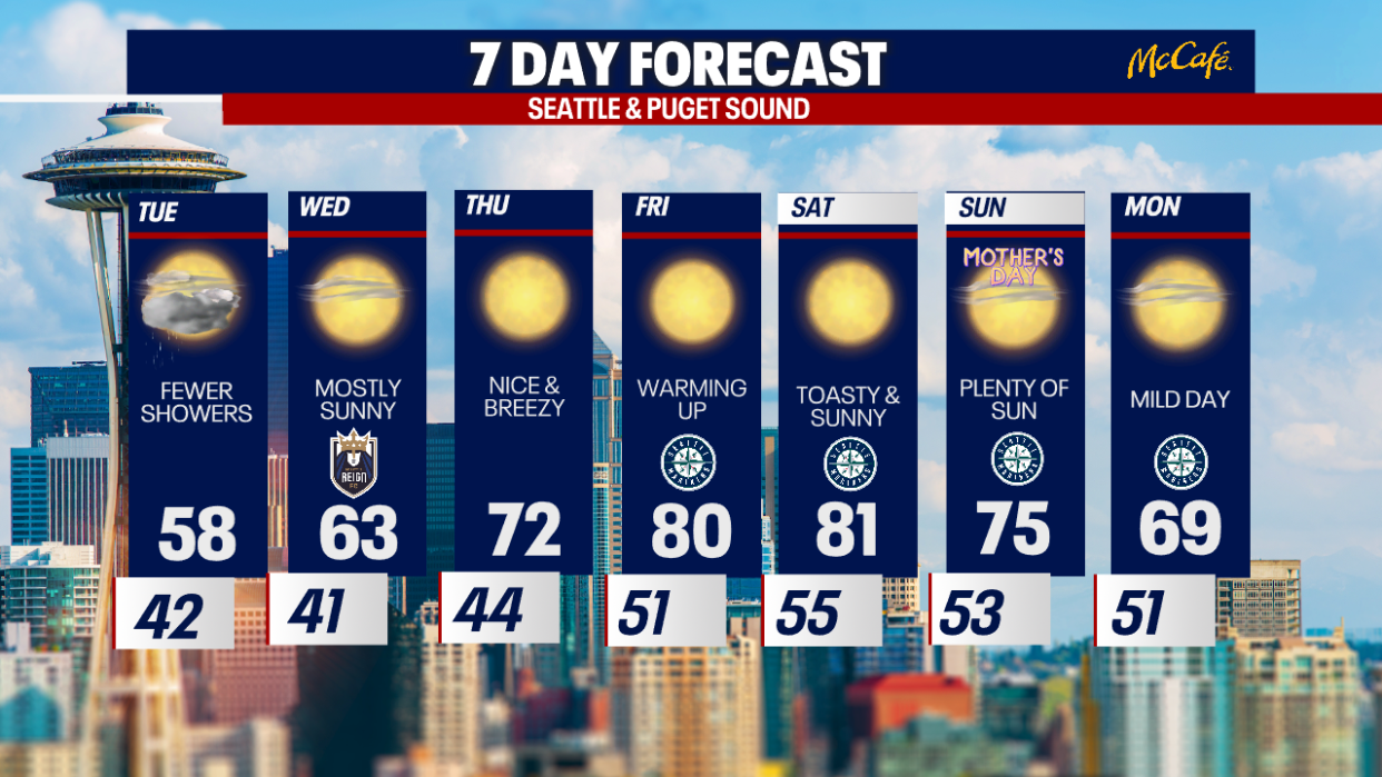
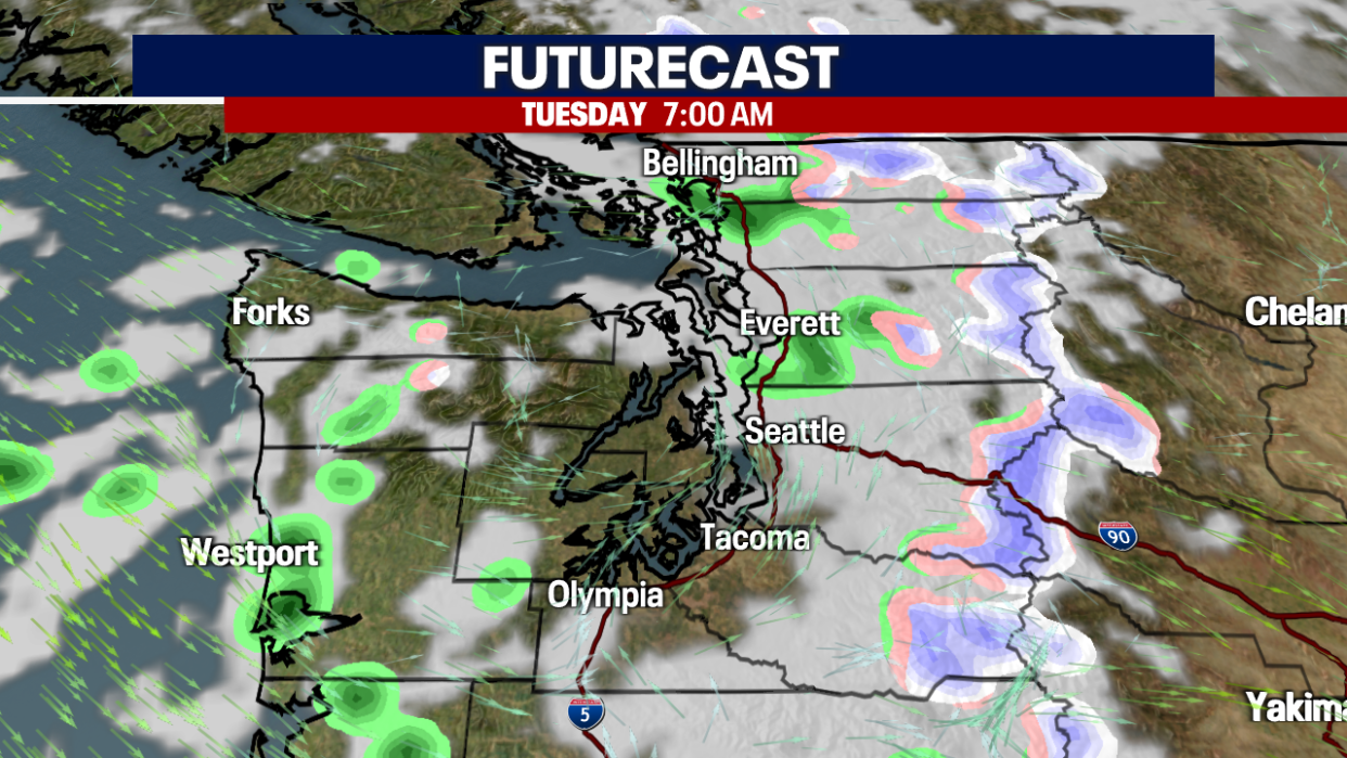
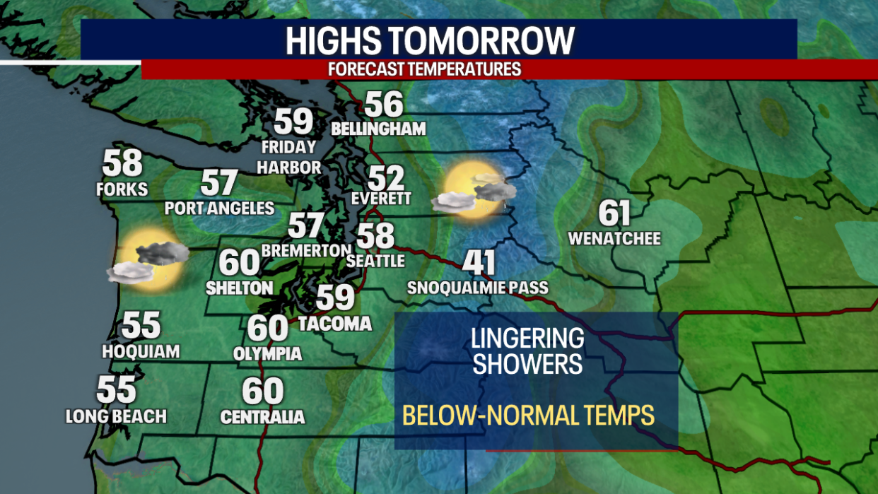
Tuesday we will see lingering cool showers for Western Washington. More sunbreaks are expected into the afternoon.
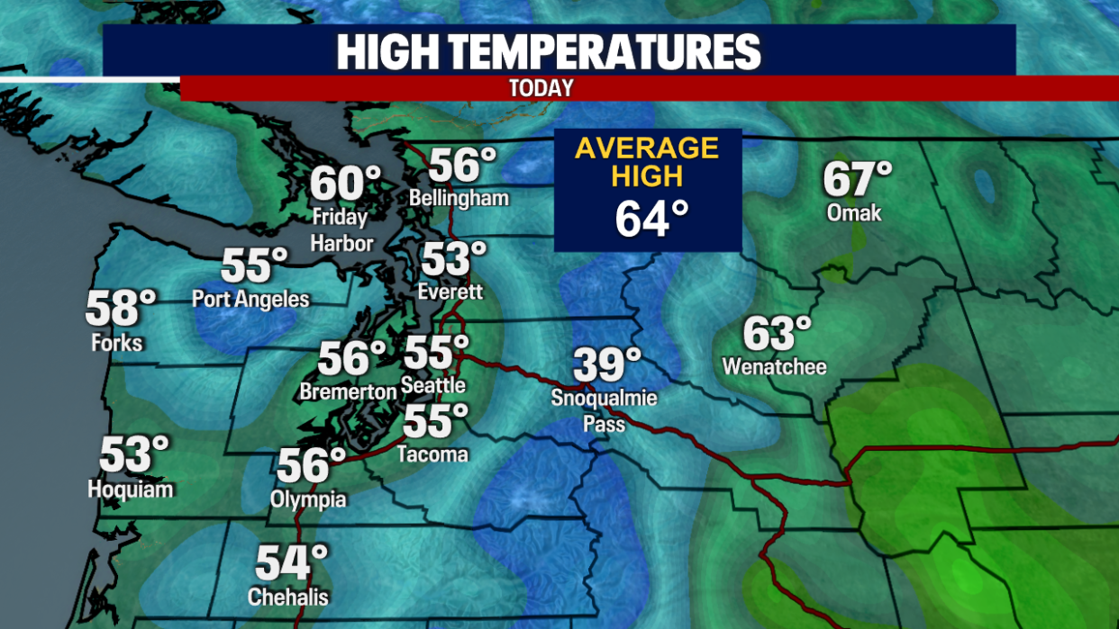
High temperatures will be a few degrees warmer, but we will remain below the seasonal average of 64F.
High pressure will start to build in the area on Wednesday, which will increase temperatures and sunshine all the way through the weekend.
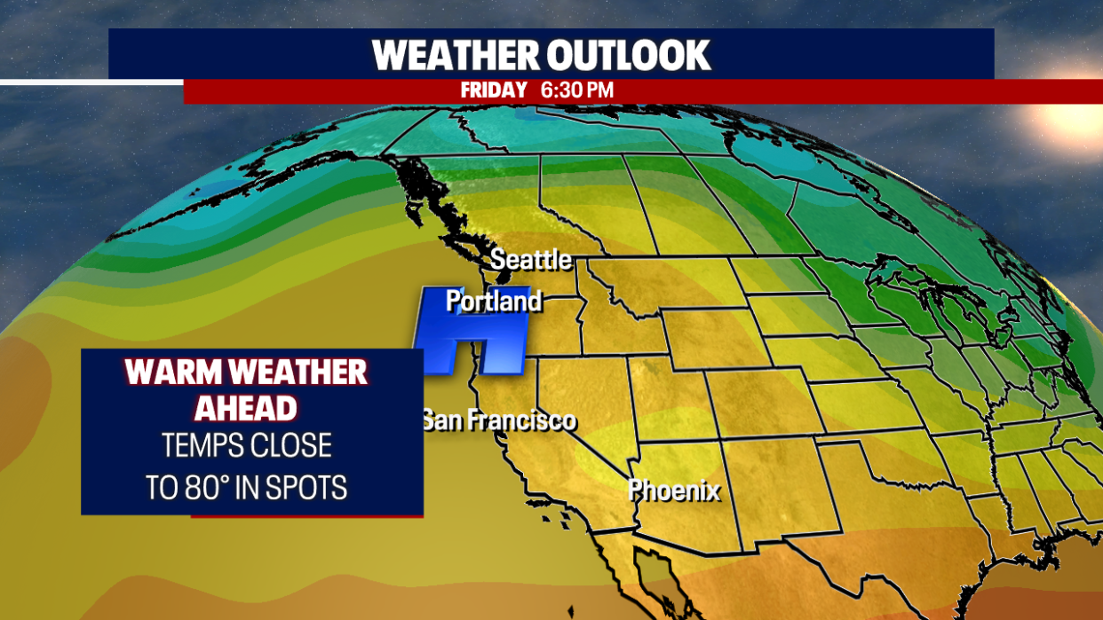
The temperatures will start to moderate on Wednesday, slowly getting closer to average with mostly sunny skies. Highs will warm into the 70s by Thursday and then the 80s on Friday and Saturday. Warm and sunny conditions are expected through the weekend.