Seattle Weather: Cool, showers and chance of storms Monday
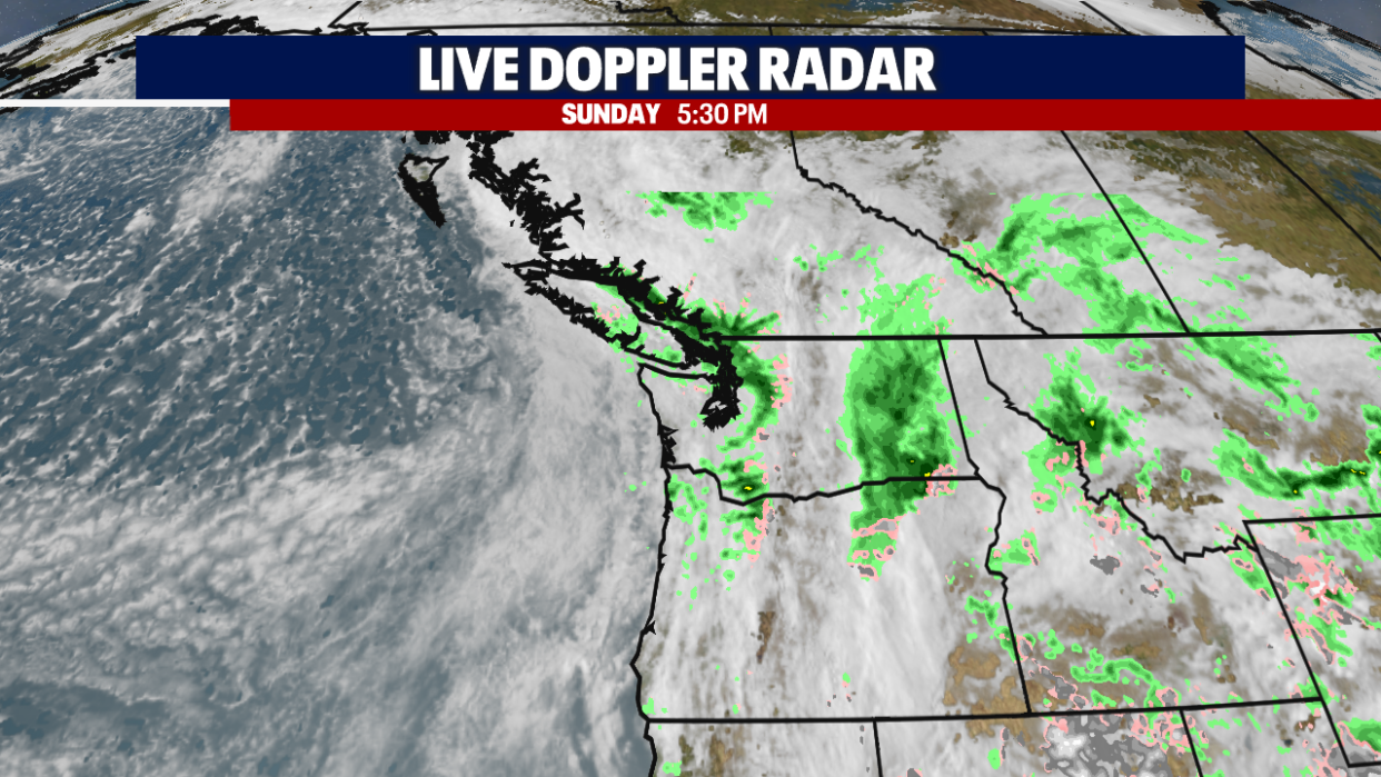
It was a cool, cloudy and wet day for the Pacific Northwest with plenty of showers around through the weekend.
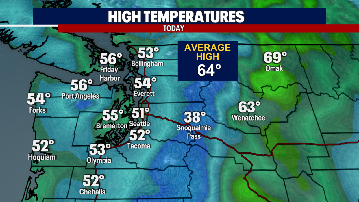
Highs were over 10 degrees below average today, with temperatures only topping out in the mid to low 50s!
A cold front will move through overnight, increasing the rain and winds. Winds could gust up to 30 mph overnight.
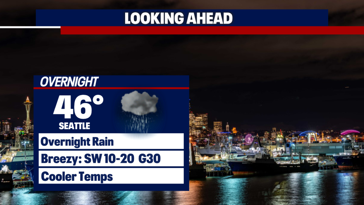
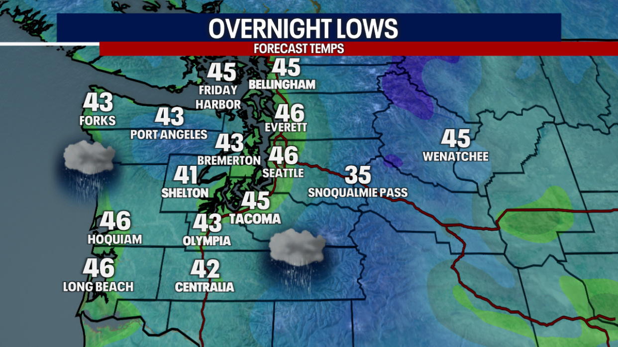
Overnight lows will be below the seasonal average, staying in the mid 40s.
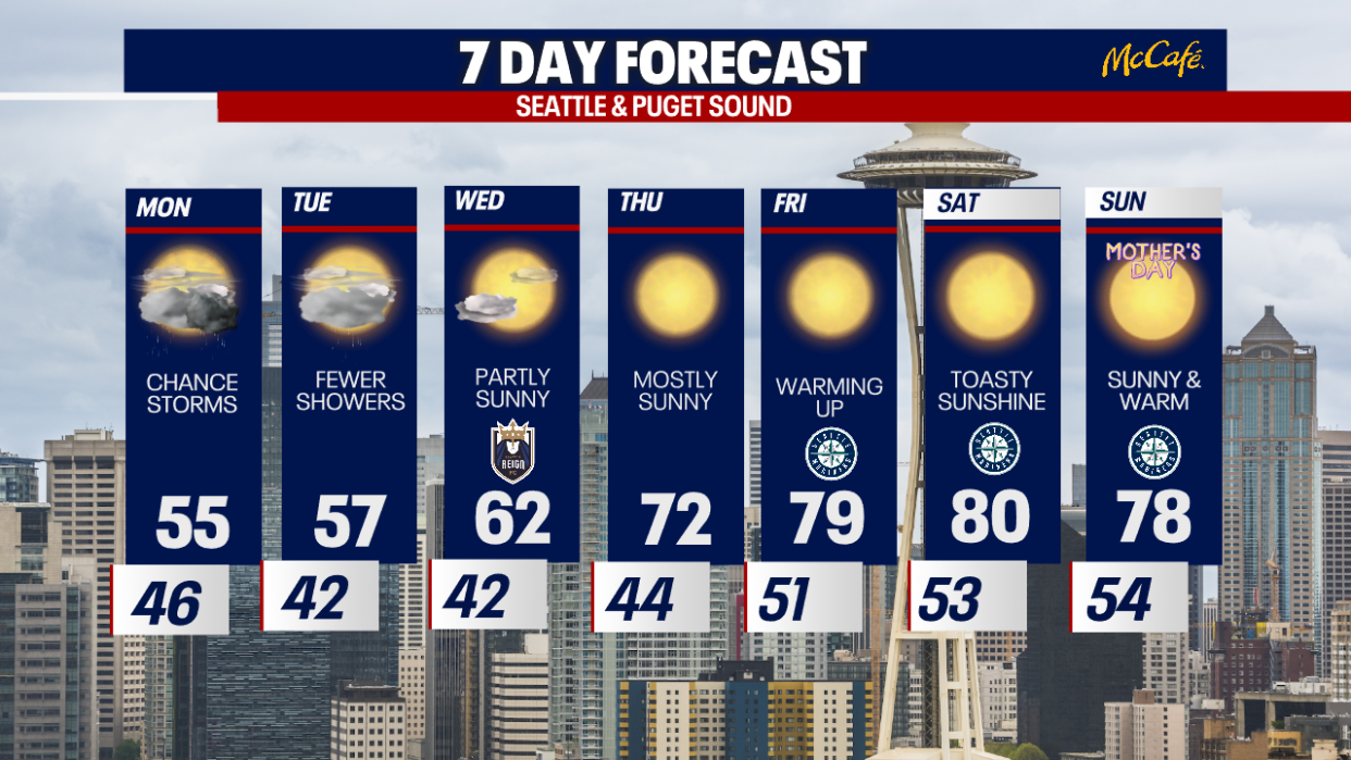
Scattered showers around Monday morning with snow levels dropping to 4000'. Showers will continue through the afternoon.
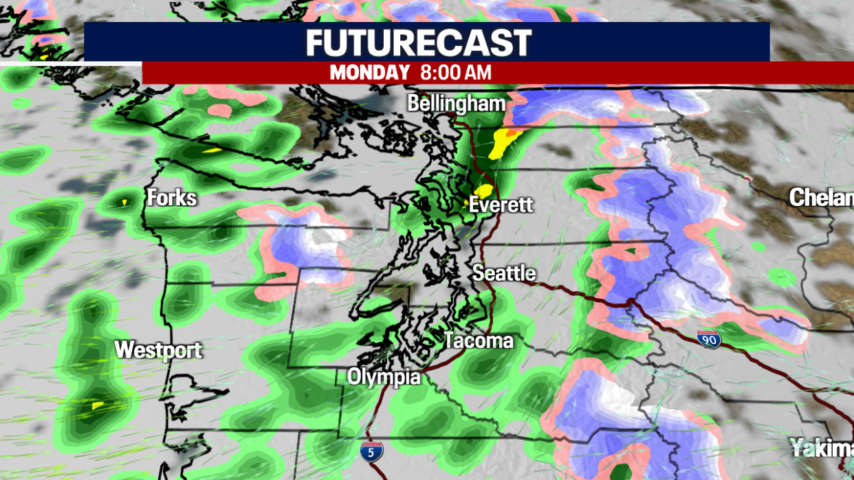
There is a chance of t-storms on Monday afternoon as instability aloft will create the potential for storms. Small hail, gusty winds and lightning are all possible.
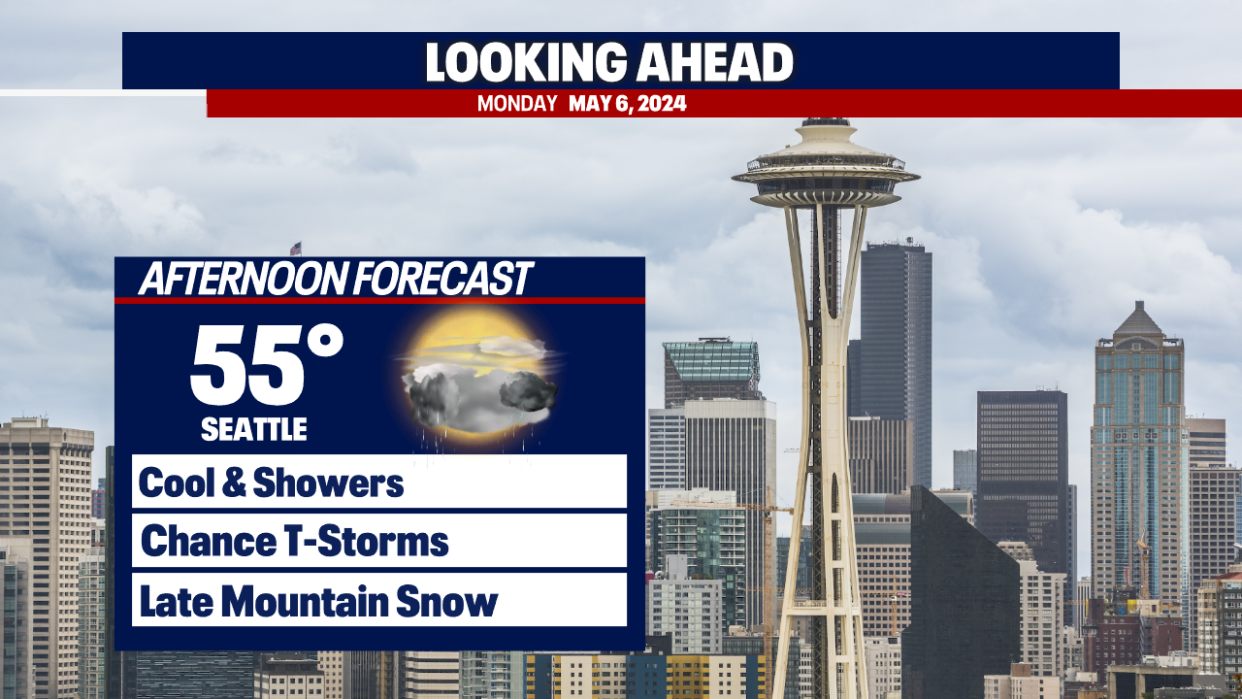
Highs Monday will be below average, only slightly warmer than on Sunday. Temperatures in the mid to low 50s.
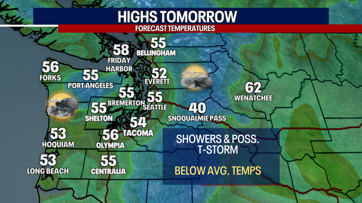
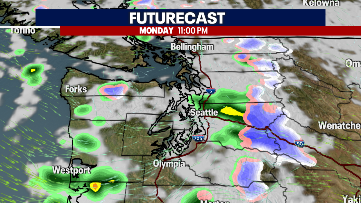
A Puget Sound Convergence Zone is expected Monday evening, which could bring some heavier snow to the Cascades, mainly above 2700'. Expecting minor impacts for travelers over the passes.
Showers will linger through Tuesday with slightly warmer temperatures. High pressure will build on Wednesday with more sunshine and warmer temperatures by the end of the week.