Orlando weather: Happy Mother's Day!
ORLANDO, Fla. - TONIGHT: A mild night under partly to mostly cloudy skies. If you were hoping for a chance to see the aurora again, it does not seem to be in the cards for the southern half of the US. Lows fall into the upper 60s to low 70s.
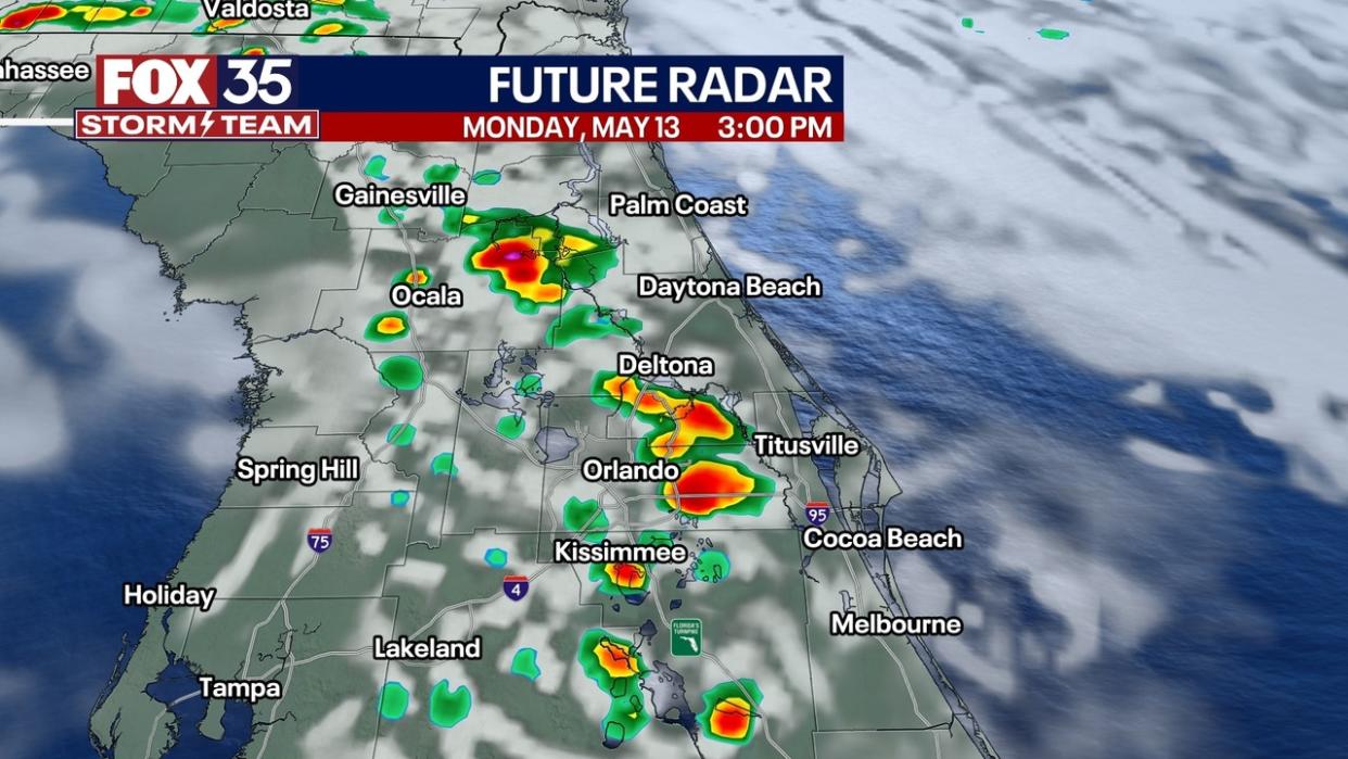
MONDAY: A very summer-like day with plenty of heat and humidity along with ample moisture for afternoon showers and storms. Expect scattered showers and storms to begin developing around lunch time and carry through the afternoon. A few storms could be strong and produce torrential rain, frequent lightning, and gusty winds. Rain chances should come down after sunset. Highs will rang in the upper 80s to low 90s.
BEACH FORECAST: The seabreeze will get rain chances going early in the afternoon Monday. It appears the best chances of rain will come later into the afternoon and linger into the evening before falling apart. Otherwise, expect surf up to 2 feet with a moderate rip current risk.
REST OF THE WEEK: A system will approach Florida through the first half of the week and keep our weather unsettled with daily chances of rain and storms. Tuesday appears to be the best chance for severe weather across northern parts of our area (Gainesville and to the west). Depending on where t-storms end up, some areas could see up to 3 inches by the end of the week, but other areas may not see close to an inch. It will be hot and humid either way with higher levels of humidity and heat with highs in the 90s all week.
