Oak Fire update: Number of structures destroyed jumps as California’s biggest blaze grows
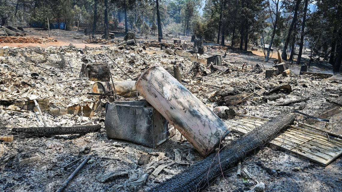
While the Oak Fire continued to burn to the north and northeast of Mariposa, Cal Fire damage assessment teams on Monday afternoon were able to survey areas impacted by the fire and the number of structures destroyed in the blaze jumped to 55 from 10.
The majority of the structures lost were residential, homes and cabins.
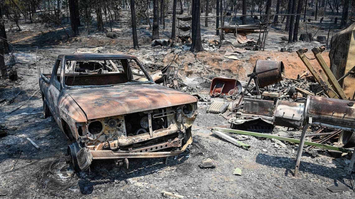
“They had to make an estimation based on what they saw from the air and once they got crews in there to look at all the properties, that’s why the number went up,” said Dominic Polito, a Cal Fire public information officer for the Oak Fire. “Most of the structures were in the south, in that first initial run that went straight across.”
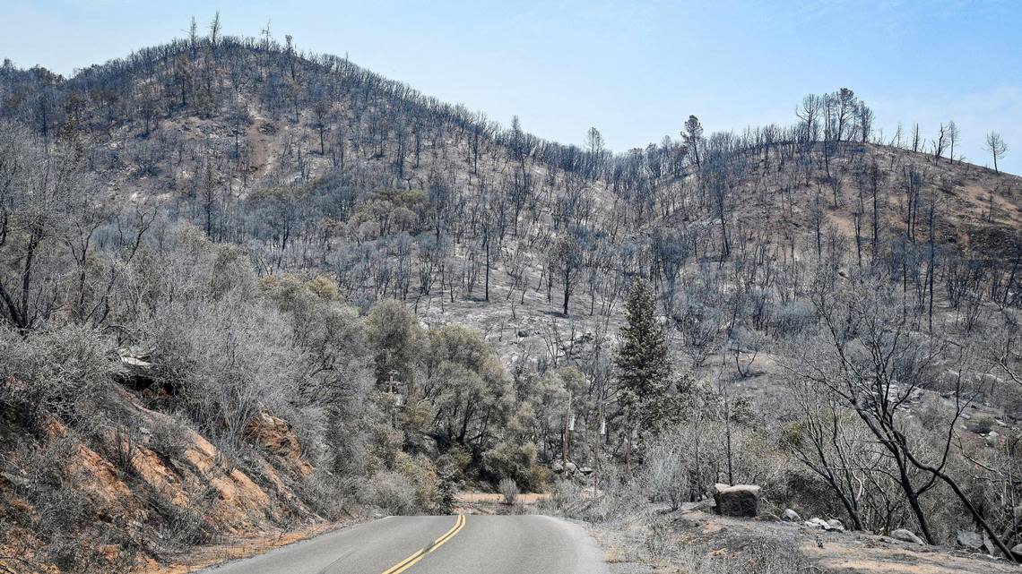
That first run moved quickly, the wildfire burning through 4,350 acres on Friday, its first day. The cause of the fire west of Yosemite National Park remains under investigation.
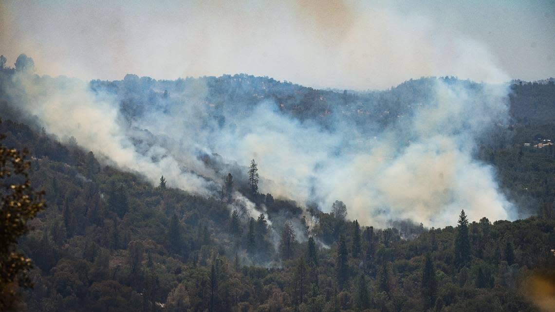
“The growth of this fire is pretty amazing given the fact of how quickly we had resources there, how quickly the state supported the incident with all the aircraft across the board from the very large air tankers that you guys see out there to the helicopters,” said Cal Fire Madera-Mariposa-Merced chief Mike van Loben Sels, at a community meeting Sunday night at Mariposa County High.
“We really threw everything at this thing from the beginning. When you start to see spots a mile, mile and a half out in front, it’s very concerning to you.”
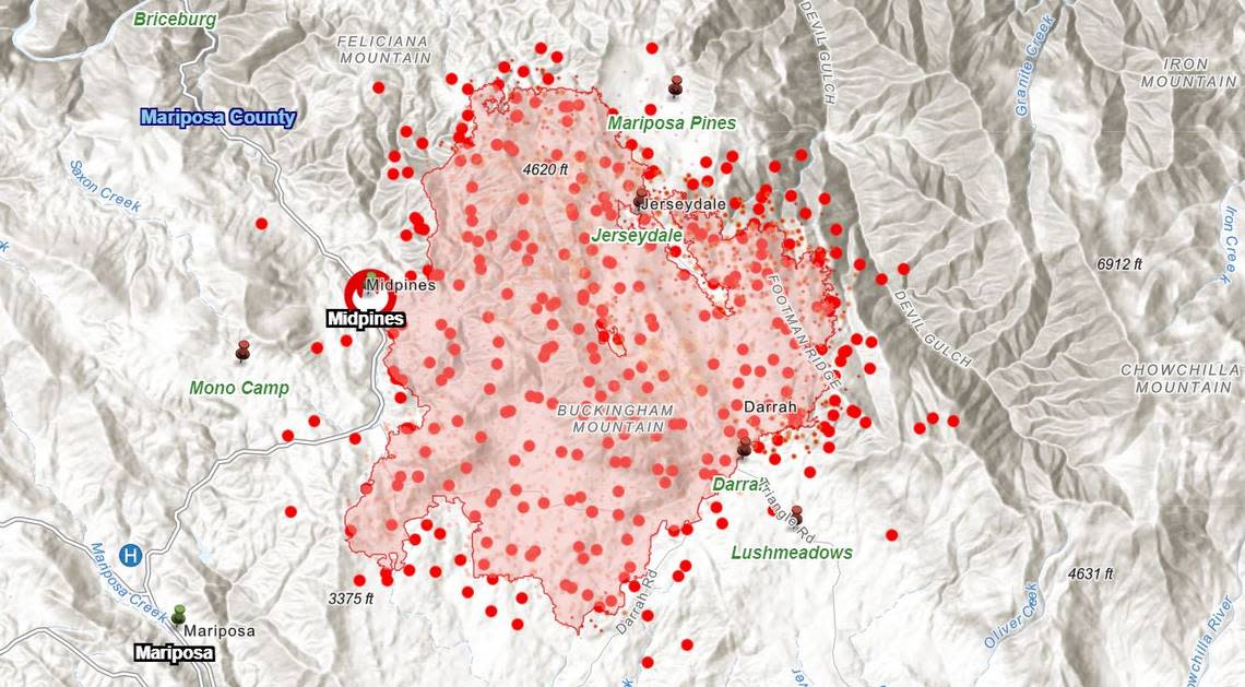
As of Monday evening, the number of acres burned in the Oak Fire was listed at 17,241, an increase of 450 acres during the day, which is considered minimal growth. The final daily update of the number of acres burned has grown from 4,350 to 11,900 to 16,791 through Sunday, and then 17,241 on Monday.
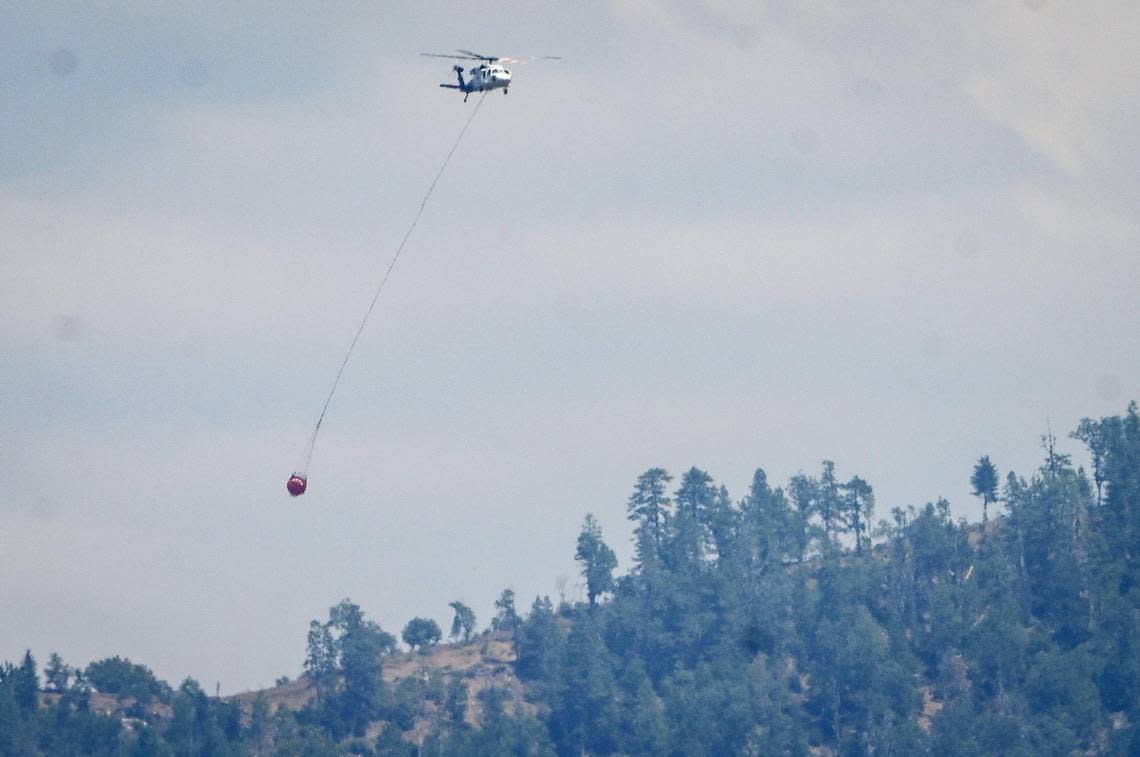
During the day, aircraft dropped more than 300,000 gallons of water on the fire and crews constructed control lines and extinguished hot spots along existing lines. Evacuation orders were reduced to fire advisories open only to residents with ID in some areas, including:
Highway 49 from Silva Road to Darrah Road
Highway 49 from McNally Road to Triangle
Boyer Road including all side roads
Brooks Road (residents must use Woodland Drive to access their homes)
Woodland Drive
McNally Road
Triangle Road from Highway 49 to East Westfall Road including all side roads
Tip Top Road including all side roads
Wass Road (residents must use Tip Top to access their homes)
Darrah Road from Highway 49 to Bootjack Lane including Bootjack Lane
Silva Road from Highway 49 to Carlton including all side roads
The Oak Fire continues to burn to the north, as well as down a slope in rugged terrain east into Devil’s Gulch, east of Jerseydale.
“We still have a lot of aircraft, so we can hit it on the ridges with the aircraft,” Pulito said. “We have a decent number of hand crews that are going to work up there. We have, luckily, because this fire is one of the first fires and one of the only big fires going right now, we have a ton of resources. So, as we button up those lower flanks we can keep shifting those resources to the north.”
The containment of the Oak Fire was up to 16%, mostly to the south and southwest. It is the largest wildfire in the state so far this year, and three times the size of the Lost Lake Fire in Riverside County. That wildfire, the second largest in the state, burned 5,856 acres in May. It is now 100% contained.