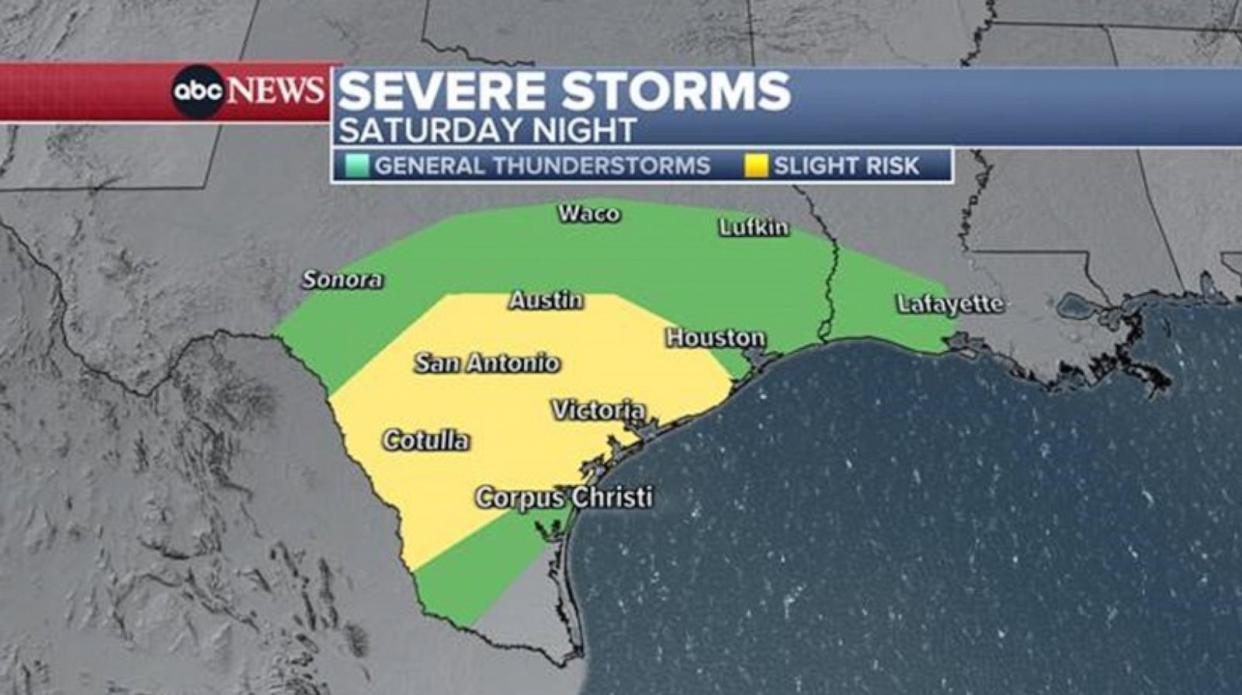
More than 13 million in Texas face risk of flash flooding, tornadoes
More than 13 million people in Texas are in the storm zone Saturday evening amid severe weather. This includes the cities of San Antonio, Austin and Houston.
The main threats tonight are for damaging winds, large hail and flash flooding. A few tornadoes are also possible.
There is a chance for a few isolated supercells to develop this evening, which could turn severe. However, the main storm system is expected to develop and move through during the late night hours.
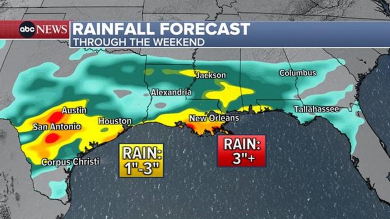
That flood risk slides east along the Gulf Coast over the weekend, leading to a soaker of a Sunday for New Orleans and much of Louisiana.
At 4 a.m. CT, widespread storms are forecast from Corpus Christi to Austin to Houston. This cluster will keep pushing east through the morning and day, eventually making it along the Gulf Coast.
Around 12 p.m. CT, the storms are expected to be in New Orleans. There is a chance for gusty strong winds and some hail, even a low chance for a tornado. But overall the severe risk is lower and the main threat is flash flooding due to the heavy rain.
Hourly rain totals to 2.5 inches with local amounts up to 4 inches are possible on Sunday along the Gulf Coast. This may lead to storm totals more than 3 inches in parts of the South.
The storm threat comes after powerful storms and more than 20 tornadoes ripped through the South and Midwest this past week, killing 3 people and injuring at least 38. The tornadoes damaged over 100 homes in Indiana, officials confirmed.
In Colorado, heavy snow is impacting the Denver area with over 60 inches dumped in Aspen over the last two days.
For the rest of this weekend, the heaviest snow shifts a bit to the south of Aspen, with the mountains of southern Colorado and central/western New Mexico seeing 6 to 12 inches of snow through Sunday night.
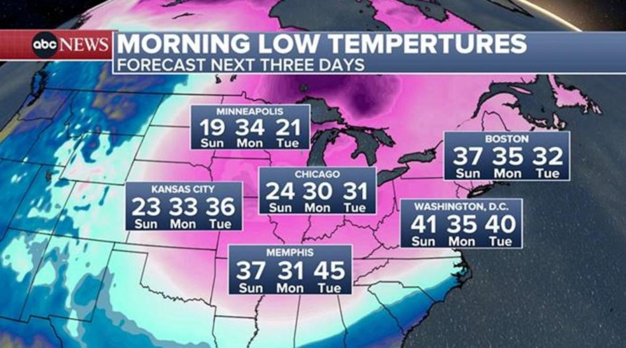
In the eastern U.S., temperatures have been above average nearly the entire winter, but that’s going to change next week as a late-winter chill moves in from the north. While this won’t be as brutal of a cold snap as the kind you get in January, temperatures are still set to drop below freezing for several states.

The colder weather comes with mainly quiet conditions, with no major storms on the immediate horizon from the Midwest to the Northeast.
More than 13 million in Texas face risk of flash flooding, tornadoes originally appeared on abcnews.go.com
