Kings County’s Island District residents voice flooding concerns, look for answers
Residents of the Island District in northwest Kings County crowded the Island School cafeteria Wednesday night to voice flooding concerns in their rural community of farmers along the Kings River.
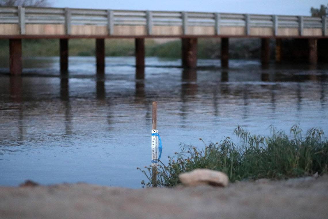
The county has estimated $1 billion in flood damage as melting snow overflows the Kings River and other waterways in the coming months.
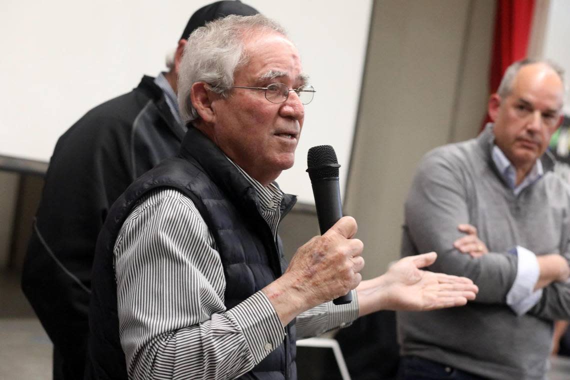
“I understand the concern, the dynamics that all of you are thinking about and going through,” said David Merritt, general manager for Kings River Conservation District who has lived in the county for more than 30 years.
It is going to be a challenging year for the conservation district as officials try to mitigate the impacts of the melting snow.
The forecast is 3.2-million acre feet in the watershed will come down between April and July, said Merritt.
The forecast is bigger than 1969, Merritt said, making it a “challenging year. But our goal is to keep this within the channels.”
Island District resident Roger Channel voiced his concern about how the conservation district is planning on moving a million-acre feet of water in about 30 days in June, when the current flood is moving about 22,000-acre feet a day (a total of 660,000-acre feet in 30 days) which is about 400,000 acres short of the June projection.
Channel said he and others have been busy mathematically calculating since March 23 hoping to hear what the plans are, how water diversion is going to be, if water can be diverted to different rivers and if not, what should residents expect.
Others wanted one answer to the questions, do they need to be prepared? Should they not have to prepare? Do they need to plan to move? What would be the best way for this community to really prepare and feel secure?
Questions that are causing a lot of worry in a lot of people but with no clear answers other than “please be prepared.”
While his goal is to keep the floodwater in the river, and to protect all those in attendance, Merritt said he cannot guarantee that, calling the King River a “very dynamic river” that all it takes is a beaver or a tree or something and there could be an issue.
When dealing with impact situations like this year, Merritt said the conservation district is writing models routinely in cooperation with the U.S. Army Corps of Engineers along with the Kings River Water Association about possible worst-case scenarios.
For the area down here, Merritt told the audience that the worst-case scenario could be 4,000 cfs coming through the Clarks Forks outboard of the river.
“That is on the very high end,” Merritt said adding that worst case scenario going north could be 6,000 cfs.
“Again, we are trying to get as much water out of that reservoir now to alleviate those types of issues,” Merritt said.
Looking for alternatives to prevent flooding
One thing that occurred since 2014, Merritt said, is the Sustainable Groundwater Management Act (SGMA) that has created many recharge facilities.
He said not only is the conservation district trying to move as much water as they can off the Kings River to those types of facilities, but also looking for areas to park water to alleviate some of the issue.
As an example, Merrit said one of those areas to park water are the basins near the High-Speed Rail crossing on Highway 43 in the upper river, and people will start seeing those getting filled with water. The project started April 7 to fill the northeast and northwest ponds.
According to Merritt, the conservation district has been talking with the Naval Air Station Lemoore to potentially flow water back through the Navy drain with the possibility of flooding 20,000 acres, but that is still in process.
“We are looking for every opportunity we can to put water off this river,” Merritt said.
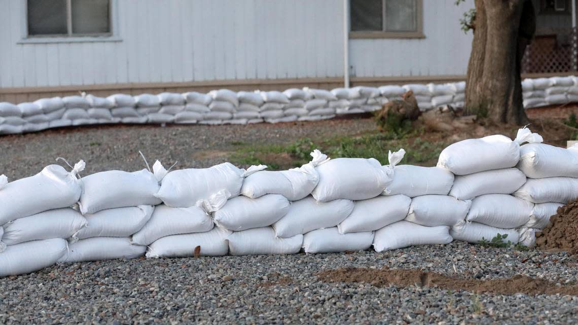
Merritt said the conservation district is monitoring and addressing issues as they come up in the 140-levee miles that protect the Kings River region.
The town hall meeting was held by the Island Property Protection Association – a voluntary neighbor- to-neighbor association for the protection of life and property for the community of the Island District - with County Supervisor Doug Verboon who represents the area.
“We trust the agencies, but we trust each other too,” said Tony Oliveira, a member of the IPPA.
Oliveira, who was around when flooding happened in the area in 1969 and 1983, reminded those present to keep watching water levels “hoping that we can stay ahead of this race.”
“It is going to get tricky, but the last thing we need to do is to lose the levee from a gopher hole or squirrel hole,” Oliveira said.
The IPPA is a non-assessment organization that is activated by the community when a natural crisis has occurred or might occur, and neighbors are called upon to support those requiring assistance,
Merritt reminded residents that the U.S. Army Corps of Engineers are the ones in charge of directing where the flood from Pine Flat goes to – either the north channel which has a capacity of 4,750 cubic feet per second (cfs) or the south channel with a capacity of 3,200 cfs.
Merritt said the north channel has been running at capacity since early March. There is the target for the south channel to be at 2,500 cfs with additional capacity increases in the south channel by the Army Corps of Engineers.
The south channel of the Kings River is operating much better with changes in this year’s flows when compared to the 2017 breach incident at only 1,300 cfs, said Merritt.
The reservoir is down to 59% capacity and the goal of the conservation district is to try and dig as “deep of a hole” in the reservoir to be able to manage the water coming into, Merritt said.
Merritt encouraged every farmer in attendance if they can pledge their farm to do it and use that water to their benefit, reminding them that there is an executive order from the governor that allows Groundwater Sustainability Agency (GSA) credit for that water.
