Huge snowpack looms above San Joaquin Valley. So far, the weather gods are cooperating | Opinion
Coming off a nasty winter, California in general, and the San Joaquin Valley in particular, needed the weather gods to play nice this early spring.
So far (as we continue to cross our collective fingers) they have. More than halfway through April, Fresno has seen average highs of 71 degrees and average lows of 47.6. The city’s average temperature of 59.3 is 1.4 degrees below normal for the month, according to the National Weather Service.
Which has been somewhat of a relief to anyone keeping a wary eye on the absurdly huge snowpack in the southern Sierra Nevada measured at 300% of average. Because the slower all that snow melts — with cooler temperatures being the key to that — the better chance officials have of controlling where the water goes and minimizing the flood damage.
While the threat of widespread flooding will continue into June, dam operators in the region took advantage of mild temperatures in late March and early April to draw down reservoir levels in order to create more space for the impending surge.
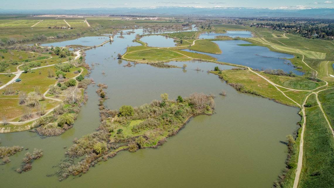
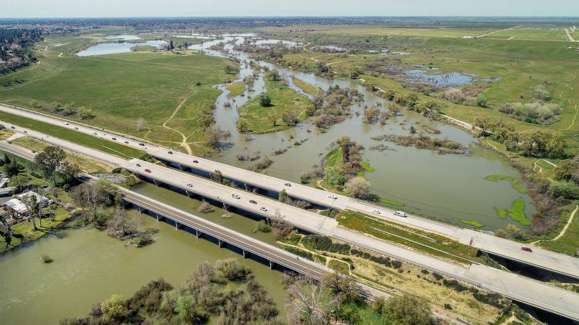
On March 18, when California got hit by the last of the 12 significant atmospheric rivers to drench the state since December, Millerton Lake north of Fresno rose to 80% of capacity.
Opinion
It seemed only a matter of days until Friant Dam, which impounds the San Joaquin River in the 520,500 acre-foot reservoir, would spill for the first time since July 2017.
That could certainly still happen this year. In fact, I’d say it’s likely. Nonetheless, the federal Bureau of Reclamation spent the last month emptying Millerton Lake as rapidly as possible without flooding the mobile home parks along the river at Highway 41 or communities further downstream.
By Tuesday, Millerton Lake was less than 35% full — well off the historical average for that date. With more mild temperatures in the immediate forecast, levels should continue to drop.
Dam operators make a dent
Dam operators are releasing so much water (including a steady 9,000 cubic feet per second into the river) because they know there’s enough currently being stored as snow in the San Joaquin watershed to fill Millerton and eight upstream reservoirs three times over.
In its latest snowpack and water content bulletin, the California Department of Water Resources forecast that 2.92 million acre-feet of water will flow into the San Joaquin between now and the end of July. Much of that is expected to occur in May (930,000 acre-feet) and June (1.03 million acre-feet).
Compare those numbers to the total storage in Millerton and the eight upstream reservoirs (of which Shaver, Edison and Huntington lakes and Mammoth Pool are the four largest): 1,130,788 acre-feet.
That’s nearly 3 million acre-feet of water and roughly 1.1 million of storage. Now you have a better idea of why Friant Dam operators are in such a hurry to drain Millerton. And probably breathing a sigh of relief over being able to make a little headway.
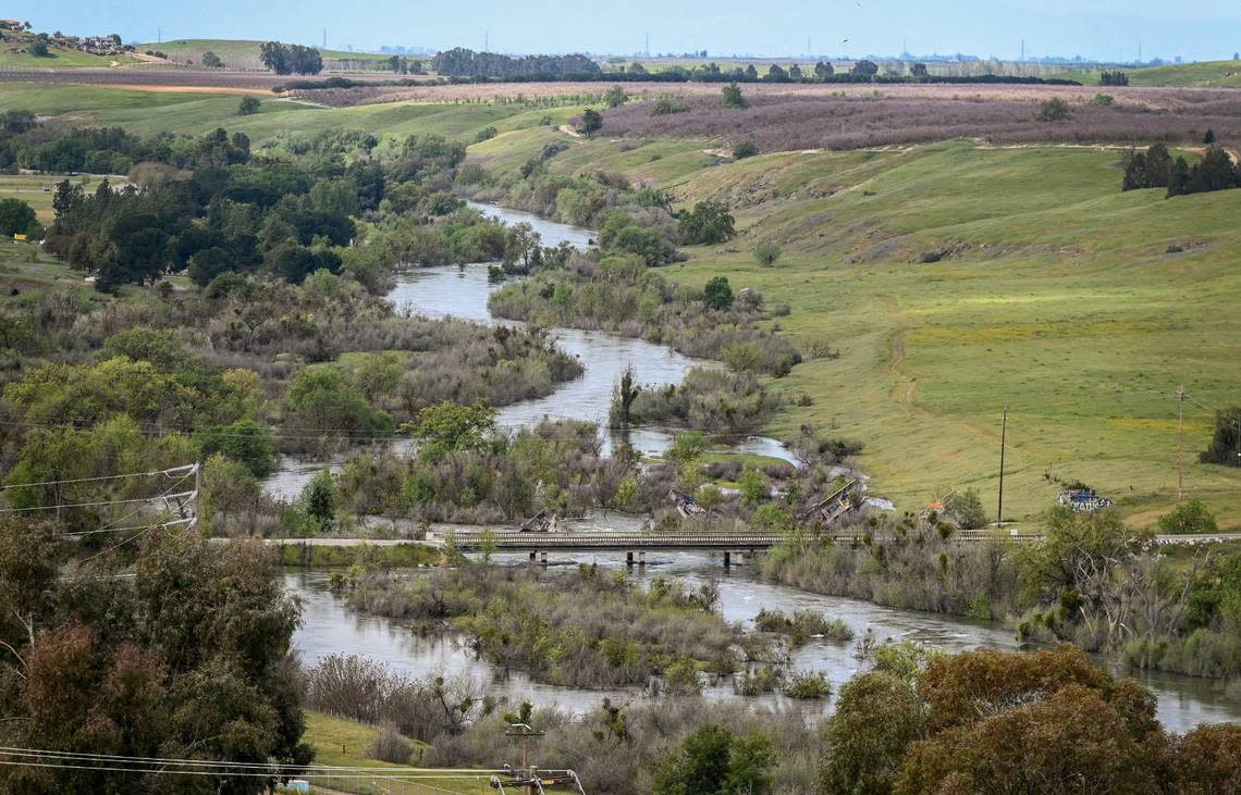
It’s a similar story on the Kings River south of Fresno, except that Pine Flat Lake stores nearly twice as much water as Millerton and its largest forks (the Middle and South) are free flowing. Meaning when the snow melts at upper elevations of Kings Canyon National Park, Pine Flat can fill in a hurry.
Cognizant of this, the US Army Corps of Engineers has steadily lowered the 1 million acre-foot reservoir during the last four weeks. On March 21, Pine Flat was 78% full. By Tuesday, it was down to 53%. That equates to roughly 250,000 acre-feet of water — enough to supply half a million households for one year.
Rivers will peak in June
Of course, dam operators have little choice. That’s because more than 3 million acre-feet of water remains in the Kings River watershed.
Like the San Joaquin, the Kings is expected to surge in May (990,000 acre-feet) and peak in June (1.11 million acre-feet). When temperatures assuredly won’t be as pleasant as they are now.
Unlike the San Joaquin, which flows to the Delta, the Kings does not have a natural outlet and is partially responsible for Tulare Lake’s startling reemergence in Kings County.
Starting March 20, the U.S. Army Corps of Engineers ordered flood releases into the historic lake bed in addition to those that reach the San Joaquin via the James Bypass and Fresno Slough. Flows into Tulare Lake have hovered between 1,500 and 2,000 cfs and could last until summer, officials said.
Tulare Lake (which is fed by several other rivers and creeks) has already surpassed 100 square miles, by several estimates. How large it ultimately gets depends in no small part on how gradually the snow melts.
May the 70-degree days continue. Into May itself would be awfully nice.