Eastern Kentucky flooding leads to significant road closures. Here’s where.
The deadly flash flooding throughout eastern Kentucky has led to extensive road closures and hazardous conditions.
Drone photos and video from the region show widespread damage as rising waters flood roads in the affected counties.
Kentuckians can monitor road conditions in Eastern Kentucky and the commonwealth using the Kentucky Transportation Cabinet’s GoKy Kentucky Traffic Information dashboard.
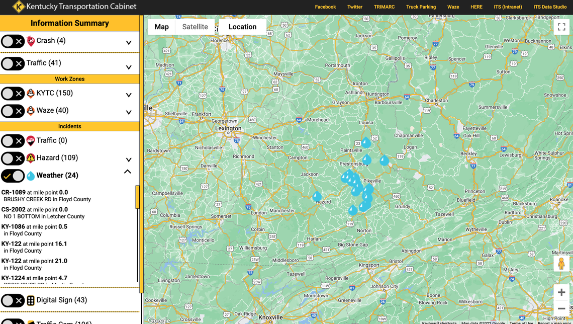
The dashboard summarizes road conditions, including crashes, traffic, road hazards and weather-related incidents, as reported by the cabinet and app Waze. Users can customize what incidents they see on the map by selecting one or more of these categories, as well as specifying a county or region of the state to focus on.
As of 9 am Friday, there were 34 weather incidents in eastern Kentucky, according to the dashboard. These included:
Water over the road on No. 1 Bottom, Route CS-2002, in Letcher County
Water over the road at mile point 10.0 on KY-1056 in Pike County
Road blockage due to flooding at mile point 0.5 on KY-1086 in Floyd County
Road blockage due to flooding at mile point 10.2 on KY-1087 E in Knott County
Road blockage due to flooding at mile point 1.5 on KY-1144 in Lee County
Water over the road at mile point 0.5 on KY-1428 in Floyd County
Road blockage due to flooding at mile point 21.0 on KY-122 in Floyd County
Road blockage due to flooding south of Jackson at Lost Creek near the KY 476 intersection at mile point 7.6 on KY-15 in Breathitt County
Road blockage due to flooding at mile point 17.7 on KY-15 in Breathitt County. Drivers are encouraged to “Seek an alternate route such as I-75 and the Hal Rogers Pkwy through London and Manchester, or the Mountain Pkwy, KY 114, US 23, and KY 80 through Prestonsburg.”
Road blockage due to flooding “for non emergency vehicle traffic” at mile point 20.0 on KY-15 in Breathitt County.
Road blockage due to flooding at mile point 2.3 on KY-1498 in Floyd County
Road blockage due to flooding at mile point 4.5 on Millers Creek Road, route KY-1571, in Estill County
Water over the road at mile point 3.5 on KY-160 in Letcher County
Road blockage due to debris at mile point 4.4 on Couchtown Road, route KY-2021, in Perry County
Road blockage due to flooding at mile point 0.7 on KY-2029 in Floyd County
Road blockage due to flooding at mile point 2.7 on KY-2029 in Knott County
Road blockage due to flooding and water over the road at mile point 26.4 on Warfield, route KY-292, in Martin County
Road blockage due to flooding at mile point 6.2 on KY-40 in Martin County
Road blockage due to flooding at mile point 0.2 on Lakeside Drive, route KY-2550, in Letcher County
Road blockage due to flooding at mile point 0.6 on Red Lick Road, route KY-3328, in Estill County
Water over the road at mile point 2.8 on KY-3381 in Floyd County
Road blockage due to flooding at mile point 3.1 on Perkins Madden Road, route KY-3391, in Knott County
Roadway is under water at mile point 5.5 on KY-364 in Morgan County
Road blockage due to flooding at mile point 2.3 on KY-550 in Floyd County
Bridge closed Jonancy at mile point 7.5 on Virgie Road, route KY-610, in Pike County
Road blockage due to flooding and water over the road at mile point 0.5 on KY-777 in Floyd County
Water over the road at mile point 11.8 on KY-805 in Letcher County
Road blockage due to flooding at mile point 18.0 on US-119 in Letcher County
