California will provide funds to protect Central Valley from flooding by Tulare Lake
The state of California is stepping in to contribute millions of dollars to raise the levee protecting the city of Corcoran and a pair of nearby state prisons from the ongoing flooding in the Tulare Lake basin.
Gov. Gavin Newsom announced the investment in the levee Thursday as part of a larger package of $290 million to deal with flooding issues in the Central Valley and elsewhere in the state. Those funds will be included in his May budget revision to be formally unveiled Friday.
The cost for raising the 14.5-mile levee is estimated at about $17.2 million. The state’s latest spending on the levee is paying to raise the earthen structure to 192 feet above sea level, or about four feet higher than before the repairs began.
Newsom’s office said in a statement that the latest work on the Corcoran Levee is the third time that either the state or the federal government have intervened to raise the levee, made necessary after decades of overpumping of underground water tables have caused ground levels in the area – including under the levee – to sink or subside.
The U.S. Army Corps of Engineers previously made repairs to the levee 1969 and again in 1983, Newsom’s office reported.
“Raising the Corcoran levee provides greater certainty that we won’t need to evacuate critical facilities and will ensure public safety,” Newsom said. “However, the state and federal government cannot continue stepping in to raise this levee. I look forward to a conversation on what (Kings County) is going to do differently so that we don’t find ourselves in this situation again.”
Tim Godwin of the state’s Sustainable Groundwater Management Office said in a telephone conference with reporters Thursday that the rate of subsidence in the Corcoran area due to groundwater overpumping has been about one foot per year.
Brian Ferguson of the state Office of Emergency Services said the agency’s director Nancy Ward had already reached an agreement with the Cross Creek Flood Protection District “to advance millions in state money for them to perform the work as an emergency protective measure.”
The state is fronting $17 million from the California Disaster Assistance Act, Ferguson added. treating the levee work as an emergency protective measure, he said, opens the possibility of reimbursement of the costs from the Federal Emergency Management Agency.
“The funding is being provided as an advance payment now, with a contingency to forgive the cost share required of local government if the county completes an updated hazard mitigation plan …” Ferguson said. He added that the state funding is contingent upon the local ability to meet a set of criteria to ensure the work is done efficiently and at the lowest possible cost to taxpayers.”
Kings County, state officials said, does not currently have an updated hazard plan.
Restoring the levee’s height to 192 feet above sea level brings it to the historic level needed to provide the necessary protection to Corcoran and nearby infrastructure, Ferguson said.
A potentially historic refilling of Tulare Lake
Tulare Lake was once the largest freshwater lake west of the Mississippi River, but has been dry in most years since water from the rivers that historically fed the lake began to be diverted for farming and other uses in the late 1800s. It has sprung back to life this year as a result of a series of atmospheric river storms that plowed into central California in January, February and March.
The deluges in the southern San Joaquin Valley and the adjacent foothills of the southern Sierra Nevada swelled local lakes and rivers beyond their capacity, forcing water officials to allow water to flood the basin, inundating thousands of acres of farmland.
The flooding in the old lakebed is expected to continue and possibly even worsen as a record snowpack in the southern Sierra Nevada range on the east flank of the San Joaquin Valley melts over the rest of the spring and summer.
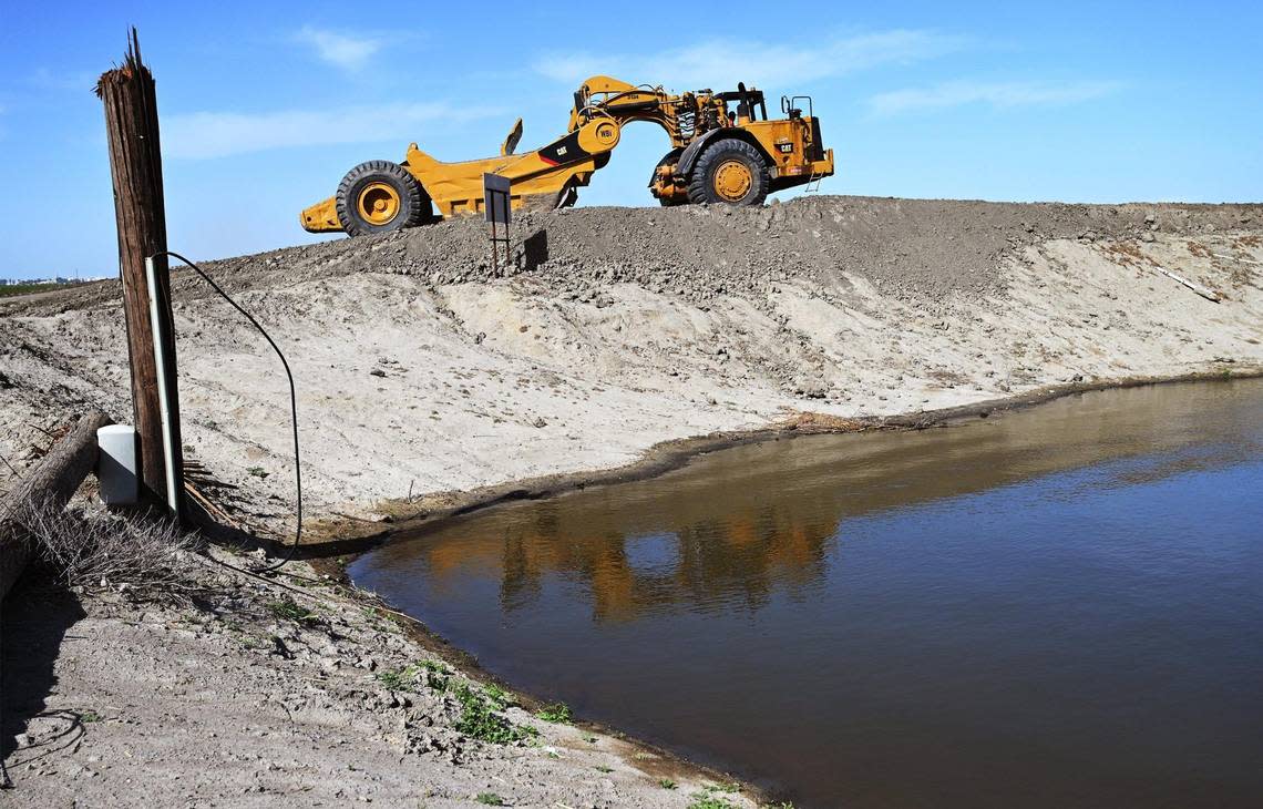
In a visit to Corcoran in late April, surreal scenes of flooded farmland and partially submerged buildings and farm equipment greeted Newsom, state Department of Water Resources Director Karla Nemeth and other state officials. At that time, heavy earth-moving equipment was already at work on a portion of the 14.5-mile levee that stands between the rising water level in the old lakebed and the town of Corcoran and a pair of nearby state prisons – facilities at risk if the levee fails.
In that April 28 visit, Newsom and Nemeth both noted that neither Kings, Tulare, Fresno nor Kern counties are participants in the Central Valley Flood Protection Plan, a state program to improve management of flood risks across the region.
“It’s complicated. It’s why I’m a little more romantic for a collaborative framework,” Newsom said at that time about the regional flood plan. “It’s a little stubborn for me, but it is what it is. These counties chose not to engage in that. Those partners that have engaged in it have received significant money from the state and we have a different engagement of platform answering that question in real time.”
“I hope when this is done we can fix that,” he added, referring to local participation in the regional plan. “I’ll certainly be a little more aggressive in expressing my point of view in that space, as well.”
Nemeth said during the Corcoran visit that while the Central Valley Flood Protection Plan spans the greater Central Valley from the Sacramento Valley to Madera and Merced counties, the absence of the counties in the southern San Joaquin Valley presents a challenge to regional flood coordination.
“I know there’s a lot of information here in these counties about what happens to the water once the (Army Corps of Engineers) releases if from the dams and before it gets to the lakebed,” Nemeth said. “Otherwise we’d have a lake emerging more frequently than we do.
“So the real challenge, is how do we collect that information and, with the counties,” she added, “and have the counties make decisions about where to divert water upstream of the lakebed to protect communities further downstream?”
