Should you go to NC beaches during Hurricane Ian? What coastal counties say
Though it’s past peak season for beach-going, there’s a chance you, or someone you know, had plans to visit the coast this weekend.
But with Hurricane Ian on track to impact much of North Carolina, is it still safe to go?
We’ve compiled some warnings from some of the state’s coastal counties and the National Weather Service, as well as some changes to services that could impact travel.
Here’s what to know.
NC coastal counties issue warnings for residents, some for visitors
In general, the state’s coastal counties are urging residents and visitors to remain vigilant and be prepared as Ian approaches.
The News & Observer reached out to several coastal counties — Brunswick, Onslow, Pender and New Hanover — about specific messaging and warnings for visitors to the area, but has not heard back from all of them. We’ll update this story if we receive more information than what we’ve provided below.
▪ Brunswick County, which borders South Carolina, encouraged residents via Facebook to “finish your preparations today” for the storm, including making an emergency kit. The county said flooding and hazardous marine conditions were expected in the area due to the storm.
In an email to The N&O, Brunswick County communications director Meagan Kascsak said the county encourages “anyone who is in Brunswick County during a storm event — whether resident or visitor — to follow the recommendations and directions from county officials and any officials within the municipality they are visiting.”
“Even if an evacuation order has not been issued, conditions can still be detrimental for traveling in and around areas where tropical storm conditions are present — this includes significant rains that impact visibility and flood roads and other areas, storm surge near beaches, and high winds,” Kascsak said.
Kascsak said the county is “reparing for conditions related to a high-end tropical storm and low-end hurricane with respect to winds.
Regarding whether beach access would be impacted in the county, Kascsak said it’s best for visitors to check with the municipality where a beach is located for the best information.
▪ New Hanover County, which includes Wilmington and Wrightsville Beach, said in a Friday update that all county government offices, services and attractions would be closed Friday. The county in a Wednesday update urged people to “remain alert and ready” for the storm’s impacts, including possible tornadoes.
In an email to The N&O, Alex Riley, a communications and outreach coordinator for the county, emphasized that visitors to the county and residents alike should stay out of the water during the storm.
“For those visiting our area, it may be a ‘once in a lifetime’ event to see a storm like this. That said, do not put your life and the lives of the public safety partners who are here to protect our community in danger,” Riley said.
“Conditions at the beach will be very dangerous with life-threatening storm surge, a high risk of rip currents and the possibility of other dangers like flying debris. Save the beach for another day and don’t put yourself in danger.”
Riley also emphasized that visitors should familiarize themselves with the area on a map and “know where they are.”
“It’s easy to lose track of your location related to a municipality or the unincorporated county because you might be in an area you’re not familiar,” Riley said. “This is really important when the National Weather Service puts out alerts like tornado warnings or flash flood warnings.”
▪ Pender County urged residents “to stay alert” in a Wednesday Facebook update.
▪ Onslow County in a series of Facebook posts warned residents of the dangers Ian could bring, including flooding, tornadoes and more.
In an email to The N&O, Stacie Miles, Onslow County’s deputy director of emergency services, said the county “would not recommend” traveling to the area on Friday, as “we are anticipating our stronger bands of rain and wind across the day tomorrow.”
Miles noted that most county offices in Onslow will be closed Friday due to weather conditions.
The town of North Topsail Beach in Onslow County announced on Facebook Thursday that it had “closed access to the drive on area at the 4x4 beach access number 3 out of precaution and it will remain closed until further notice.”
Miles said in her email that North Topsail Beach may “see some localized flooding due to tides, surge, and rainfall.”
“Residents and visitors are advised that the beach will be impacted by high surfs and dangerous rip currents,” Miles said.
Surf City, which is located in Pender and Onslow counties, said in a Wednesday update that the town encouraged “all of our residents and visitors to remain vigilant and stay weather aware until the storm is no longer a threat.”
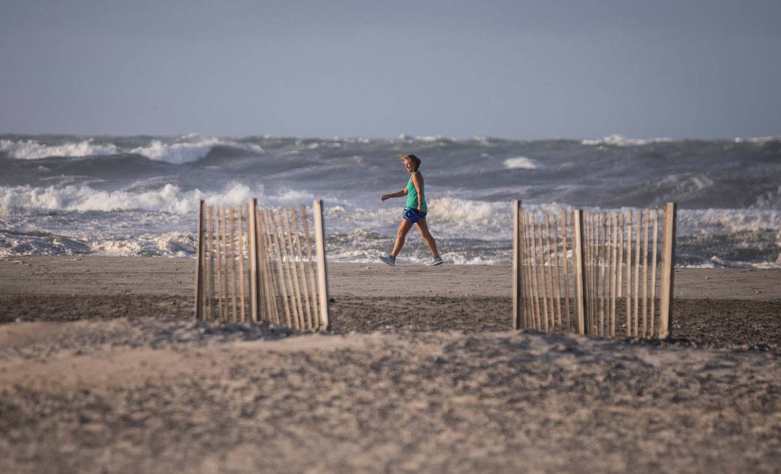
Storm surge, coastal flooding predicted at NC coast
Storm surge and flooding pose a serious risk and threat at the coast this weekend, making it best to stay out of the water.
“Regardless of Ian’s path, an extended period of strong east to northeast winds beginning Thursday could produce a variety of coastal impacts, including coastal flooding, high surf, beach erosion, and strong rip currents,” the NWS said, according to a previous N&O report.
Storm surge is “an abnormal rise of water generated by a storm, over and above the predicted astronomical tides.” The rise in water levels can result in extreme flooding and create extremely dangerous water and marine conditions.
Storm surge warnings have been issued for the following counties and areas in North Carolina due to Ian, as of midday Thursday:
Pamlico
Craven
Storm surge watches have been issued for:
Beaufort
Hatteras Island
Inland and coastal Onslow
Mainland Hyde
Northern Outer Banks
Ocracoke Island
East and west Carteret
Coastal Brunswick
Coastal Pender
Coastal New Hanover
A coastal flood advisory went into effect for North Carolina at 2 p.m. Thursday, The N&O reported.
NCDOT makes changes to ferry routes for Ian
The N.C. Department of Transportation has made several changes to its ferry services due to impacts of the storm system.
▪ As of Friday at 8 a.m., the department announced that all North Carolina ferry routes had been suspended “due to weather impacts.” “Each route will reopen as soon as it is safe to do so,” the department said in a tweet.
Good morning! Unfortunately, due to weather impacts, ALL North Carolina Ferry Routes are suspended at this time. Each route will reopen as soon as it is safe to do so. pic.twitter.com/j2fD3mJ2pg
— NCDOT Ferry Division (@NCDOT_Ferry) September 30, 2022
▪ The department’s Ocracoke Express passenger ferry, which runs between Hatteras and Ocracoke islands, ended its seasonal service Wednesday, two days earlier than its scheduled end of Friday. NCDOT said the change was “due to the bad weather forecast to impact the Outer Banks” beginning Thursday.
For more information and updates about the impacts of Ian on ferry service, check twitter.com/NCDOT_Ferry.
Reporter Richard Stradling contributed to this story.
