Mass casualty incident in Logan County northwest of Columbus after possible tornado
A series of severe storms ravaged Ohio on Thursday night, spawning a series of tornado warnings across the state and knocking out power to thousands.
Authorities in Logan County are dealing with a mass casualty incident from a suspected tornado that struck a trailer park near Indian Lake, located about 70 miles northwest of Columbus.
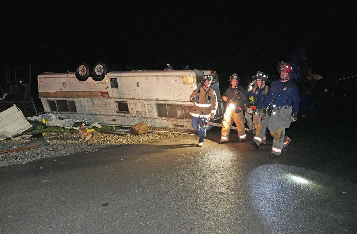
The Logan County Emergency Management Agency confirmed that a trailer park — Lakeview RV Park — in the Indian Lake area just north of Lakeview has reportedly been struck by a tornado or at least very high winds that have caused extensive damage. A shortage of ambulances was reported at one point.
The National Weather Service in Wilmington reported "multiple buildings destroyed in the Lakeview area."
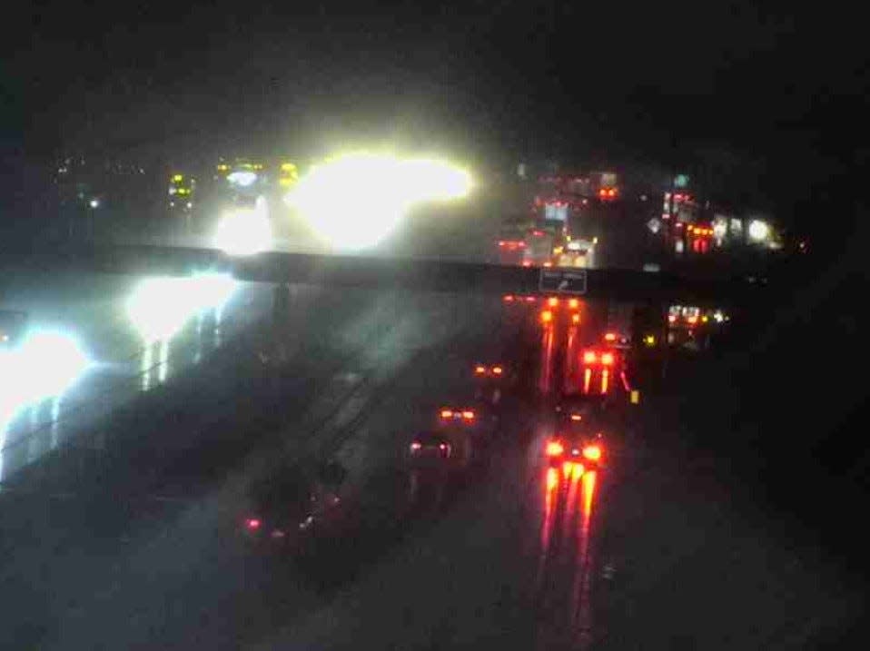
An X user who was driving from Lima and passing through Logan took pictures of the extensive damage. In the post on X, he said authorities told him that he had missed a tornado "by about 2 minutes." He could not confirm if there were any casualties, but said that a large section of U.S. Route 33 northwest of Marysville would remain closed as authorities assessed the damage.
Y’all pray for the folks of Indian Lake… cops said I missed the tornado by about two minutes… pic.twitter.com/ITY3f6gkjF
— Ole #CBJ Dad (@CBJ_Dad0424) March 15, 2024
Tornado touchdowns were also reported near Jenera in Hancock County south of Findlay in northwest Ohio and near Plymouth along the Huron-Richland counties line. A half-mile-wide tornado was reported on the ground in Huron County by that county's emergency management agency with damage to homes and structures reported, according to the NWS Cleveland.
Auglaize County Emergency Management Agency reported "a tornado producing damage" just after 7 p.m., believed to be near Fryburg south of Wapak.
A tornado watch was issued late Thursday night for portions of far southern and southeast Ohio, southeast Inddiana and northern and north-central Kentucky until 4 a.m. Friday along the Ohio River, where earlier in the day Thursday a tornado was seen crossing the river from Indiana into Kentucky.
In central Ohio, tornado warnings were issued at various points Thursday night as the severe storm front that struck Logan County moved east-southeast into Union, Delaware and Licking counties.
Numerous downed trees and power lines were reported in Delaware County, where Genoa Township police had closed a section of Route 3 due to downed trees.
More than 10,300 customers were without power Thursday night, according to AEP's power outage map.
Licking County was the last of the tornado warnings in central Ohio, issued around 9:45 p.m. However, tornado sirens in Pataskala in western Licking County did not go off until about 10 p.m. and could be heard in eastern Franklin County. The county's tornado warning expred at 10:15 p.m., though another round of thunderstorms moved in behind it.
Severe thunderstorm warnings remained in effect until 11:30 p.m. for Licking, Fairfield and other counties along and south of Interstate 70. Hail was still possible with that front.
A tornado watch for all eastern Ohio counties except Monroe and Noble had been canceled by NWS Pittsburgh at 11:14 p.m.
Some thunderstorms and then pockets of heavy rainstorms were expected to continue in central Ohio into the first hours of Friday morning based on future radar projections from The Weather Channel and the National Weather Service, but no further tornado watches or warnings were anticipated.
At least three people were killed by a tornado Thursday afternoon at a mobile home park in Winchester, Indiana.
At least three other confirmed tornadoes touched down Thursday afternoon in southern Indiana and north-central Kentucky Thursday, leaving dozens of structures damaged or destroyed, The Louisville Courier-Journal reported. Tornadoes were confirmed near Hanover and Marion in Indiana and near Milton in Kentucky.
Marc Weinberg, chief meteorologist at the WDRB news station in Louisville, posted photos of heavy damage from a one of two confirmed tornadoes in the area of Hanover, a town in southeastern Indiana. That front moved on into northern Kentucky,
Significant damage coming in from Hanover, IN via our @StephanWDRB. pic.twitter.com/ydX4o9dWUe
— Marc Weinberg (@MarcWeinbergWX) March 14, 2024
Tornado warnings here come on heels of tornadoes just over 2 weeks ago
The tornado warnings Thursday night came just over two weeks after Ohio was hit by nine tornadoes in the pre-dawn hours of Feb. 28, seven of which struck central Ohio. Removal of downed trees, demolished buildings and barns, and other restoration work is still continuing in Madison, Franklin and Licking counties.
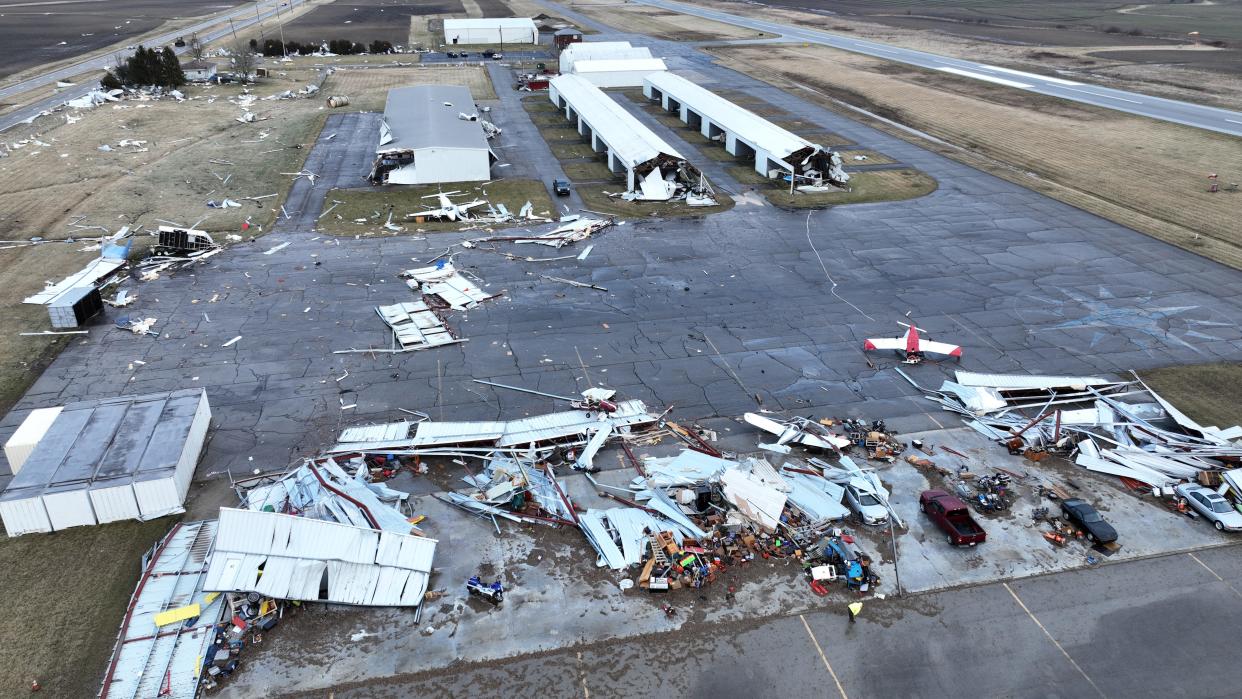
Three of the nine Ohio tornadoes were EF0 tornadoes (65-85 mph), one each reported in Groveport and Darbydale in Pleasant Township, Franklin County, and one in Harrisburg village in Franklin and Pickaway counties; three were EF1 tornadoes (86-110 mph), one each hitting between east of London and West Jefferson, in Hilliard and in Riverside, Montgomery County between Dayton and Springfield; and three EF2 tornadoes (111 to 135 mph), including one that traveled from Clark County into Madison County that severely damaged the Ohio State University Agricultural Center and Madison County Airport in Madison County, one that struck in the Blacklick area of Jefferson Township in eastern Franklin County before traveling into Pataskala and Jersey Township in Licking County and weakening to an EF1 before dissipating southwest of Granville, and a third one in Malaga Township in Monroe County, eastern Ohio.
What's the difference between a tornado watch and a tornado warning?
A tornado watch means tornadoes are possible in areas that often include large parts of several counties or states.
If a tornado watch is issued, it's a good time to review emergency plans, check supplies and decide the safest place for you to go in the event that the storm gets worse. Ensure your phones are charged and have a plan to act quickly should the watch become a warning.
A tornado warning means a tornado has been sighted or is indicated by weather radar. A warning means there’s imminent danger to life and property in the warning area, and you should immediately move to an interior room on the lowest floor of a sturdy building and avoid windows.
@ShahidMeighan
smeighan@dispatch.com
This article originally appeared on The Columbus Dispatch: Ohio tornadoes cause mass casualty response northwest of Columbus
