Muddy hike in remote Sequoia National Park reveals astonishing flood damage | Opinion
Nestled in the remote foothills of Sequoia National Park, far from the main tourist attractions, the South Fork area provides hikers and campers with a peaceful escape.
At least it used to. The whole place looks and feels a lot less tranquil now. And judging by the astonishing flood and rockslide damage caused by California’s recent atmospheric river deluge, it will be a while before there’s any semblance of recovery.
During normal times, it helps to have a high-clearance vehicle on the final dirt section of South Fork Road (which traces the South Fork of the Kaweah River from Three Rivers).
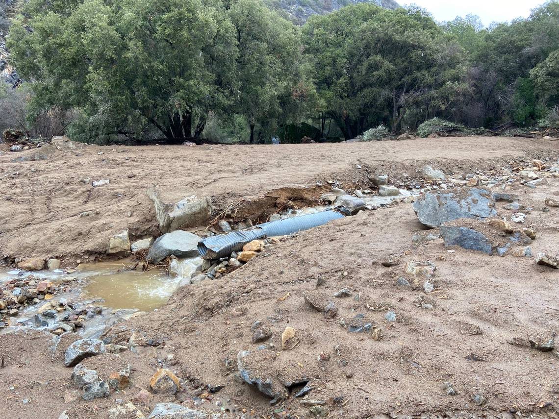
Right now, you’d need a bulldozer. Not just to fill in gaping ruts but to remove giant boulders and repair a section of roadway blown away by a flooded creek that left behind a muddy chasm. Just above that mess, there’s an entire oak tree that came skidding down the hill, roots and all.
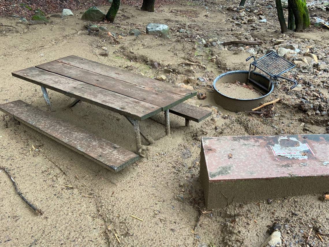
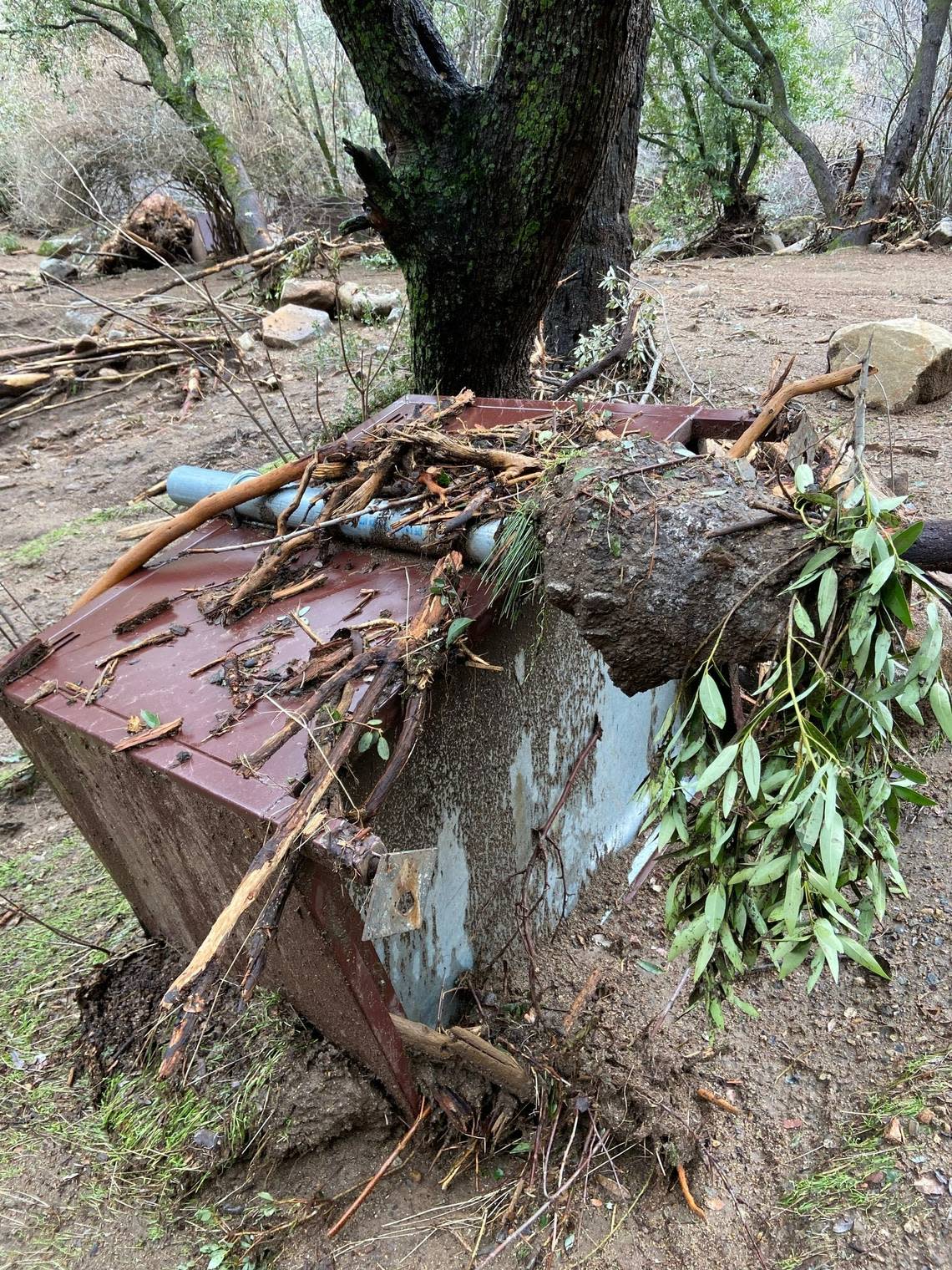
At South Fork Campground itself, picnic benches are upended, bear boxes ripped from their cement anchors and fire pits almost completely buried in sediment and rocks. Boulders, logs and branches are strewn everywhere, as if deposited by a massive explosion.
Opinion
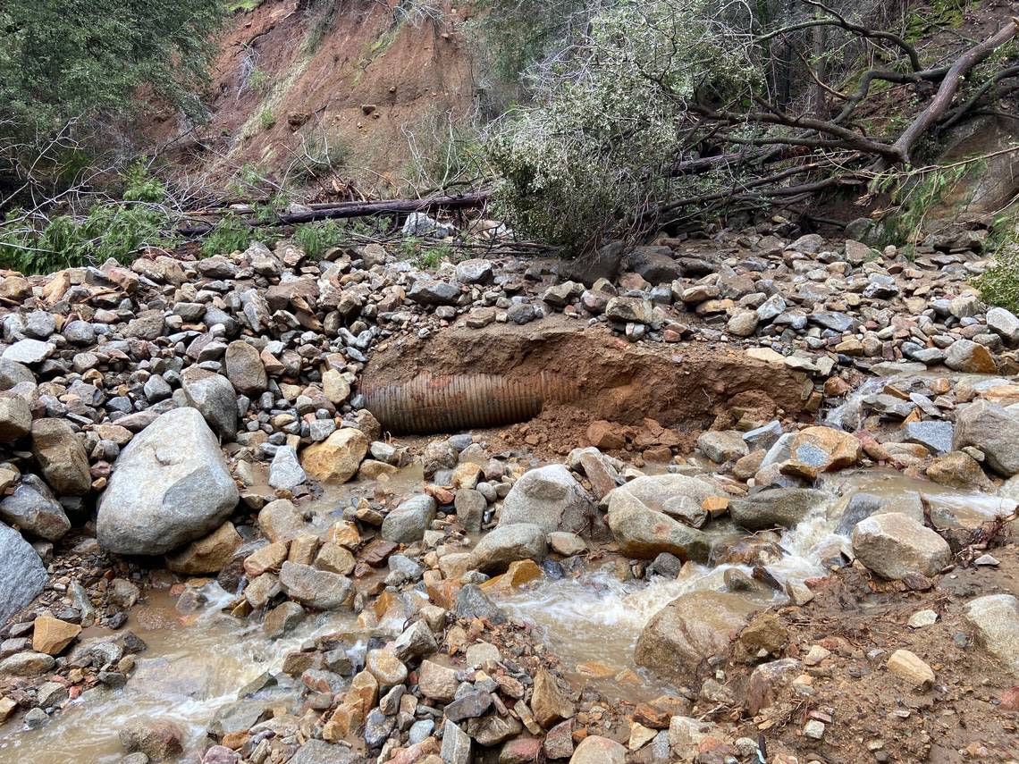
Above the campground en route to the Ladybug Trail trailhead, a friend and I encountered an even more dumbfounding sight: An area the size of multiple football fields that until recently was filled with oak trees and other foliage has been completely leveled.
Not a single tree remains standing. Just a wide-open expanse of rocks and mud with a new thread of the South Fork running at its bottom. Portions of the creek flow through a twisted, mangled cistern exposed to fresh air after being buried for decades.
“Holy s–!” exclaimed my hiking companion, who had visited the area less than a month earlier. “Oh my god, Marek. This is insane.”
It truly was. Mother Nature’s jaw-dropping power of destruction on full display before our eyes.
We continued on and found the Ladybug Trail, which crosses the South Fork on a footbridge (still intact, thankfully) and re-enters a dense grove of oak trees dotted with moss-covered boulders. As if everything is fine and back to normal.
Getting this far required tromping through shin-deep mud with the color and consistency of red clay. When we made the hike Sunday during a break in the weather and careful not to overstay our welcome, ours were the only footsteps. (Human footsteps, at least. We did see deer tracks.)
By Tuesday, a ranger’s report from the area had made its way to park headquarters.
Rebecca Paterson, a Sequoia National Park spokeswoman, said that even though the South Fork area won’t be officially closed the public is “strongly discouraged” from visiting due to the unstable conditions.
To be frank, park officials have more pressing concerns. Access to Sequoia’s most popular destinations — including the Giant Forest, Lodgepole and Wolverton — is cut off due to rock and mudslides on the Generals Highway. There is no timetable for the road to reopen.
It will undoubtedly take months, if not years, for the damage to the South Fork infrastructure to get fixed. I did some checking and learned the drainage has a history of landslides, including one that washed out a silver mining trail in 1876.
Today, the primary attractions are ladybugs (hence the Ladybug Trail) and remote giant sequoia groves, some of which were severely burned during recent wildfires.
“That road and those trails are important access points for us,” Paterson said. “We definitely need to do some thinking about how to handle this.”
Seeing all that destruction firsthand made me do some thinking, too. Mainly about how much flood and rockslide damage other recreation areas likely sustained. Damage that we have yet to discover because of all the snow. Not just in Sequoia National Park, but throughout the Sierra.
And beyond that, the heavy impact all that is going to have on public enjoyment of these areas this spring and summer. It’s a little scary to think about. Especially since we don’t know the full extent.
“We’re going to see a lot of damage like this in other places,” Paterson agreed. “Places such as Cedar Grove, which we haven’t been to yet. We’re really bracing ourselves for what we’re going to discover.”
I wouldn’t recommend anyone visit the South Fork anytime soon. But if you do, prepare to get walloped.
