How much more rain will Dallas-Fort Worth get before storms slowly move to the east?
Spring rains will fall across Dallas-Fort Worth for most of the day Wednesday, dropping up to 2 inches in some parts, before exiting the region overnight, according to a National Weather Service Fort Worth office report.
“One last round of showers and thunderstorms will move across the area today,” the NWS forecast states. “While the threat for severe storms is low, a few strong storms capable of hail and gusty winds are possible, especially along and east of I-35.”
Flooding is possible in low areas with poor drainage or areas near rivers and creeks. Those who encounter floods should turn around and avoid the overflow.
⚡ More trending stories:
→ There’s no ‘better place’ to see April 8 total solar eclipse than in this tiny Texas town.
→In Texas, set your thermostat at 80 when it's 100 degrees, expert says.
→Groceries at this national chain are the cheapest, study finds.
The weather service says the lows tonight will drop into the 50s with a slight chance of showers tonight accompanied by modest winds. Today’s high will be in the mid 60s.
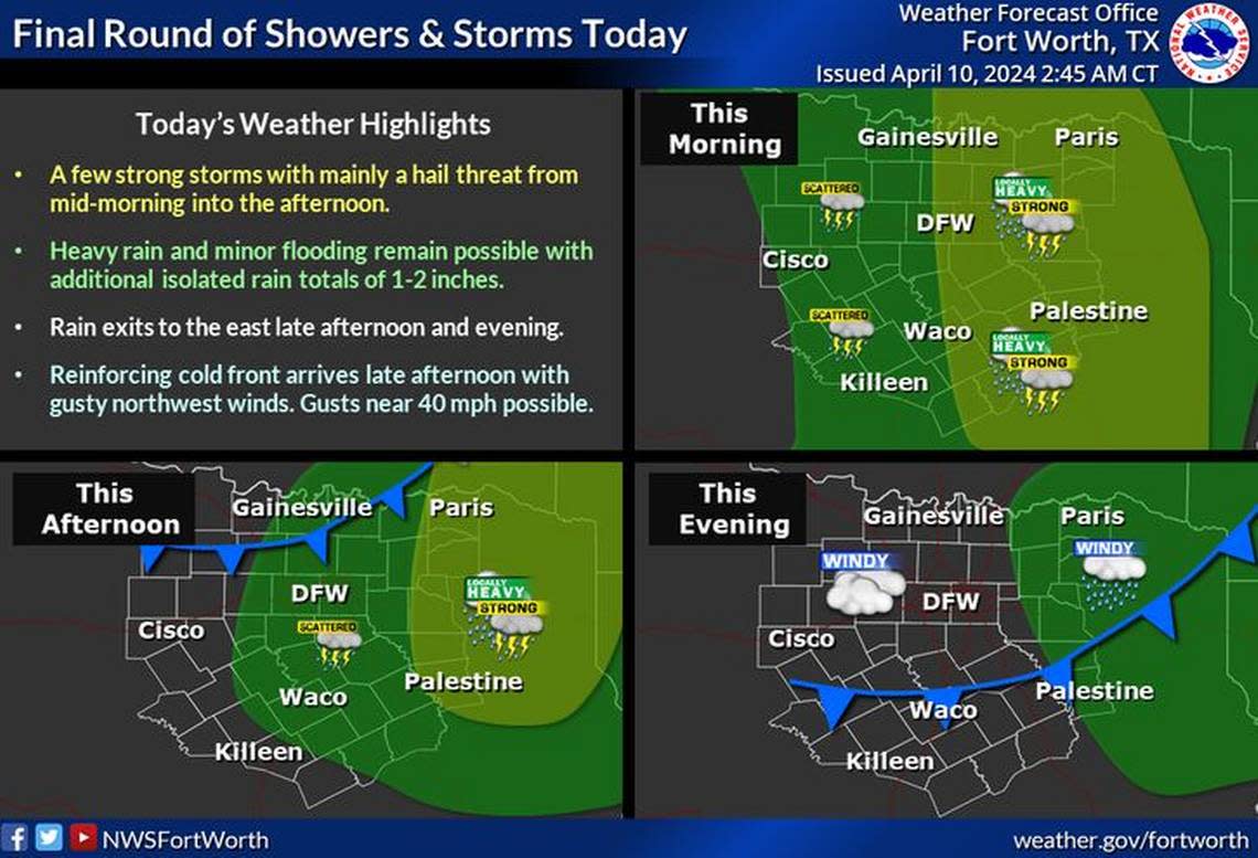
A cold front moves in behind tonight’s light showers bringing strong winds. Tomorrow’s highs look promising with highs in the low 70s and sunny.
Expect warmer days going into the weekend, according to the NWS, with highs topping 80 degrees and cloudy skies on Saturday and Sunday.
Thunderstorms are not surprising for North Texas in April. March through May tend to be the months when severe weather occurs. The region is in the middle of its tornado season.
