More storms coming to Dallas-Fort Worth through Friday morning. Here’s the forecast.
More rain and storms are forecast in North Texas through Friday morning after a front moved in Monday night, according to the National Weather Service in Fort Worth.
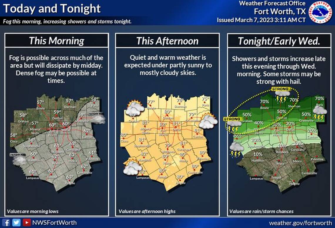
On Tuesday night, a few strong storms with gusty winds and small hail were possible across portions of North Texas with a system moving in from the northwest, heading southeast.
The best chances for rain in the Dallas-Fort Worth area will be Thursday, with scattered thunderstorms possible.
While there is no expectation yet for widespread severe weather, that could change as conditions evolve.
In some areas, local rain could cause flooding, and strong winds and hail are possible. The storms should leave the Dallas-Fort Worth Metroplex after Friday morning.
3-Day Storm Outlook
This map shows the 3-day weather outlook for storms by the National Weather Service's Storm Prediction Center. Sources: National Weather Service, Esri.
Current Temperatures
Current temperatures and weather data from NOAA weather stations updated hourly. Tap on the map for current weather conditions, including humidity, wind speed. and direction. Data provided by NOAA and Esri.
