Massive winter nor’easter still headed to New York, with up to 36 inches possible on Long Island
Long Island, prepare to get clobbered. New York City, watch and wait.
A nor’easter set to blanket the tristate area Friday night and Saturday, is likely to bury the Island in a blizzard, with a storm track that could spare the city the worst of it.
The “bomb cyclone” could drop as much as 36 inches in parts of Long Island like Islip, AccuWeather predicted Thursday. More likely, though, 12 to 18 inches will pummel everything from Wantagh to Westhampton.
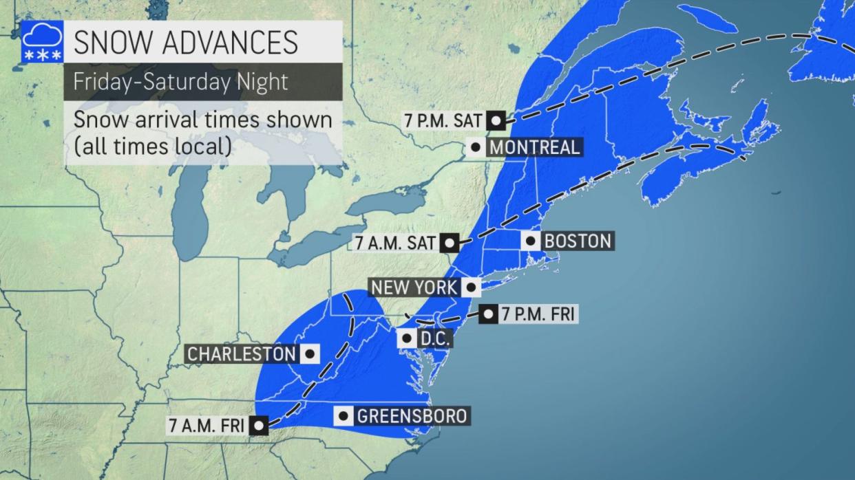
New York City would be at the western back edge of the storm, Accuweather senior meteorologist Paul Walker told the Daily News. He said that a foot could fall east of the city and 6 or fewer inches west of the city, with up to 4 inches hitting the boroughs.
If the storm takes more of a western path, the city could get creamed as well.
“We’ll have to see what the exact track is. ... There’s nothing set in stone yet,” Walker said.
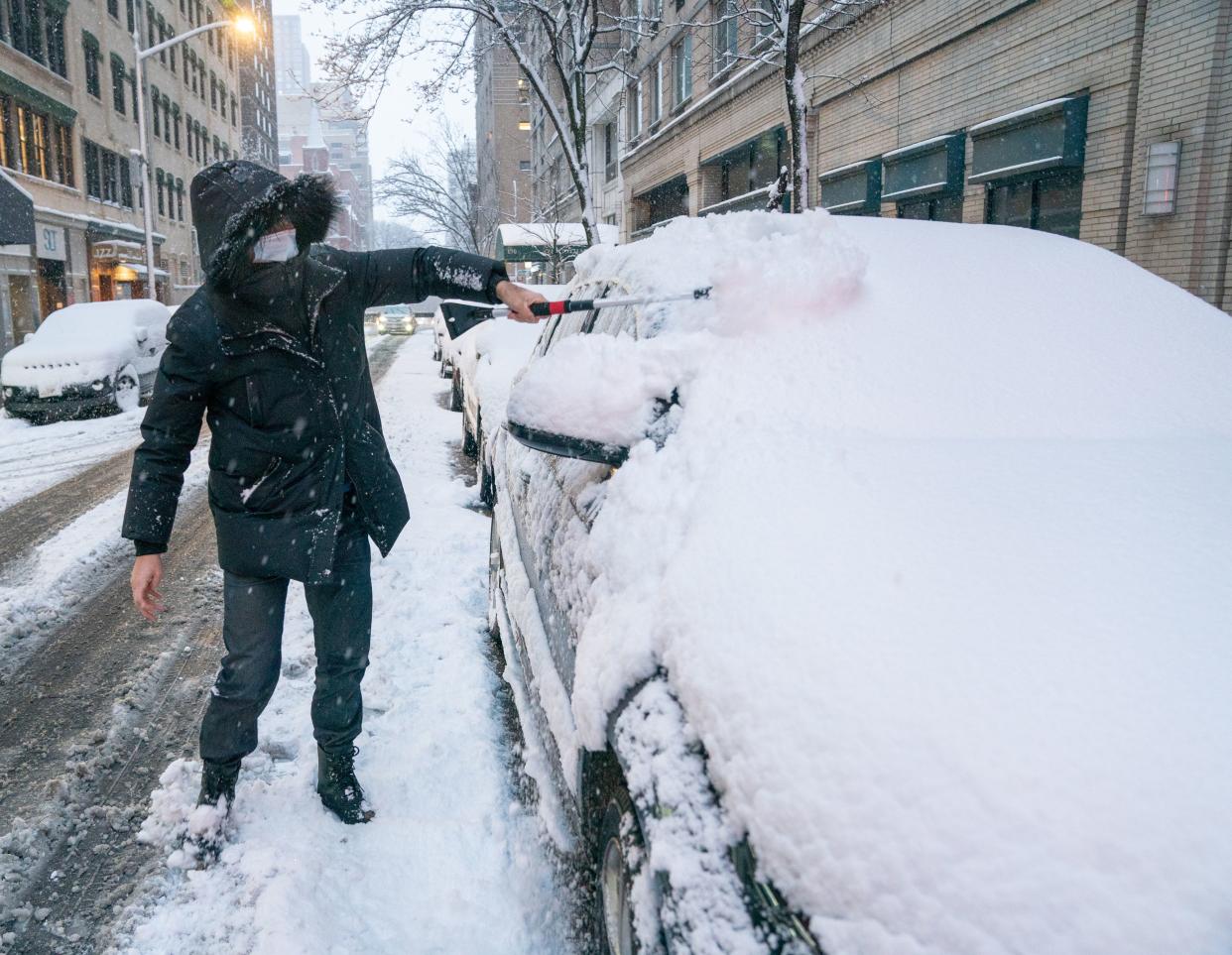
A Thursday night update from the weather service said the city could get 5-10 inches.
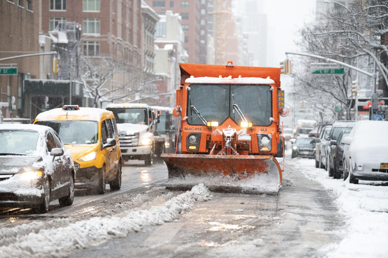
The forecast led to a warning Thursday from Gov. Hochul, who said, “As we head into the weekend, I encourage New Yorkers to closely follow their local weather forecasts, stay off the roads and avoid unnecessary travel.”
Key aspects won’t become apparent until the storm has actually materialized, Walker said. But a cold front could also bring some flurries Friday.
“There’s going to be a cold front coming in [Friday] and that’s going to bring a bit of snow,” he said, cautioning that driving could be hazardous.
After that, the real fun begins.
“The main show is certainly [Friday] night and Saturday, with the developing storm off the coast that will intensify rapidly and move up toward New England,” Walker said. “Eastern Long Island and up into New England looks to be an all-out blizzard, with 12 to 18 inches of snow, with 40-50 mph winds creating blizzard conditions.”
Similar snow totals are expected in Boston and Worcester, Mass., Providence, R.I., Hartford and Groton, Conn., Portsmouth and Manchester, N.H., and Portland and Bangor, Maine, according to Accuweather.
“This is going to be an intensifying storm that will produce a lot of wind, which raises concerns for blowing and drifting snow, power outages and blizzard conditions in some areas,” AccuWeather Chief Meteorologist Jonathan Porter said.
Even before there are big accumulations, blowing snow could make for whiteout conditions, making travel dangerous.
The hardest hit areas are expected to stretch from central and eastern Long Island to New England, forecasters warned.
A winter storm watch is already in place from Friday evening to Saturday evening for portions of northeast New Jersey, southern Connecticut and southeast New York, including the city. Gusty winds up to 45 mph could make travel difficult even before the snow piles up.

The storm is expected to fully form off the coast of the Carolinas, then strengthen as it moves north, picking up high winds and moisture as the pressure plummets, creating a “bomb cyclone.”
“Everything we’ve been looking at all week indicates there’s going to be a strong storm, and the big uncertainty remains as far as where the heaviest portion of the storm is going to be, and the worst conditions,” Walker said.
