Mapped: Where are the wildfires in Tenerife as blaze forces thousands to flee
Wildfires have ripped through holiday hotspot Tenerife, ravaging thousands of hectares and forcing tens of thousands of people to flee.
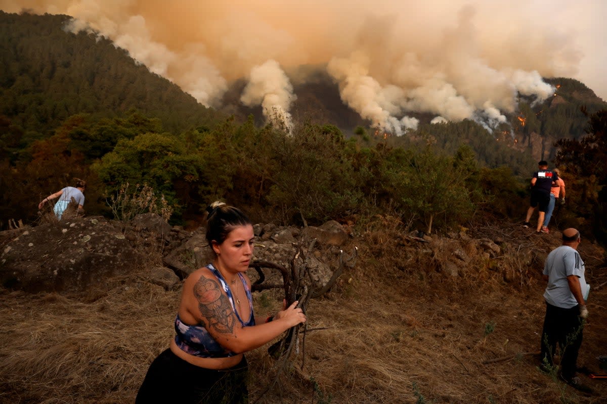
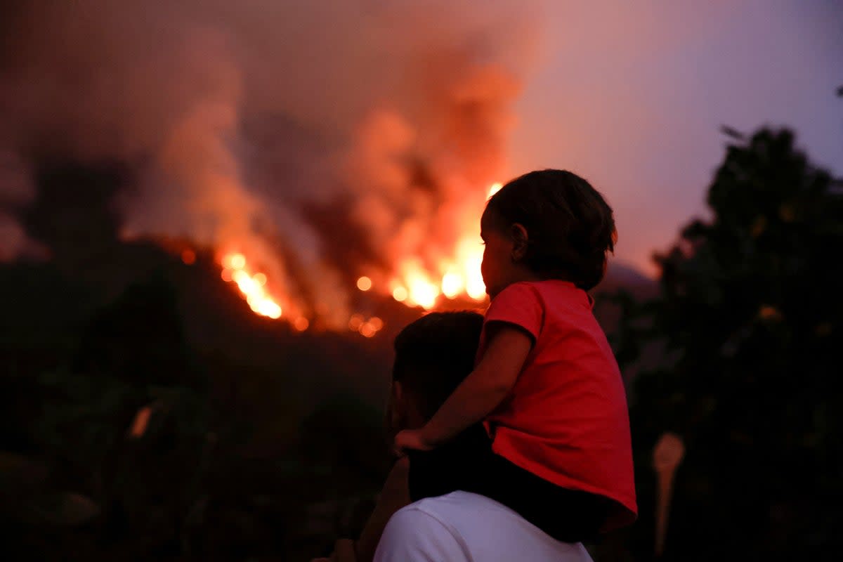
The devastating fire has prompted the evacuation of more than 12,000 people as photos show residents escape in horror as plumes of smoke and fire tower behind them.
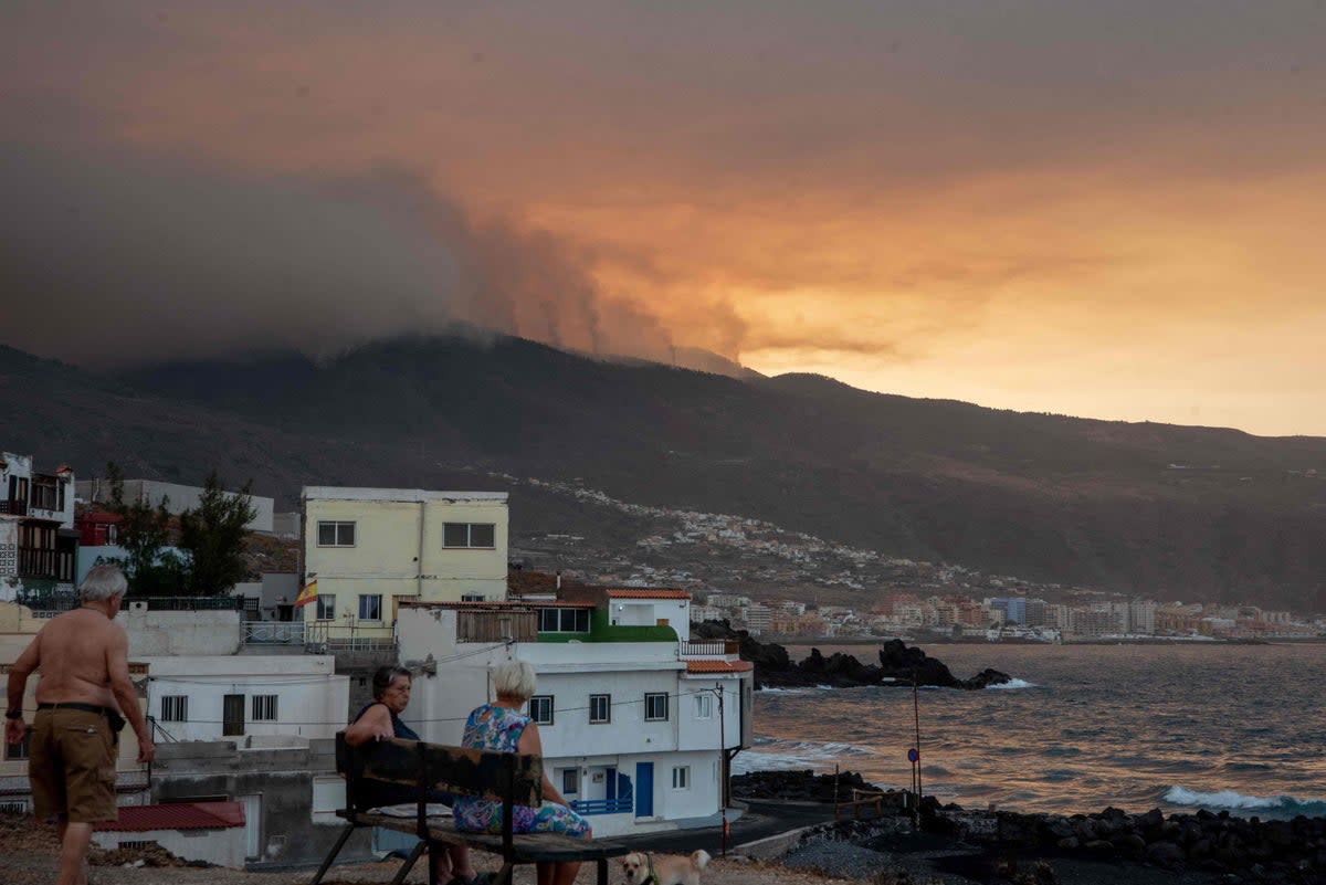
Orange flames lit up the night sky from Saturday into Sunday on hillsides just above the lights of inhabited areas, while thick black smoke billowed high into the air.
Late on Saturday, emergency services said the fire was now affecting 10 towns, although 11 had been evacuated as a precaution.
The blaze covers an area of over 8,000 hectares (20,000 acres) with a perimeter of 70 km (40 miles), spreading from 5,000 hectares and a perimeter of 50 km early on Saturday.
Fernando Clavijo, Canary Islands’ regional leader, said the largest firefighting deployment in the history of Tenerife had so far prevented the loss of any homes.
Evacuations were ordered on Saturday due to worsening weather conditions. At a news conference, the head of Tenerife‘s local government Rosa Davila described the fire as “devastating” and said it had forced new evacuations.
But on Sunday morning, Ms Davila confirmed firefighters had helped to tame the raging blaze, saying: “The night was very difficult but thanks to the work of the firefighters, the results have been very positive.”
The Canary Islands emergency services said in a tweet on the social media platform X, formerly known as Twitter, that firefighters had been able to work in “better weather conditions than expected”.
Below is a map of the areas impacted by the wildfire:
The blaze broke out on Wednesday in a mountainous national park around the Mount Teide volcano - Spain’s highest peak.
Popular tourist areas on Tenerife, part of the Canaries archipelago in the Atlantic Ocean, have so far been unaffected and its two airports have been operating normally.
“This is probably the most complicated blaze we have had on the Canary Islands, if not ever, in at least the last 40 years,” President Fernando Clavijo said earlier this week.
The fire has been burning in a forested area with steep valleys in the northeast part of the island in the municipalities of Arafo, Candelaria, El Rosario, La Orotava, Santa Úrsula, La Victoria, El Sauzal and Tacoronte.
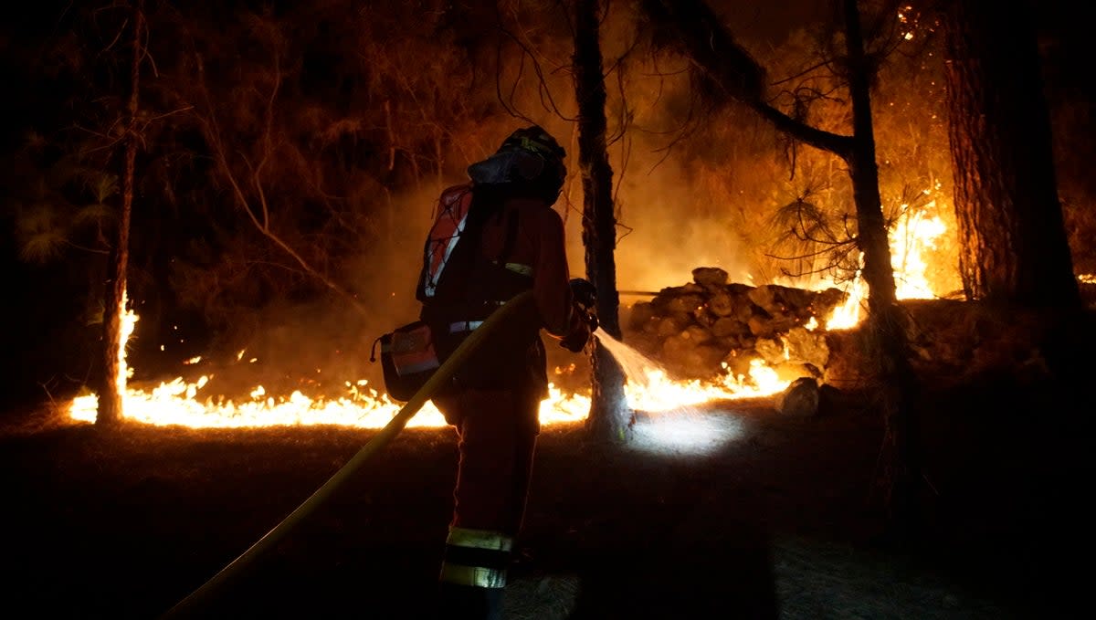
Some 250 firefighters and members of the Spanish army have been tackling the fire, which is just 12 miles away from the island’s main town, Santa Cruz.
Francisco Linares, mayor of La Orotava, told Las Mañanas de RNE earlier this week: “It is the worst fire that the island has suffered in the last 40 years, it affects 8 municipalities, the perimeter exceeds 42km and we have walls with a verticality that is almost impossible to enter”.
“When you go outside you start suffocating. It’s as if you have something stuck in your throat,” said Alba Gil, 37, a resident of the village of La Esperanza where authorities ordered people to stay home due to the heavy smoke earlier this week. She and her family stayed up until 4am worried about the flames higher up the mountain.
Tenerife is the largest of the Canary Islands, off the northwest coast of Africa. The island’s tourism office stressed in a statement Thursday afternoon that the main tourist areas and cities of the island were away from the fire.
Last month, a wildfire burned out of control on another Spanish island of La Palma, forcing the evacuation of at least 4,000 people.
The wildfire and evacuations came nearly two years after a three-month volcanic eruption caused devastation on La Palma. While nobody was killed, around 3,000 buildings were buried along with many banana plantations, roads and irrigation systems.
In the past few weeks, a series of heatwaves have swept across southern Europe, causing temperatures to reach record highs in certain areas of Spain, Greece, Italy, and Albania.
