Mapped: Where will snow fall in the UK today
More sleet and snow are expected across southern England and south Wales on Wednesday while scattered snow and hail showers will impact Scotland's northern coasts as the Arctic blast intensifies.
The Met Office's early morning radar showed an area of rain moving in from the south and west which was starting to turn increasingly to sleet and snow as it pushed north and east.
The conditions, which have been attributed to an Arctic blast, are expected to bring more snow and ice throughout the UK, the Met Office said.
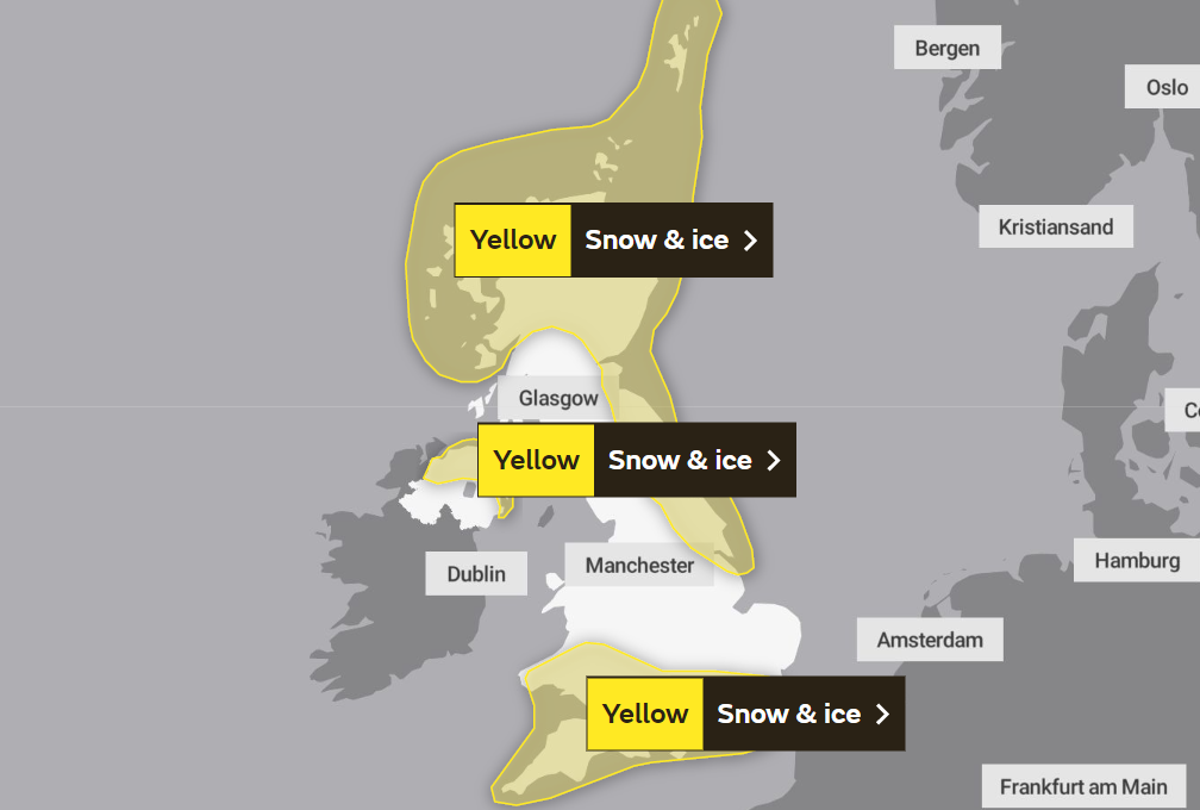
A Met Office weather map has issued a snow and ice warning for almost all of Scotland and the Highlands, in addition to parts of northeast and east England.
All of Northern Ireland is also expected to see snow today according to the Met Office’s map.
Much of southern England and Wales are also experiencing snow today.
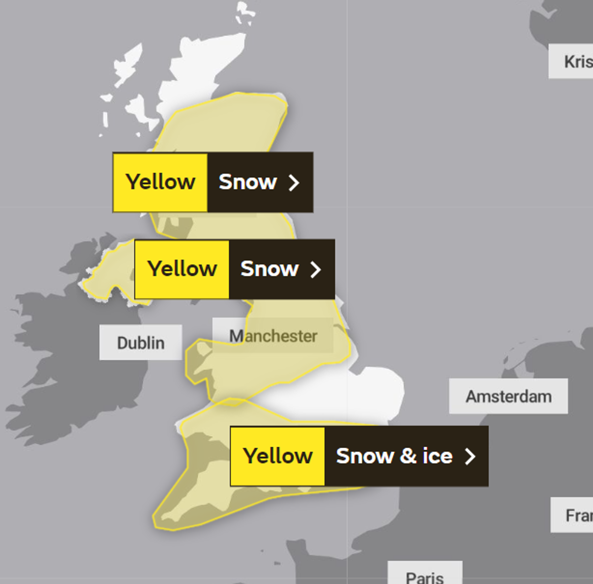
Going into Thursday more snow is expected, with Met Office maps showing increased snowfall across northwest England and the West Midlands also.
The forecasting body's chief meteorologist, Matthew Lehnert, said the weather could cut off rural communities in the north and impact travel over the next few days across southern England and south Wales.
A number of national severe warnings for snow and ice were issued, with the Met Office saying further warnings, or updates to the current warnings, are “very likely”.
Mr Lehnert said: “Snow, ice and low temperatures are the main themes of this week's forecast, with the UK under an Arctic maritime air mass.
“Snow could lead to some travel disruption, with a chance some rural communities in the north could be cut off.
“The focus for the snow moves to southern England and South Wales tomorrow and some may wake up to a few centimetres of snow, with the south coast and far south-west likely to see a mix of rain and sleet. Further snow and hail showers are also expected along northern coasts, especially in northern Scotland.”
He added: “During the afternoon, a further spell of sleet and snow is likely to develop across southern England and South Wales which could cause travel disruption into the evening. The impact of lying snow and ice on untreated surfaces may have an impact on Thursday morning travel.”
Dale Hipkiss, national network manager at National Highways, urged people to pack extra provisions in vehicles in case they become stranded.
“Keeping a kit of essential items like a torch and warm clothes, in your vehicle, can be vital in case you and your passengers become stranded in winter,” he said.
“Freezing conditions bring so many hazards, such as snow and ice, and take every possible step to understand your journey in advance and allow lots of extra time when travelling to prepare for the unexpected.”
The Met Office also warned that ice will be an additional hazard through the week as regions experience sub-zero temperatures.
