Louisville faces potential severe weather this week. Here's what to know
The Louisville metro area could face severe weather starting Monday, with the National Weather Service saying there is the potential for “isolated strong to severe storms” in the afternoon and evening hours.
According to a statement sent out by the weather service, the main threats of potential severe weather on Monday are “large hail and damaging winds.”
Another round of storms set to arrive late Tuesday has a severe threat that “looks very low,” but forecasters said another set of storms developing late Wednesday morning or afternoon carries a higher risk.
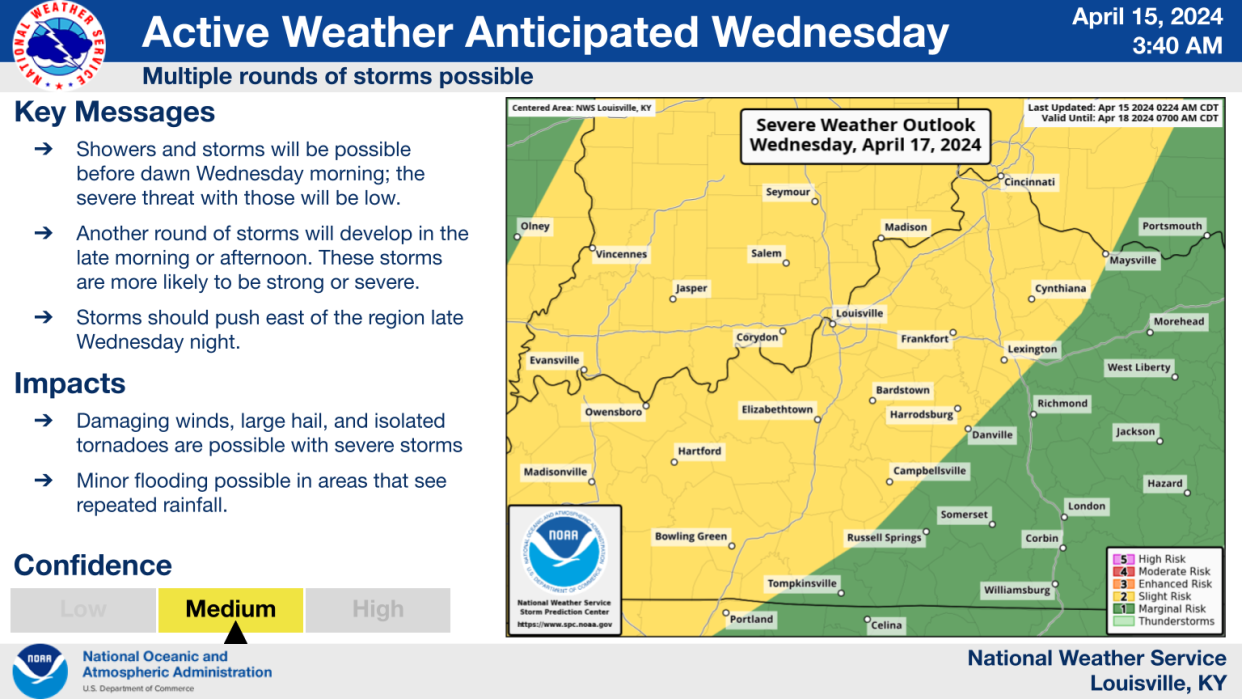
An infographic shared by the weather service early Monday morning shows Wednesday’s storms shows the Louisville metro and southern Indiana have a “slight risk” to see damaging winds, large hail, isolated tornadoes and minor flooding.
Those storms are anticipated to leave the region late Wednesday night.
Louisville weather radar
Reach reporter Josh Wood at jwood@courier-journal.com or on X, formerly known as Twitter, at @JWoodJourno.
This article originally appeared on Louisville Courier Journal: Louisville weather: Severe storms to move into area Monday, Wednesday
