Live Updates: Flights canceled, power outages, icy roads after winter storm hits Kansas City
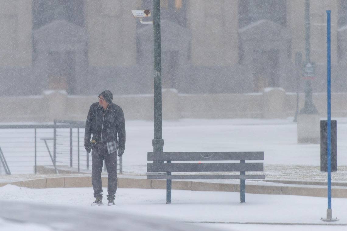
A quick-moving winter storm cut through the Kansas City area Thursday, bringing bitter cold, freezing drizzle and snow that soon turned roads slick and made travel hazardous.
Weather radar showed most of the snow moving out of the Kansas City area by midday.
But strong prevailing northwest winds of 15 to 25 mph, along with gusts up to 35 mph, created blowing snow and reduced visibility. Near blizzard and whiteout conditions made travel hazardous in the Kansas City area and across northwest Missouri and northeast Kansas.
At one point, a rare snow squall warning was issued by the National Weather Service in Wichita for Interstates 35, 135 and 235 and U.S. 254 near Wichita. The warning also was for U.S. 169 near Chanute, U.S. 54 and U.S. 77 near El Dorado and U.S. 54 and U.S. 77 near Augusta, all in Kansas.
Blowing snow had created whiteouts that made travel dangerous, possibly life-threatening, the weather service said. That snow squall warning was in effect until 10 a.m.
In the Kansas City area, the snow was expected to end between 10 a.m. and noon.
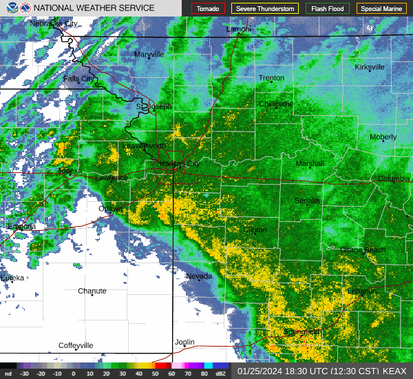
Blowing snow, however was expected to continue to reduce visibility throughout the day and linger into at least Friday. Travel is expected to remain hazardous into Friday.
Between one and two inches of snow was expected in the Kansas City metro area, according to the weather service’s latest forecast. Some areas to the south of the metro could see as much as four inches of snow.
Roads in the Kansas City area and across northwest Missouri and northeast Kansas turned slick earlier Thursday from freezing drizzle that fell overnight and transitioned over to snow early in the morning, according to the weather service.
Numberous accidents were reported, although most were fairly minor.
The KC Streetcar was suspended Thursday afternoon following a third-party vehicle incident near 19th and Main streets. Services resumed after the incident was cleared.
Winter storm and wind chill warnings remain in effect for the Kansas City region. Strong winds gusting as high as 40 mph were expected, and wind chills as low of 35 degrees below zero were likely.
Wednesday, the Missouri National Guard was alerted to help Missourians with anticipated travel issues.
Gov. Mike Parson alerted around 500 members of Missouri National Guard to position personnel and equipment across the state. The guard will assist the Missouri State Highway Patrol and other agencies with stranded motorists and other issues from the inclement weather.
Power outages blamed on weather
Update 2:00 p.m.: About 1,200 households were left without power in Lenexa early Thursday afternoon in the wake of the winter storm.
According to Evergy, 1,208 households in the area of Renner Road and 87th Street were affected by the outage, which was reported around 12:20 p.m. The situation was expected to be resolved around 2 p.m.
An Evergy spokesperson said the outage can likely be attributed to inclement weather conditions.
That came after several transformers caught fire Thursday morning in Liberty, causing a power outage for thousands of residents, leaving them in the cold as the winter storm rolled through.
Two transformers caught fire near U.S. Highway 291 and Brown Street, causing a power outage in the southern section of Liberty, the Liberty Police Department tweeted. Police posted dash camera footage showing the start of the fire around 6:40 a.m. from U.S. Highway 291 at Kent Street.
Police said Evergy crews were working to have power restored by midday.
Ice and wind from the winter storm caused the fire, according to fire officials.
The Liberty Community Center was opened as a warming center for anyone in need.
Timelapse shows temperatures crashing in KC
Update 11:30 a.m.: A timelapse video taken by the National Weather Service in Pleasant Hill showed how quickly temperatures plunged after a winter storm moved into the Kansas City metro area.
The video shows that temperatures were slightly above freezing — 33 degrees — just after midnight. Less than five hours later, temps had fallen to around 8 degrees.
The temperatures continue to drop lower.
“As of 6:45 am, the temperature at the office was 2 degrees,” the weather service said on Twitter. “Wind chills are ranging from -25 degrees to -15 degrees. Bundle up before heading out this morning and be prepared for slick roads.”
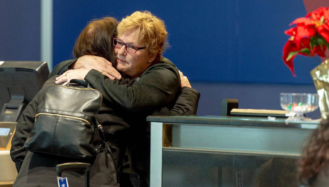
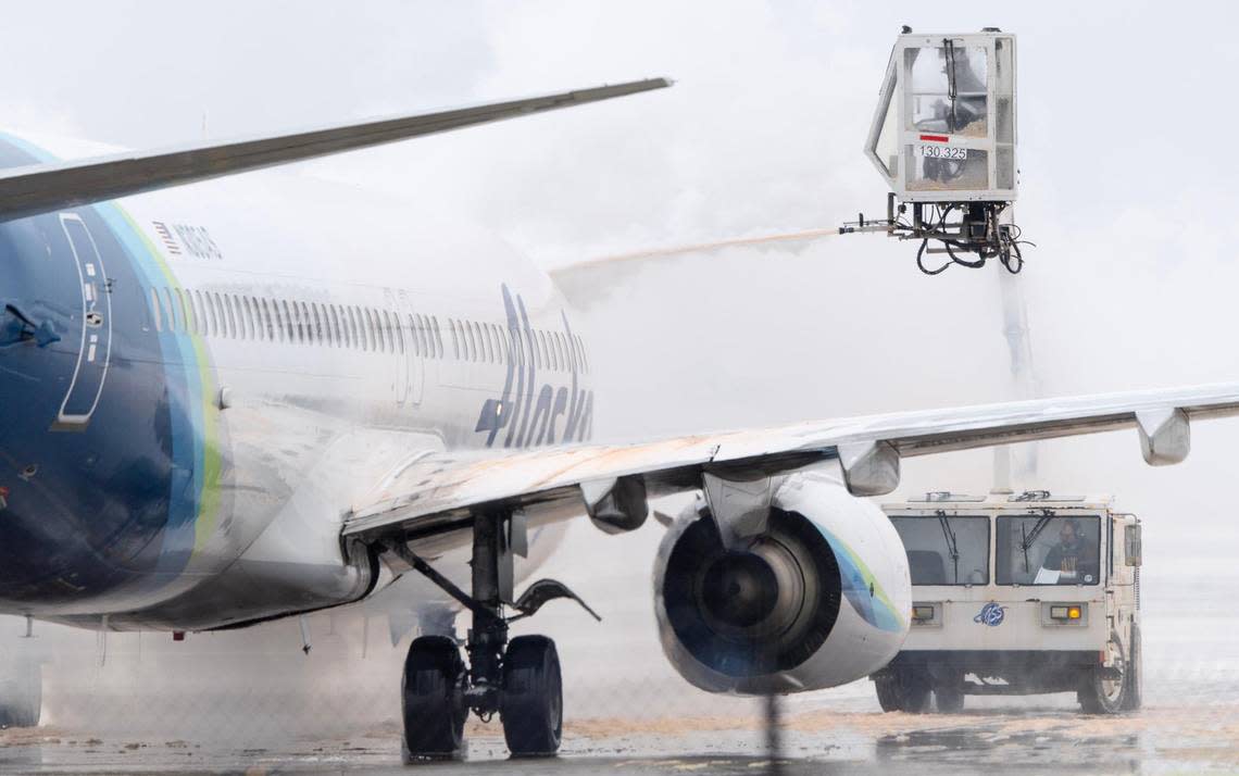
Flights canceled or delayed at KCI
Update 9 a.m.: Dozens of flights into and out of Kansas City International Airport were delayed or canceled Thursday as the major winter storm moved through the area.
Southwest Airlines, the largest passenger airline at the airport, had canceled nearly 20 flights out of KCI as of 9 a.m.; several others had been delayed. About 20 flights into Kansas City also had been canceled, according to the airport’s website.
By Thursday afternoon, Delta had also canceled around 20 flights out of KCI.
Each airline also had canceled around 20 flights arriving into Kansas City.
Because the winter storm was affecting such a large part of the country, many airlines were waiving or discounting change and cancellation fees. Passengers were urged to check their airline’s website for the latest status on their flights.
Our crews are on standby for the impending snow storm. Check https://t.co/sshKJZCarq for flight info or airline web sites for flight status or to make changes. Some airlines are waiving or discounting change fees. Airport Snow Removal 101: https://t.co/fTyG6ZrMtb pic.twitter.com/pjOimPuTYl
— Kansas City International Airport (@KCIAirport) December 20, 2022
Schools, governmental offices close due to storm
Update 8:15 a.m.: Several schools and governmental agencies announced they would be closed due to hazardous conditions created by the winter storm.
The Lee’s Summit School District and Park Hill School District announced they would turn to online learning Thursday. Meanwhile, the Raymore-Peculiar School District canceled all classes.
At the University of Kansas, only employees labeled as essential workers were to report. The university had closed its Lawrence, Edwards and Leavenworth campuses. Students and all other employees were encouraged to staff off campus and employees designated as remote or hybrid workers should work online.
For a listing of closures, see: Schools, offices announce closures ahead of expected winter storm Thursday
Other cancellations and weather news
Kansas City cancels trash collection Thursday and Friday ahead of winter storm
Patrick Mahomes is making a change for cold-weather game. Other Chiefs adjusting, too
Where is the plow? Here’s how to track Kansas City’s snow removal in real time
Why is storm hitting KC blizzard-like, not a ‘blizzard’? Winter weather terms, explained
What is a wind chill warning? What to know before extreme cold hits Kansas City
Officials warn of dangerous road conditions
Update 8 a.m.: The Missouri State Highway Patrol urged residents to stay home and off the roads as strong winds and cold temperatures created dangerous conditions.
Several accidents or stalled vehicles have been reported across the metro area, but none so far have caused serious injuries or major roadway closures. According to KC Scout, there have been crashes reported throughout the morning on Interstates 435, 35 and 70.
With the low temperatures, road salt isn’t effective, limiting the effectiveness of plowing, the city of Independence tweeted. But plows won’t work with the small accumulations of snow, the city said, so they’ll be relying on warmer temperatures to help melt snow and slick spots.
“Unfortunately, that won’t happen until Saturday,” the city wrote.
Anyone who does need to drive is encouraged to slow down, stay far behind other cars and be cautious. Drivers can also track road conditions using this map from the highway patrol. As of 8 a.m., the tracker listed many Kansas City roads, including parts of Interstate 435 and Interstate 35, as covered or partially covered, and more snowfall and strong winds are expected.
In Johnson County, a vehicle traveling at a high speed crashed into the back of a sheriff’s office vehicle. The lieutenant was not injured in the incident, but officers encouraged drivers to slow down and stay home if possible because of reduced visibility on the roads.
Snow moving into Kansas City metro
Update 6:45 a.m.: Weather radar showed a heavier band of snow moving into the Kansas City metro area, the National Weather Service said. The bulk of the snow is expected to fall during the rush hour.
6:39 AM Radar Update: Heavier band of snow just moving into the KC Metro. Expect road conditions to deteriorate over the next few hours. Snow should come to an by late morning, though blowing snow and bitter cold remains. pic.twitter.com/TXORqkJ4xR
— NWS Kansas City (@NWSKansasCity) December 22, 2022
Between one and two inches of snow was expected in the Kansas City metro area, according to the weather service’s latest forecast. Some areas to the south of the metro could see as much as four inches of snow.
As of 6 a.m., one-tenth of an inch of snow, most of it freezing drizzle, had fallen at the weather service’s office in Pleasant Hill. At Kansas City International Airport, four-tenths of an inch of snow had fallen.
The winter storm system is a quick moving one and the snow is expected to end between 10 a.m. and noon, however blowing snow will continue to reduce visibility into at least Friday, the weather service said.
Temperatures have already plummeted as the front moved through the area. Temperatures were hovering around freezing at midnight at Kansas City International Airport. By 6 a.m., they had plunged to 3 degrees.
The wind chill made it feel more like 20 degrees below zero. Winds were blowing out of the north about 20 mph and gusting up to 36 mph.
Temperatures are expected to fall below zero by mid-morning and approach minus-10 in some places this afternoon. Dangerous wind chills of near 40 degrees below zero are expected overnight.
The arctic temperatures will linger in the Kansas City area, with conditions in the single digits.
Temperatures will warm slightly on Saturday, climbing from one degree below zero in the morning to the teens the afternoon.
On Christmas morning, temperatures will be slightly above zero. They will climb to the mid-20s by the afternoon.
Weather watches and warnings
A live data feed from the National Weather Service containing official weather warnings, watches, and advisory statements. Tap warning areas for more details. Sources: NOAA, National Weather Service, NOAA GeoPlatform and Esri.
