Sunday updates: After weekend of havoc in Fresno region, when is the next storm coming?
Fresno and some of the central San Joaquin Valley got a short break from rain Sunday morning, but more rain battered the region Sunday afternoon, with more promised overnight – the next blow in an anticipated barrage of atmospheric river storms flowing off the Pacific Ocean and into California over the next several days.
From Thursday night through mid-morning Sunday, about 1.35 inches of rain fell at Fresno Yosemite International Airport. That brings the total rainfall for the water year that began Oct. 1 to 15.69 inches – and more than 10.6 inches of that has fallen just since Jan. 1.
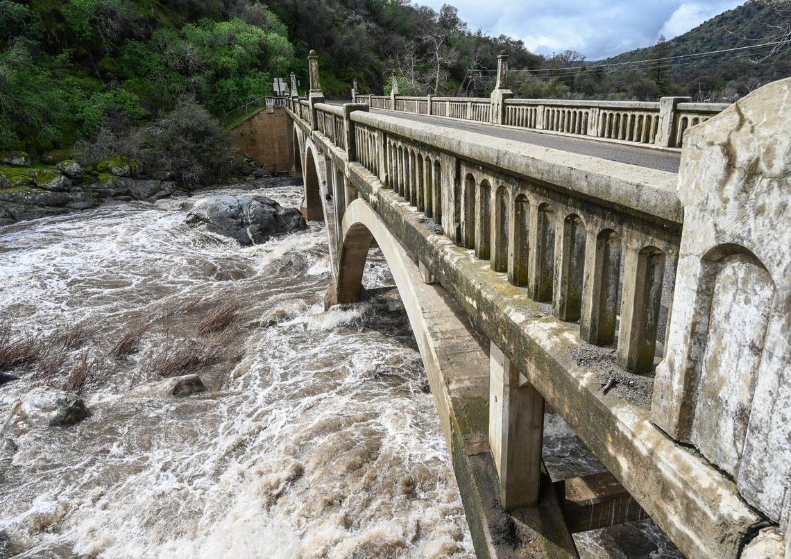
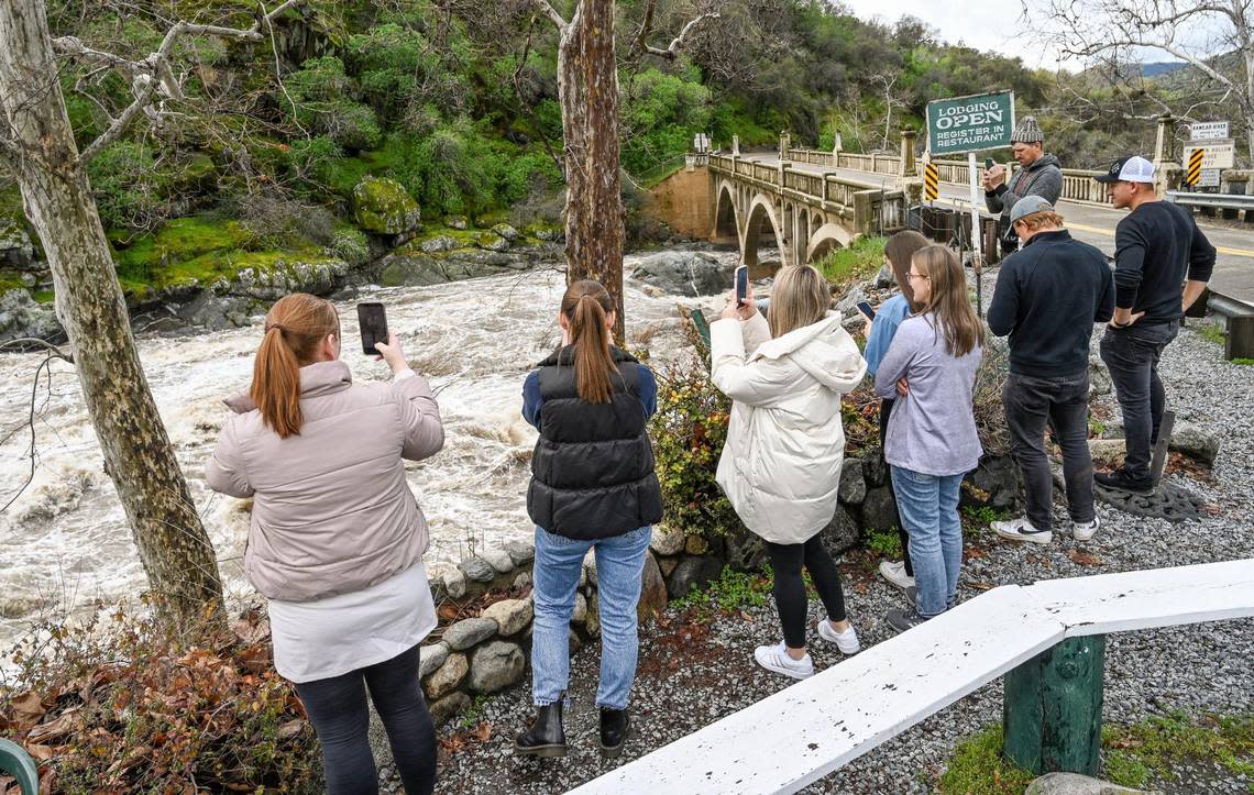
But that pales compared to the volume of rain that’s fallen in the Sierra Nevada foothills and mountains on the east flank of the Valley. In the Tulare County town of Three Rivers, for example, more than a half inch of rain was reported since midnight Sunday, and the storm total since Thursday night was 5.86 inches.
Also in Tulare County, water levels in Lake Success on the Tule River east of Porterville reached the spillway of Schafer Dam on Sunday, according to the county sheriff’s office, prompting concern over the potential for uncontrolled flows and triggering warnings for residents to be prepared to evacuate if needed.
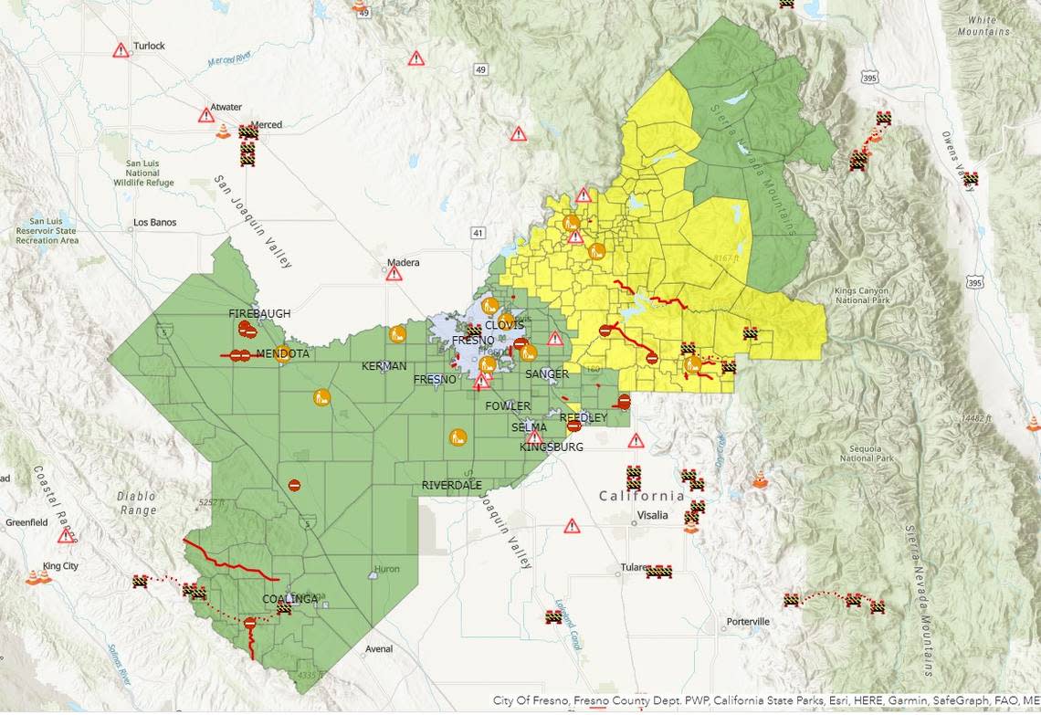
And Highway 99, the major north-south artery through the heart of the San Joaquin Valley, was closed Sunday for flooding in the Earlimart-Delano area of southern Tulare County between Avenues 24 and 56. The California Highway Patrol did not have an estimated time for reopening that stretch of the freeway.
In other parts of the Valley, storm totals since Thursday night through mid-morning Sunday include:
Madera: 0.9 inches at Madera Municipal Airport.
Visalia: 1.87 inches at Visalia Municipal Airport.
Porterville: 1.95 inches at Porterville Municipal Airport.
Merced: 1.04 inches at Merced Regional Airport.
The recent storm has been warmer than previous systems that moved through the region, dropping plentiful snow in the Sierra Nevada range to elevations as low as 3,000 feet. That new rainfall melted much of the lower-elevation snow, creating even more water runoff than would have resulted just from the rain.
That has created road closures for flooding and washed-out pavement, closed a foothill casino, and even necessitated at least two mountain rescues this weekend. And with more rain expected over the next few days, a flood watch remains in effect for the Valley through 10 a.m. Wednesday before things may start drying out.
Tornado, thunderstorm alerts issued
For the second day in a row, a tornado warning was issued in the region Sunday afternoon. The alert from the National Weather Service named Merced, El Nido, Los Banos, Firebaugh, and Dos Palos.
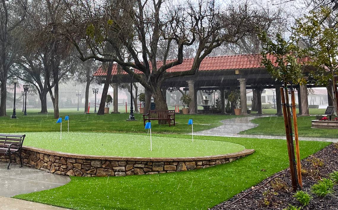
Another alert from the weather service in Hanford warned of severe thunderstorms in portions of Fresno, Madera, and Merced counties, with the possibility of one-inch hail and wind gusts to 60 mph.
It was extended to 6:15 p.m., with gusts to 50 mph and hail detected and tornadoes still “possible.” Kerman and areas of Fresno southwest of Highway 99 were in the crosshairs.
5:30 PM Update: The Severe Thunderstorm Warning is now in effect for 6:15 PM PDT tonight. Wind gusts up to 50 mph and hail up to 1.25 inch detected. Tornadoes are possible. Kerman and portions of #Fresno southwest of 99 are in the warning area. #CAwx pic.twitter.com/TdloLnEyBX
— NWS Hanford (@NWSHanford) March 13, 2023
Weather service meteorologist J. P. Kalb described the storm as “strong, but not severe.”
He said the weather service did not expect to extend the thunderstorm alert again.
The thunderstorm was followed by a flash flood warning through 9:45 p.m. Sunday night. Areas put on alert included Biola, Kerman, Calwa, Raisin City, and Easton.
The weather service in Las Vegas reported that cirrus clouds coming from the supercell storm from Fresno quickly made their way to Southern Nevada, stretching about 200 miles.
Reedley College to reopen
Reedley College, which was closed on Friday afternoon because flooded roads cut off access to the campus, is scheduled to reopen Monday morning for normal business hours and classes.
“If your own travel to campus is impacted by the effects of the storm and you are unable to attend classes, please inform your instructor … as soon as possible,” college officials said in a message to students. “Areas of the campus along the Kings River will remain off limits.”
Madera County rescues
The Madera County Sheriff’s Office reported that several people required rescue by search teams Saturday afternoon after they got stuck in the snow on Miami Mountain Road in the Oakhurst/Sugar Pine area. Deputies said the people were trying to make their way on foot to provide supplies to a snowed-in family member.
A day earlier, the Madera County sheriff’s dive team was called in to rescue a man who tried to drive through a portion of a flooded mountain roadway and became stranded in their pickup truck. “Thankfully the man was safely brought to shore,” the agency reported on its social media platforms.
Casino closes
Late Saturday night, the Eagle Mountain Casino near Springville in eastern Tulare County closed its doors due to storms that washed out the road leading to the Tule River Reservation land. Officials with the Tule River tribe said the casino would be closed “until further notice” as they evacuated the casino’s guests and employees.
“We are shuttling everyone at the casino to the reservation entrance and walking them across on what remains of the road,” tribal chairperson Neil Peyron said. “The goal is trying to restore the road to a point where we can have regular vehicle traffic.”
Tule River bridge impassible
Also in the Springville area, operators of Ciderhouse Foods on Balch Park Road posted dramatic video on the company’s Instagram account showing torrential flow of the Tule River’s north fork slopping over the Balch Park Road bridge, rendering the bridge impassible.
In Fresno County, evacuation warnings remain in effect because of flooding potential in much the eastern foothills and mountains, including Shaver and Huntington lakes, Pine Flat Reservoir, Dinkey Creek, Hume Lake, Dunlap, Miramonte, Yokuts Valley and other communities.
In the Orosi area in northern Tulare County on Sunday, California Highway Patrol officers and the Tulare County Fire Department asked Caltrans to close a portion of Highway 63 near Avenues 412 and 413 for water “coming up from the ground in the middle of the road.”
About six miles to the north on Sunday, CHP officers reported that flowing water in Sand Creek was eroding the soil under the roadway in the area of Avenue 460 near Road 136, east of Orange Cove.
Water reaches spillway
Schafer Dam that contains Lake Success east of Porterville was drawing the attention of Tulare County Sheriff Mike Boudreaux on Sunday as the water reached the spillway.
“We are monitoring this situation, and we ask that you continue to avoid this area as well as all waterways right now,” the department stated in social media posts. “At this point, we still feel the water levels are safe. The spillway is doing what it was designed to do.”
“There is no reason to panic,” the office added. “Sheriff Boudreaux just wants residents to be prepared if the water reaches a dangerous level.”
What’s still on the way
The National Weather Service office in Hanford forecast a 40% chance of showers and thunderstorms for Sunday afternoon, mainly after 3 p.m.
“Scattered showers and thunderstorms are expected (Sunday night) into the following evening,” forecasters reported Sunday. “This rainfall will continue to aid in snowmelt for elevations below 5,000 feet. Rivers and streams in (Valley counties) continue to see increased river flows and flooding due to recent storm activity.”
Monday is expected to be mostly sunny, but more rain is poised to move into the area Monday night, bringing as much as a quarter inch of rain. “The next system will bring a chance of moderate to heavy rain and high elevation snow Monday night into Wednesday, which will pose additional flooding concerns,” the weather service stated.
Rain will likely continue to Tuesday, with meteorologists anticipating the possibility of one to two inches of rain in the Fresno area Tuesday and Tuesday night before tapering off Wednesday morning.
Wednesday night and Thursday are expected to be dry, but a 20% chance of rain will return on Friday. “Relatively cool and unsettled conditions will continue into (the) week, though we could get a break for Thursday,” the weather service reported. “Another system arrives on Friday, and chances for precipitation will last into the following weekend.
“It does not appear we will receive nearly as much precipitation” from next weekend’s system, forecasters said.