Saturday updates: Flash flood warning in Fresno County foothills. Snow falls in higher elevations
Follow all our weather updates at fresnobee.com/weather-news.
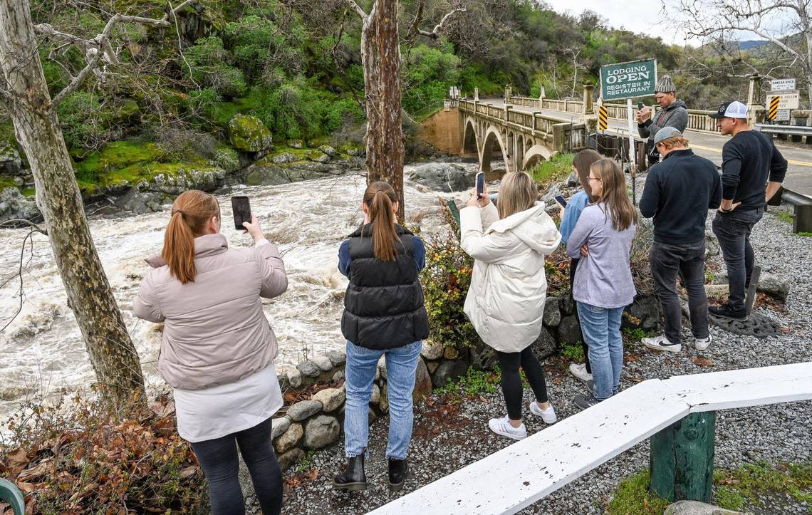
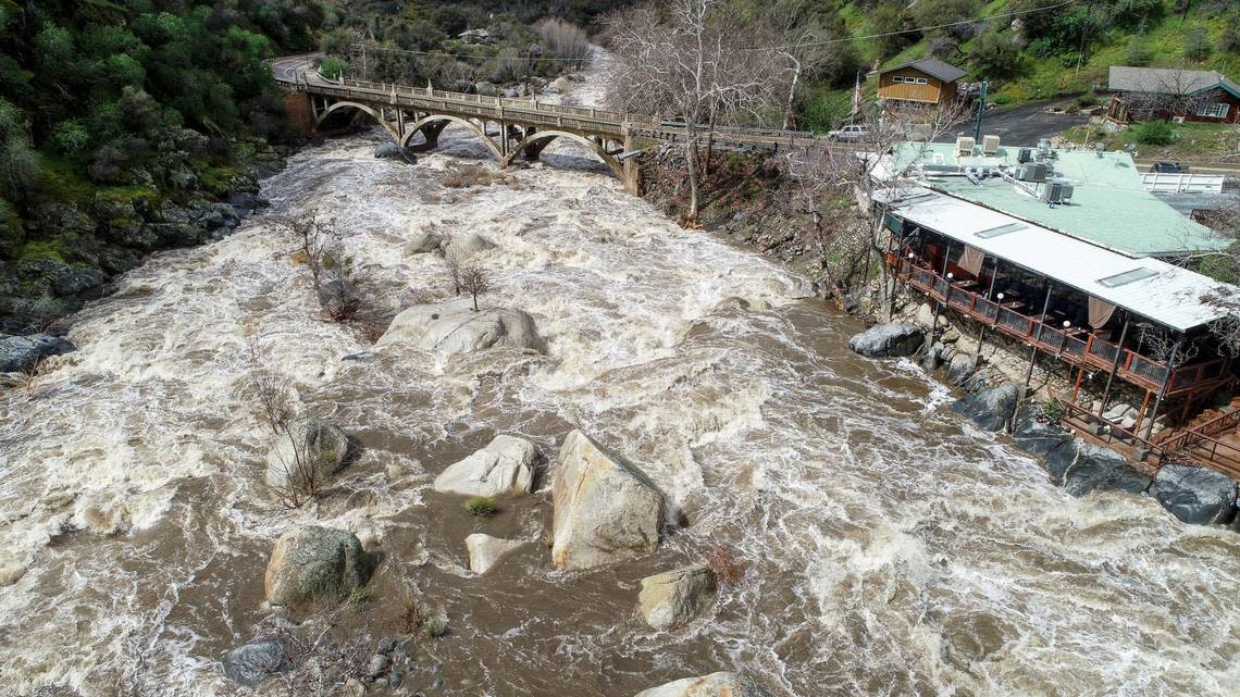
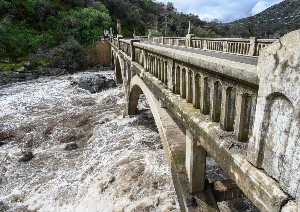
A flood watch remains in place and more rain is expected as an atmospheric river continues to cause damage as it moves across the bulk of the Fresno area Saturday morning.
The National Weather Service is predicting excessive rainfall in the region below 7,000 feet through Sunday, with thunderstorms possible in areas north of Kern County through Saturday night. Most of the rain is expected Saturday afternoon and evening before the system passes through Sunday.
But any reprieve will likely be short — another storm system moves in Monday night.
Here are highlights of the storm’s current impacts:
Flash flood warning in Fresno foothills
7:10 p.m.: A flash flood warning was issued for the foothills of Fresno County, including the areas of Auberry, Shaver Lake and O’Neals.
The warning is in effect until 9:15 p.m.
It also is snowing in the higher elevations of Fresno County, including in the Huntington Lake area.
On Friday, China Peak received 16 inches of snow.
Dry for now, more rain later
5:15 p.m.: According to the Accuweather radar, the current storm passed through Fresno and Clovis by around 5:15 p.m. as it traveled eastward.
And shortly after, blue skies and the sun could be seen once again.
But more rain was expected to make it way to the Fresno area by around 6:15 p.m., according to the weather radar.
Heavy rain was expected to pour down all over Fresno by 7 p.m.
With the atmospheric storm traveling east, the National Weather Service issued a flash food warning for areas east of Fresno, including Three Rivers, Lemon Cove and Silver City.
Roads in upper parts of Madera County closed
4:35 p.m.: Substantial damage was sustained to multiple roads around the upper parts of Madera County in the Bass Lake Ranger District due to this weekend’s storm, according to Sierra National Forest service.
So Forest Road 4S81 from a mile east of Road 225 intersection to Mammoth Pools will be closing due to multiple wash outs and damage.
“We are very aware of the affected residents and have received emergency contracting authority to bring contracted resources aboard in an expedited manner,” the Sierra National Forest service wrote.
The road will remain closed to the general public until more permanent repairs are completed. However, residents will be allowed to use the one-lane road, the national forest service said.
Hail falls in parts of Fresno
4:25 p.m.: From sunny and dry conditions to sudden hail falling.
That’s what residents in southeast Fresno received entering late Saturday afternoon.
The storm was traveling eastward and more hail was expected to fall around 5 p.m. northeast of Parlier, in the Minkler area, according to the Accuweather radar.
Flash flood warning for foothills
4 p.m.: A flash flood warning was issued for the foothills areas of Fresno County, including Auberry, Shaver Lake and O’Neals.
The flood warning is in effect currently until 7:15 PM.
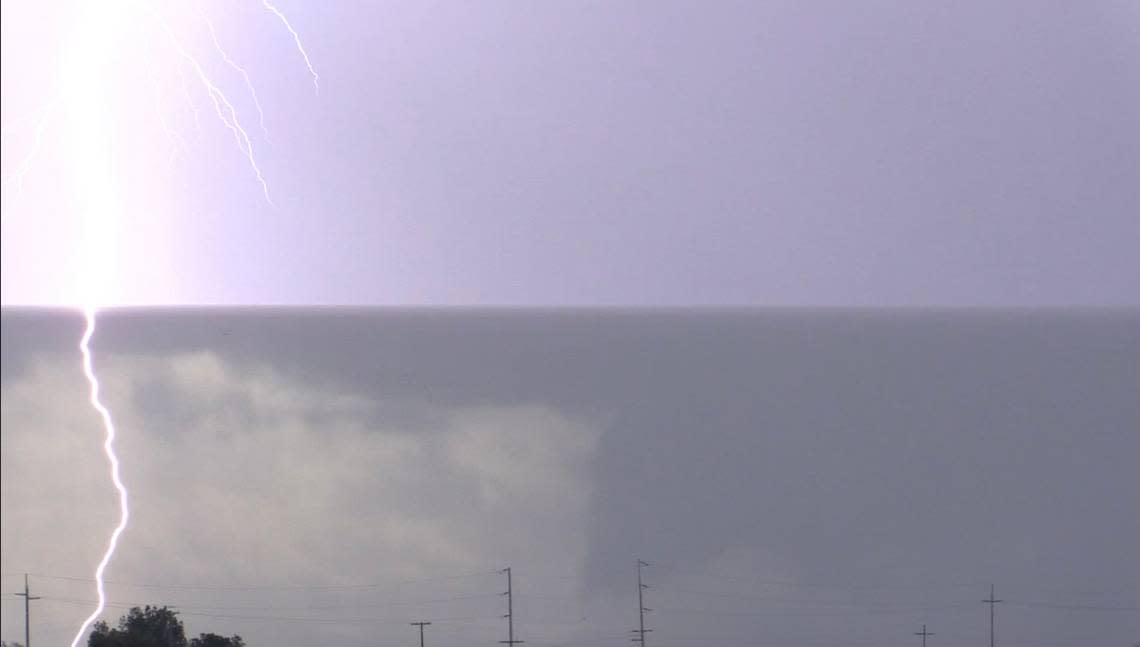
Tornado warning in Fresno County
3:40 p.m.: A tornado warning was issued for Fresno County due to reports of funnel clouds, according to the National Weather Service in Hanford.
The area in potential danger includes Kerman, Biola and Tranquillity with the warning effect until 4:15 p.m.
Residents are advised to seek seek shelter immediately indoors in an interior room without windows on the lowest floor if possible.
Tornado Warning including Kerman CA, Biola CA and Tranquillity CA until 4:15 PM PST pic.twitter.com/NnWIDXWabw
— NWS Hanford (@NWSHanford) March 11, 2023
Thunder, lightning spotted
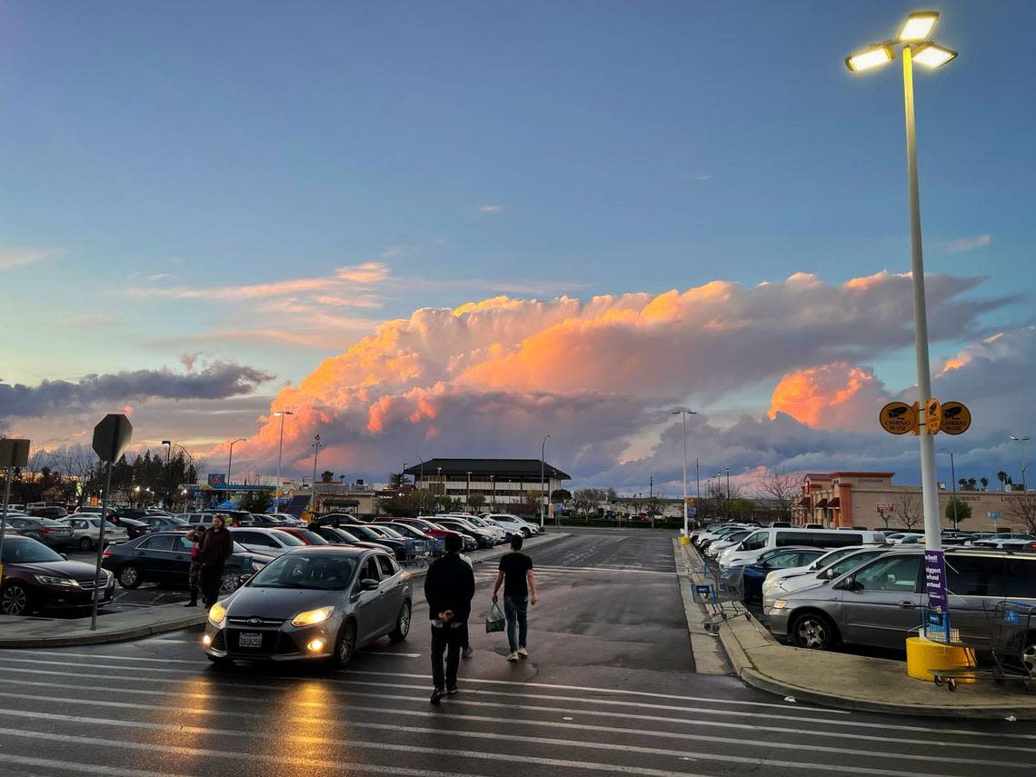
3 p.m.: The mix of the cold and wet weather from and this morning with the sunny and warm condition from Saturday afternoon has led to thunderstorms.
Lightning was spotted west of Fresno near Mendota and Kerman.
And the storm appears to be heading east, expected to arrive in Fresno by about 4:15 p.m., according to the AccuWeather radar.
The storm cell is part of the funnel clouds that prompted the National Weather Service to issue a tornado warning.
A severe thunderstorm warning was issued for the western part of Fresno County until 4:45 p.m. That area under warning includes Kerman, Caruthers and Easton.
Emergency operations remain at Level 1 in Fresno County
1:45 p.m.: The Fresno County Emergency Operations Center is operating at Level 1 and is expected to continue throughout the weekend, according to an update Saturday afternoon. The operations center also is preparing for the upcoming storm system, which will bring heavier rainfall beginning Monday.
Current evacuation warnings remain in place and the county is reminding residents to avoid unnecessary travel: “Many roads are still precarious as some have been washed out or blocked by rockslides and debris.”
A map of current roadway conditions and detours can be found on the Sheriff Office’s web page.
Also available online is a link to donate to the Central Valley Red Cross and additional information on evacuation assistance for those with livestock animals.
Evacuation warning for Poso Creek near Highway 99
11:30 a.m.: Water flow from Poso Creek has become a threat to areas near McFarland along Highway 99, south of Fresno.
The Kern County Sheriff’s Officer issued an evacuation warning on Saturday morning for residents living near the creek and affecting Elmo Highway south to Famoso Road between Driver Road and Highway 99 to the west.
The alert said all residents should be prepared to leave the area quickly. Those who require additional evacuation time (such as those with pets and livestock) should leave now.
An evacuation center is open at Horizon Elementary School, 800 Garzoli Ave. in McFarland.
Rain totals close to 2 inches in Fresno area
11 a..m.: The National Weather Service is reporting rain totals of more than 1 inch and close to 1 inches in parts of Fresno and Clovis in a 48-hour period.
Northeast Clovis reported 1.77 inches of rain as of 8 a.m. Saturday.
The gauge at Fresno Yosemite International Airport, by contrast, reported 1.22 inches.
More rain was reported in higher elevations. Hume Lake received nearly 6 inches and Shaver Lake reported just over 3 inches. Bass Lake received more than 7 inches. Some of the higher elevations in Tulare County reported nearly 12 inches of rain, according to data from the weather service.
So far, Fresno has seen 2.1 inches of rain for the month, 8.21 inches on the year, and 15.49 inches since October.
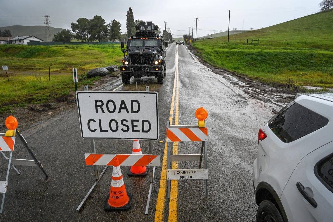
Morning freeway and roadway closures
8 a.m.: Caltrans is reporting a series of road closures due to flooding.
There is a full closure on Highway 99 south of Fresno near Delano. The freeway is closed in both directions between the under and over crossings at Avenue 24 and Avenue 56. Traffic is being diverted to Howard Road. There is no estimated time for reopening.
Both the eastbound and westbound lanes of Highway 180 are closed from Dunlap Road to Route 245 east of the Yokuts Valley near Dunlap.
In Fresno, the southbound on-ramp for Freeway 41 is closed at Shaw Avenue, with no estimated reopening time.
A map of street and highway conditions is available online.
Le Grand, Planada still on alert
The Merced County Sheriff’s Office said it does not expect the flood control dams at Owens and Mariposa Creek to reach maximum capacity this weekend. According to an update from the Army Corps of Engineers, the rivers shouldn’t reach top levels until Tuesday.
“While this is good news, we are not out of the woods yet. We still highly recommend that the communities of Le Grand and Planada stay prepared for potential flooding,” the sheriff’s office said. An evacuation warning was issued for those areas on Thursday.