Storm Day 1: Heavy rains lead to flood advisory for Madera County; warning to drivers
10:30 p.m.: A Flood Advisory is in effect for Madera County until 4:30 a.m. Sunday, according to the National Weather Service in Hanford.
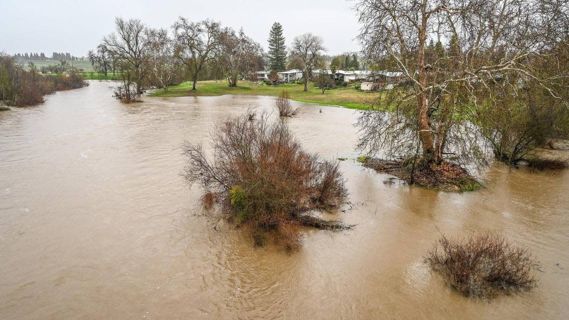
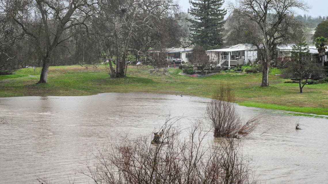
Among the locations that could experience flooding include the Crane Valley Reservoir and North Fork.
The area of North Fork that sits at lower elevations has been vulnerable to heavy rains and the threat of flooding before.
In 2017, North Fork flooded and caused several mobile home owners to scramble for higher ground.
Based on precipitation reports that measured the past 24 hours, North Fork had received 1.37 inches of rain.
Nearby Bass Lake had received 1.92 inches of rain.
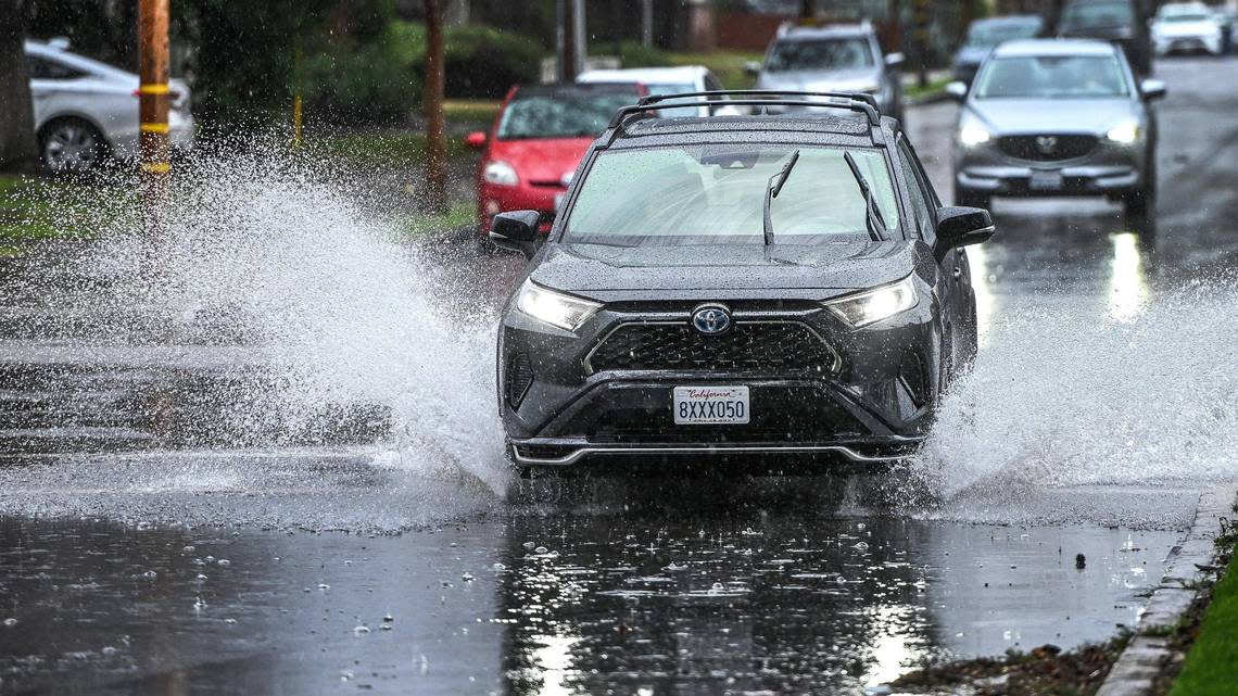
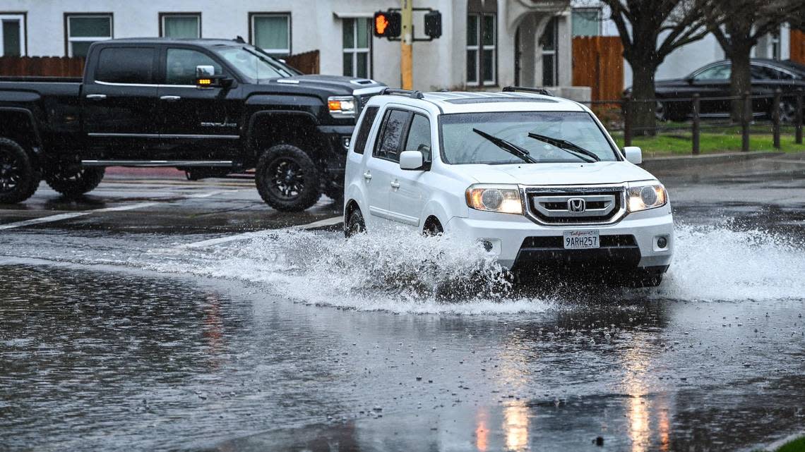
Dangers of driving over standstill water
9 p.m.: If you’re planning on driving Saturday night, be aware of going over standstill water.
According to Caltrans Headquarters, only 18 inches of water will float most cars and 2 feet of water can float SUVS and trucks.
Drivers are advised to not drive through large puddles of water on the roadway.
“If you see a good amount of water on the road, it’s safer to turn around,” meteorologist Carlos Molina said. “You might not know how deep that water really is.”
Strong winds threaten northern valley
8:30 p.m.: The National Weather Service in Hanford issued a special weather statement Saturday night for Mariposa County with winds threatening to reach as strong as 40 mph.
Residents were advised to seek shelter in a sturdy structure if in danger.
A special weather statement has been issued for Mariposa County, CA until 9:15 PM PST pic.twitter.com/p9hy1s3LCu
— NWS Hanford (@NWSHanford) January 15, 2023
Reservoirs nearing 100% capacity
6:30 p.m.: Just two weeks into the new year, and it’s possible the central San Joaquin Valley could have enjoyed enough rain and snow to reduce concerns of droughts during the summer.
The National Weather Service in Hanford on Saturday said reservoirs had reached near 100% capacity thanks to the recent storms that have passed through the area.
And it’s not necessarily the rain that’s fallen in the Fresno area but the snow that’s accumulated up in the mountains.
On Saturday, the Yosemite area and to the south toward Kings Canyon National Forest received between 2 to 3 feet of snow, according to the NWS.
Meteorologist Carlos Molina projected as much as 5 feet in snow at the crest of some mountains, as well as on the eastern side of some of the Sierra Nevada.
“In a more typical snowstorm, they usually get 1-2 feet on the western side of the Sierras,” Molina said. “But because the fact that this storm was associated with an atmospheric river, that amount has doubled.”
In terms of the snowpack helping maintain a healthy water supply in the Central Valley, Molina said reaching 100% at the reservoirs certainly is good.
But it’d be more ideal to be at the 150% mark to help sustain levels during the drier, hotter months.
“All the snow that’s falling, that’s definitely beneficial come the summer,” Molina said. “Right now, we’re closing in on 100% for our reservoirs. But it would be nicer to get that higher and reclaim the water lost from the past years of drought.”
More rain in forecast late Saturday night
5 p.m.: Though much of the heavy rain in the Fresno area ran its course from around 11 a.m. to 1 p.m., and dry conditions even lasted for a couple of hours late Saturday afternoon, another downpour was brewing for this evening.
Heavy rain was projected to occur from around 10 p.m.-11 p.m as precipitation from the Bay Area shifted eastward and towards the central San Joaquin Valley.
Fresno already had collected 0.69 inches of rain Saturday, according to the National Weather Service in Hanford.
Other rain counts logged by the NWS going into the evening throughout the central San Joaquin Valley were:
Yosemite got 1.24 inches of rain
Three Rivers had 1.04 inches
Merced with 0.60 inches
Hanford had 0.48 inches
Visalia had 0.33 inches
Madera got 0.30 inches
“There will be additional precipitation tonight but to a far less extent compared to what we saw earlier afternoon,” NWS meteorologist Carlos Molina said.
11:36 a.m.: A wall of water burst through a levee on Bear Creek in Merced County early Saturday morning, flooding homes and stranding eight horses and a dog.
Merced County Sheriff Vern Warnke described the scene Saturday morning, which ended with an Army National Guard Chinook helicopter flying in and a conveyor belt straddling the creek, both bringing supplies to stop the flow of water.
Around 1 a.m., emergency personnel were keeping an eye on two stretches of the creek near Highway 140 near Rogers and Gur roads. One was about 150 long and the other 60 feet long, with the levee about 30 feet tall.
“The entire levee gave out at that point. ... It was gone,” Warnke said. “Literally a wall of water came through there.”
Within 10 minutes about a dozen properties on 5-acre lots were flooded, with water still about hip deep midday, he said. The residents safely evacuated themselves.
Warnke said he gave permission to Merced-based Cen-Cal Trucking to skip the red tape and start repairs.
They tried to install K rails — concrete barriers weighing 8,000 pounds each — but they didn’t work, he said.
“The water was moving so hard and fast ... it looked like they were putting pencils in the water,” he said. “It scooted them out of the way.”
The trucking company erected a large conveyor belt (similar to the type used in quarries) over the water to bring sand and gravel to the broken levee.
“It actually reached clear across the creek and filled that area up,” he said.
Meanwhile, the Army National Guard flew in a CH-47 Chinook helicopter from Stockton carrying giant cube-shaped sandbags about 4-feet by 4-feet to shore up the area.
Eight horses and a dog were rescued from a makeshift barn on one of the properties.
“The horses, the water was clear up to mid belly on them and they had no place to go,” Warnke said. “The dog was standing on its hind legs with one paw against the wall because it was afraid to move.”
The animals were all fine and were taken to an animal rescue operation at the Merced County Fairgrounds.
“The community has been absolutely phenomenal,” he said. “It’s a bad situation but fortunately nobody lost their lives. Now we’re bracing for the second act. Those who are praying for rain, please stop.”
Governor to visit Merced County
11:23 a.m.: Rain is continuing to pound the Merced area ahead of a scheduled trip by Gov. Gavin Newsom shortly after noon Saturday to visit people affected by flooding.
He is expected to visit with Merced County residents and highlight preparedness efforts by the state of California.
Residents are being warned to stay away from Bear Creek, which is expected to flood again Saturday.
Dump trucks and other large equipment are hauling boulders to the creek to stop flooding, noted Jennifer Flachman, public information officer for the city of Merced.
Friday, city officials were filming a safety video on the bike path near Bear Creek.
“We turned around for maybe a few seconds and portions of the bike path slid into the creek,” she said.
There was no warning and the collapse of the bike path happened relatively quietly, highlighting the how quickly things can turn dangerous, she noted.
“We would like for people to stay out of the Bear Creek area. Stay off the bike paths,” she said. “Please be mindful where you’re walking or driving.”
Three atmospheric rivers hitting Fresno, Valley
9:30 a.m.: Rain is drenching Fresno and the Valley on Saturday in what is expected to be an extremely wet weekend with three back-to-back storms forecast.
A flood watch was declared for the central San Joaquin Valley from 10 a.m. Saturday to 7 a.m. Sunday.
The Fresno area is forecast to get between 1.5 and 2.5 inches of rain between Saturday and Monday, said meteorologist JP Kalb with the National Weather Service in Hanford.
“It’s going to be multiple atmospheric rivers back to back to back, but in such a short time,” he said. “You could think of it like a single event with multiple waves” of rain.
Atmospheric rivers are bands of water vapor that can dump extreme amounts of rain and snow on land.
The flooding risk is especially high because the ground hasn’t had time to dry out since the last series of storms, Kalb said.
Fresno got 1.91 inches of rain between Jan. 7 and Jan. 11.
Storms have pummeled the state since New Year’s Eve, destroying homes, flooding cities and killing at least 17 people.
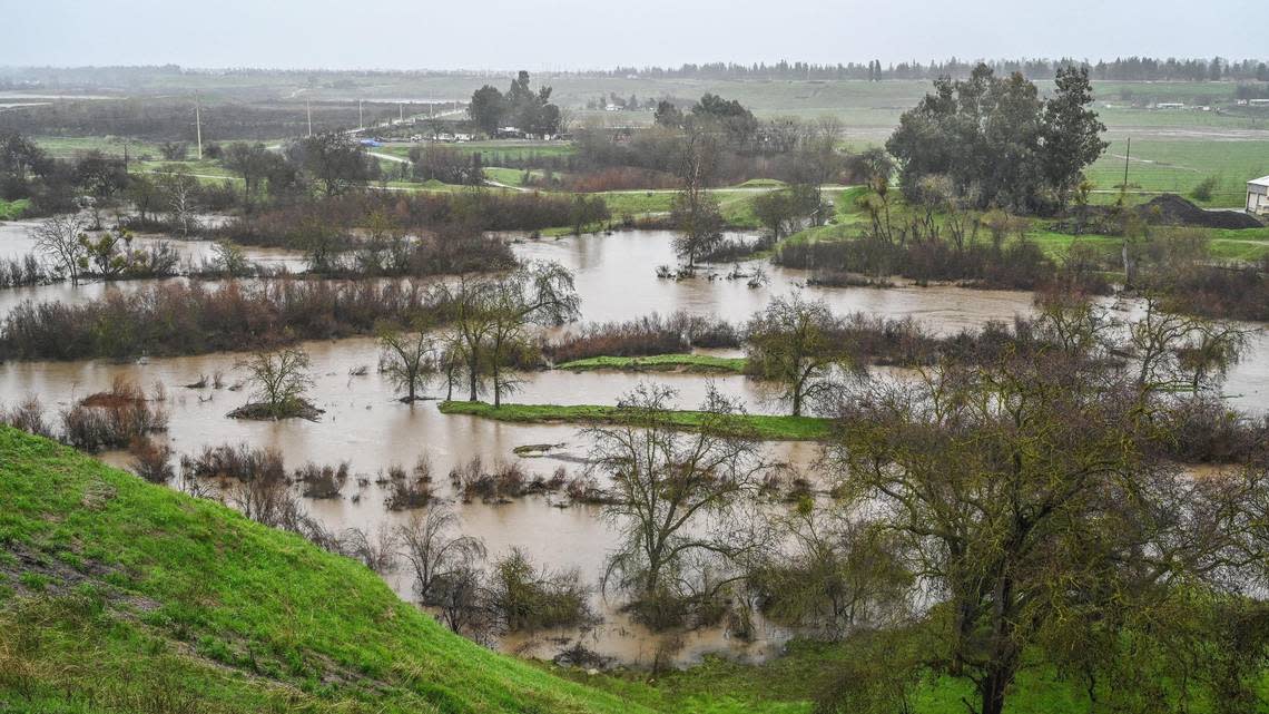
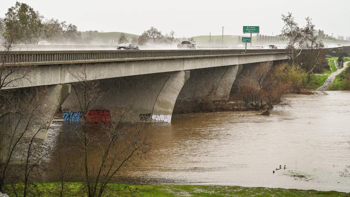
Flooding expected on San Joaquin River, Bear Creek
9:30 a.m.: The San Joaquin River in the Fresno area is expected to reach flood stage, according to Nancy Ward, director of the California Governor’s Office of Emergency Services.
“Let me emphasize: We are not out of the woods yet,” she said Friday in an update on recent storms. “The threat to communities remains and waters will continue to rise even after the storms have passed. The impacts of these storms have been significant.”
Heavy rains caused widespread flooding in Merced and nearby Planada earlier this week, causing mandatory evacuations and millions of dollars in property damage.
Merced’s Bear Creek is expected to flood again, likely by Saturday evening.
Thunderstorms possible Saturday afternoon
9:30 a.m.: In Fresno, thunderstorms are also possible, especially between 2 p.m. and 4 p.m. Saturday and into the evening, according to the National Weather Service forecast.
Thunderstorms are possible Monday too.
Meteorologist Kalb said the No. 1 issue this weekend is flooding. People should not drive or walk on flooded roadways.
“If you see a road flooded, turn around and don’t drown,” he said.