Lingering smoke from prairie fires sparks elevated air quality concerns in eastern Kansas
Lingering smoke from recent prairie fires was creating elevated air quality concerns Thursday in an area that included Topeka, said Sarah Teefey, meteorologist for the National Weather Service office here.
Air quality was worst to the south of the capital city, the Environmental Protection Agency said.
Topeka was part of an area shown in yellow on a "fire and smoke" map published Thursday morning on an EPA website at airnow.gov.
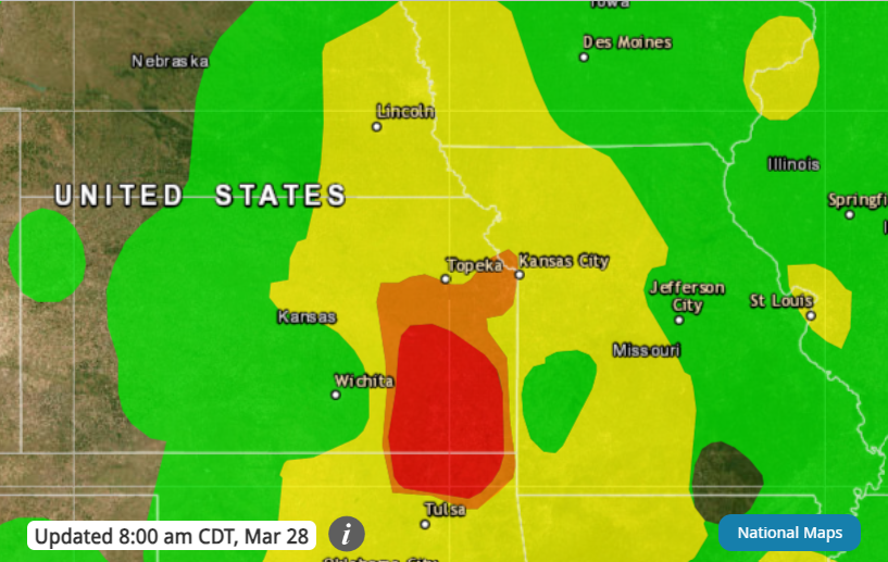
Air quality in that area was in the "moderate" category with ratings of 51 to 100, although there may be a risk for some, particularly those who are unusually sensitive to air pollution, the EPA said.
Some areas to the south, east and west of the capital city were shown in orange on that map, meaning air quality ratings were between 101 and 150 and conditions were deemed as being "unhealthy for sensitive groups."
Other areas further south, including Emporia, were shown in red, meaning air quality ratings were between 151 and 200.
"Some members of the general public may experience health effects," the EPA website said. "Members of sensitive groups may experience more serious health effects."
It wasn't immediately clear how long the situation would continue.
Contact Tim Hrenchir at threnchir@gannett.com or 785-213-5934.
This article originally appeared on Topeka Capital-Journal: Prairie fires bring diminished air quality to eastern Kansas
