New disturbance emerges in Gulf; tropical depression to form in Atlantic by midweek
Activity is heating back up in the tropics, with National Hurricane Center forecasters watching for potential development of a low-pressure system in the southwestern Gulf of Mexico and another off Africa.
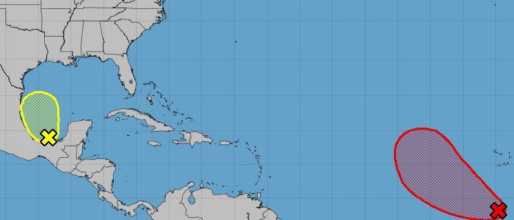
A tropical depression is expected to form by midweek from the tropical wave off Africa as it moves west.
As of 2 a.m. Monday, the National Hurricane Center had given it an 80% chance of developing in the next seven days and 60% in the next two days, up from just 30% on Sunday.
Meanwhile, odds are low — at 10% — for the disturbance in the southwestern Gulf. As of 2 a.m. Monday, it was located about 75 miles northeast of Coatzacoalcos, Mexico.
Forecasters said development, if any, would be slow-going as the system heads northwest. By midweek it is forecast to merge with a frontal system over the western Gulf.
So far this season in the Atlantic, there have been 17 named storms, six of which were hurricanes. Of those, three were major hurricanes, meaning Category 3 or above.
Those were Hurricane Lee, a rare Category 5; Hurricane Franklin, a Category 4; and Hurricane Idalia, which made landfall on Florida’s Big Bend region at Category 3 strength on Aug. 30.
The next named storm will be Sean.
Hurricane season officially runs through Nov. 30.
