Life-threatening flash flooding threatens parts of Texas and Louisiana
Relentless rounds of heavy rain have battered parts of Texas and Louisiana this spring, and another round is coming Thursday to many of the hard-hit areas.
Following weeks of constant storm systems, rivers like the Trinity River near Liberty, Texas, are still in major flood stage. And just two weeks into May, some areas have picked up more than 500% of their monthly average rainfall.
As of Tuesday, several locations from northern to eastern Texas, including Dallas, are having a top 10 wettest start to the year.
The combination of swollen rivers and saturated ground is creating a recipe for a flood disaster. With rainfall totals forecast to approach 6 to 12 inches Thursday into Friday, the soil is so saturated that there is nowhere for the water to go.
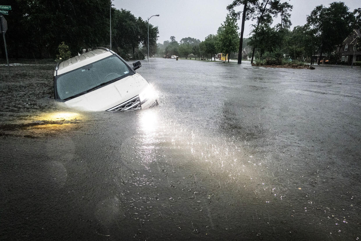
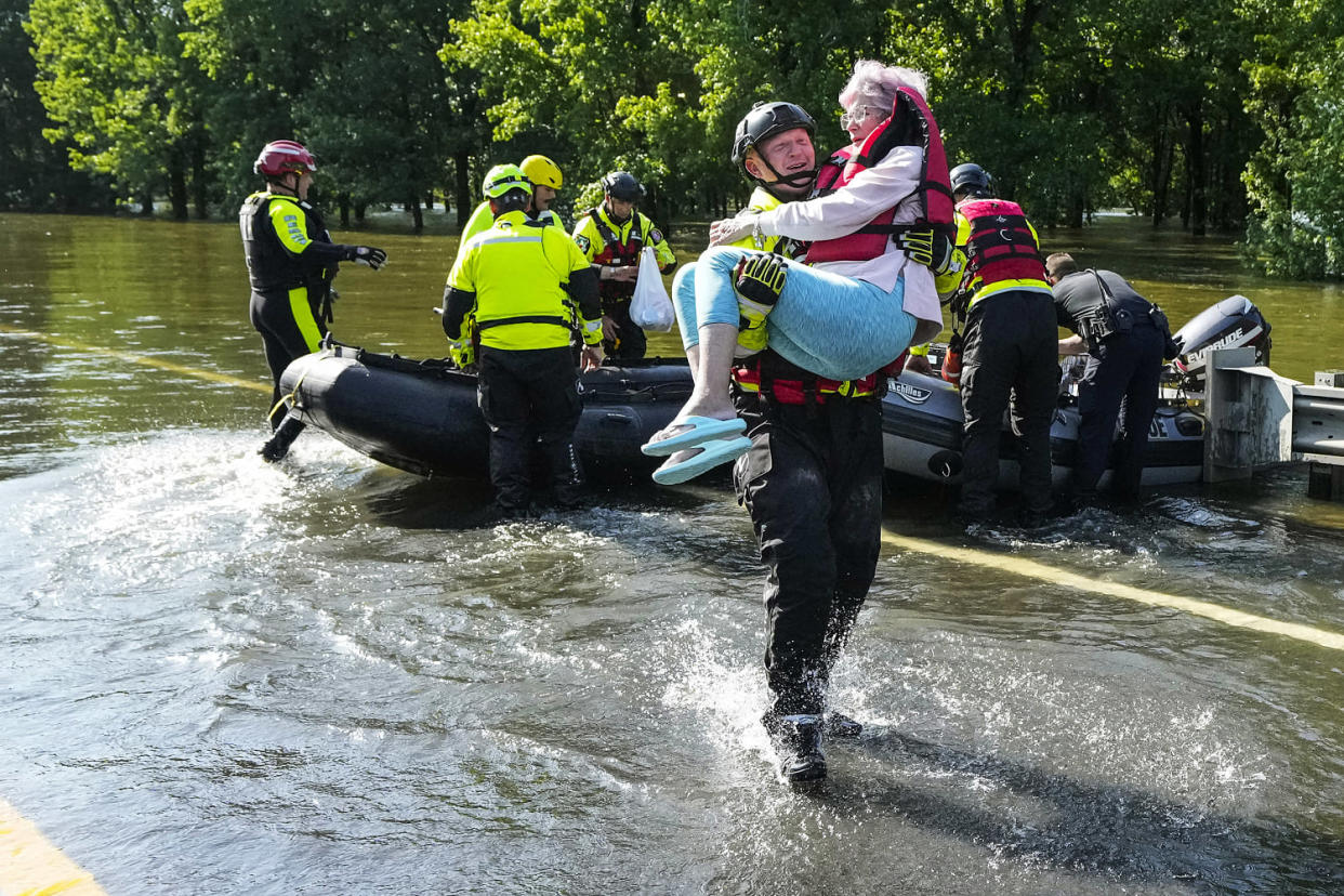
By Thursday morning, 17 million people were under flood watches stretching from northern Texas to central Mississippi, including the major metro areas of Dallas and Houston; Lake Charles and Baton Rouge, Louisiana; and Jackson, Mississippi.Forecasters sounded the alarm over a high risk for flash flooding that has been designated for parts of eastern Texas and western Louisiana where rainfall rates exceeding 3 inches per hour could quickly lead to significant and life-threatening flash flooding.
Communities located within the high-risk area include Huntsville, Lufkin, Nacogdoches and Jasper, all in Texas, and Fort Johnson in Louisiana.
High risk means there is a 70% chance of rainfall amounts exceeding flash flooding guidance within 25 miles of a point within that risk area. High risks are only issued a few times per year, and historically these days have accounted for about 40% of flood-related fatalities and about 80% of flood-related damages, according to the Weather Prediction Center.
On Friday, the greatest risk for flash flooding shifts east to include parts of Mississippi and Alabama. By the time this storm system finally moves out of the southern and Gulf Coast states, a widespread 3 to 6 inches of rain is expected, with locally higher amounts of up to 12 inches possible through Saturday.
In addition to flooding, much of Texas will also be at risk for severe storms Thursday.
Eighteen million people from western Texas to western Louisiana could experience very large hail, wind gusts to 60 mph and a few tornadoes through Thursday evening. Cites to watch include Dallas, Houston, Austin, San Antonio and Lake Charles.
On Friday, 9 million people across Louisiana, Mississippi, Alabama and the western Florida Panhandle are forecast to see storms capable of all storm hazards.
