Here are the latest winter weather updates for Greater Akron
![A motorist takes a cell phone photo of his SUV that slid off Cuyahoga Street on Friday, Jan. 19, 2024, in Akron, Ohio. [Phil Masturzo/ Beacon Journal]](https://s.yimg.com/ny/api/res/1.2/GntGcS5eQeZ4I4yvAwe3fw--/YXBwaWQ9aGlnaGxhbmRlcjt3PTEyNDI7aD05NTk-/https://media.zenfs.com/en/aol_gannett_aggregated_707/6a1a4b93bed1cb0d640e6efa0f282f59)
Plows are on the roads Friday morning and school is canceled in much of Greater Akron. Here are the latest updates on the winter weather the region is expecting to get.
Winter storm warning in effect for Akron
The National Weather Service has issued a winter storm warning for Medina, Summit, Lorain, Cuyahoga, Erie and Huron counties from 1 a.m. Friday through 4 a.m. Saturday.
Lake effect snow coming in
At 11:05 a.m., NWS reported that a "band of lake enhanced snow showers" will head into southwestern Summit County. With that, expect an increased rate of snowfall, quick accumulations of snow and less visibility.
NWS warns drivers to "use extra caution," and notes roads have the potential to be slick.
What is lake effect snow?: And how does it develop on Lake Erie? What to know
Initial round of snow lighter than expected, more coming
The National Weather Service says the snow has been lighter than expected so far across northern Ohio but warns we are not out of the woods yet.
"There has been some variability to the heavier snow west of Cleveland as a pocket of mid-level dry air passed overhead," they said.
As the morning has progressed, the weather service says the snow is becoming more persistent.
"Looking upstream in (southeast) Michigan we are seeing a good burst of snow that moved off Lake Huron drifting south towards the Detroit Metro area," they said. "This is expected to provide some local enhancement as it arrives later this morning."
Are Akron, Cleveland flights canceled?
Most flights at the Akron-Canton Airport are departing and arriving as scheduled with few, if any, delays.
Things are bit different at Hopkins International Airport in Cleveland.
A fair number of flights are delayed and canceled Friday with most of the impacted flights to Orlando and Washington, D.C.
It is best to check with your airline before heading to airport today.
Akron-Canton Airport: Check here for flight status
Cleveland-Hopkins Airport: Check here for flight status
How much snow is Akron going to get?
Heavy snow is expected with anywhere from 3 to 7 inches expected to fall across the region.
Akron road conditions
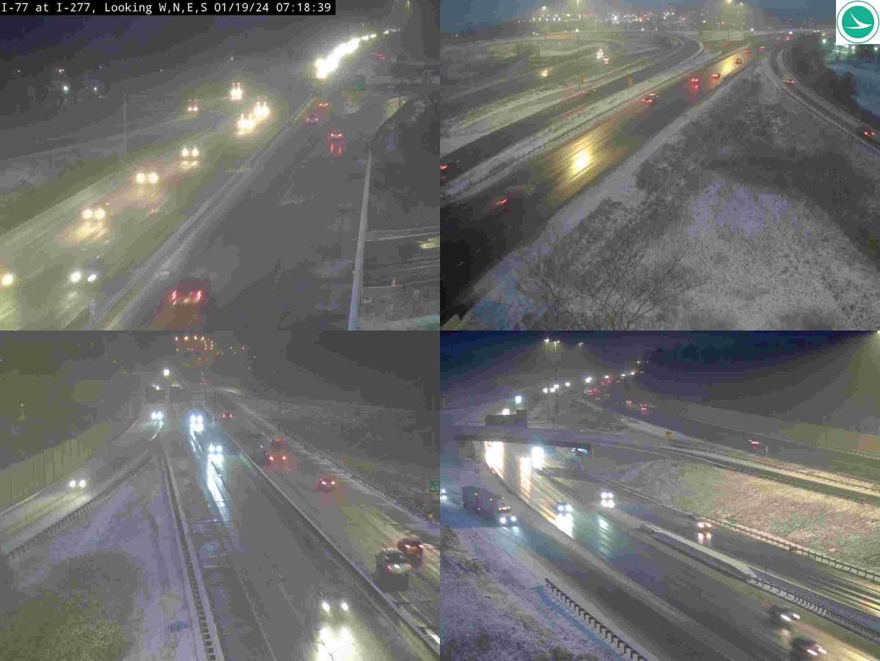
"Travel could be very difficult," the weather service warns. "The hazardous conditions could impact the (Friday) morning and evening commute."
The widespread snow will continue into the afternoon and eventually transition to lake effect snow showers. NWS said snow may be heavy at times, especially Friday morning.
The Ohio Department of Transportation posted on social media that more than 760 crews were deployed at midnight across the state. By 4:30 a.m., nearly 1,200 plows were on Ohio roads. About 300 crews out across Northeast Ohio.
"This means you can travel, but you will have to take it slow and allow extra travel time," ODOT warns.
Reload. Refuel. Keep rolling. We're at 1,200 plows strong across Ohio. Check https://t.co/ulNKKYsusD for updated travel information. #ODOTwinterhttps://t.co/ZjPSw0QHkF
— Ohio Dept of Transportation (@ODOT_Statewide) January 19, 2024
Winter weather advisory for other northern Ohio counties
Other northern Ohio counties including Portage, Stark, Wayne, Ashland and Richland counties are under a winter weather advisory with anywhere from 3 to 6 inches of snow possible.
What is the wind chill like?
Wind chill may fall into the -5 to -15 range late Friday night into Saturday morning, NWS reports.
⚠❄ Widespread snow this morning will transition to lake effect snow this afternoon and evening. Impacts to the AM and PM commute today are most likely in the warning areas. 🥶Frigid wind chills of 5 to 15 below zero return tonight into Saturday morning. pic.twitter.com/shIiOoNUd7
— NWS Cleveland (@NWSCLE) January 19, 2024
Weather-related closings and cancellations
The following schools in Summit County are closed Friday, Jan. 19:
Akron Public Schools
Barberton City Schools
Copley-Fairlawn City Schools
Nordonia Hills City Schools
Norton City Schools
Revere Local Schools
Stow-Munroe Falls City Schools
Tallmadge City Schools
University of Akron
Woodridge Local Schools
Best places to sled in Akiron: 11 places to sled or tube in the snow for free this winter
The following schools in Medina County are closed Friday, Jan. 19:
Brunswick City Schools
Highland Local Schools
Medina City Schools
Wadsworth City Schools
This is not intended to be a complete list. Please check with your destination.
More on school closings: Are Akron schools closed? Here's the list of closings and delays in the area
Is there a parking ban near me?
The following areas have announced parking bans during the storm.
This is not intended to be a complete list. Please check with your destination.
Ravenna: Snow parking ban in effect from 9 p.m. Thursday through 9 a.m. Saturday on all city streets.
Village of Silver Lake: 48-hour parking ban on village streets starting at 9 a.m. Friday.
Akron warming centers
To help residents cope with the cold temperatures, Akron plans to offer places for residents keep warm.
The Summit Lake Community Center at 380 W. Crosier St. is open as a warming center 8 a.m. to 7 p.m. through Friday along with the city's other community centers. The Emergency Overnight Shelter at 111 East Voris St. will be open 7 p.m. to 8 a.m. through Monday.
Mayor Shammas Malik to return to Akron from conference
Akron Mayor Shammas Malik was in Washington, D.C., this week for the U.S. Conference of Mayors. He posted on social media Thursday night saying he would return to Akron earlier than planned due to the incoming storm.
Akron 311: With snow on the way, Akron residents can use new app to request a plow or salt
Akron-Canton weather forecast and timeline
Friday: Snow before noon, then snow showers after noon. High near 26. Light northwest wind increasing to 8 to 13 mph in the morning. Chance of precipitation is 100 percent. New snow accumulation of 2 to 4 inches possible.
Friday night: Snow showers likely, mainly before 1 a.m. Cloudy, with a low around 8. Wind chill values as low as -3. West wind 11 to 14 mph. Chance of precipitation is 70 percent. New snow accumulation of less than one inch possible.
Saturday: A chance of snow showers, mainly before 1 p.m. Mostly cloudy, with a high near 16. West wind 11 to 15 mph. Chance of precipitation is 30 percent. New snow accumulation of less than a half inch possible.
Saturday night: A chance of snow showers, mainly before 1 a.m. Mostly cloudy, with a low around 12. Chance of precipitation is 40 percent. New snow accumulation of less than a half inch possible.
Sunday: Partly sunny, with a high near 24.
Sunday night: Partly cloudy, with a low around 12.
Monday: Mostly cloudy, with a high near 34.
Monday night: A chance of snow showers after 1 a.m. Cloudy, with a low around 28. Chance of precipitation is 30 percent.
Tuesday: A chance of showers. Cloudy, with a high near 39. Chance of precipitation is 50 percent.
Tuesday night: A chance of showers. Cloudy, with a low around 35. Chance of precipitation is 50 percent.
Wednesday: A chance of showers. Cloudy, with a high near 45. Chance of precipitation is 50 percent.
Check Akron weather hourly
Need to know weather conditions by the hour? Make sure to check out our weather page here.
This article originally appeared on Akron Beacon Journal: Akron snow storm updates: Schools canceled, 7 inches of snow predicted
