The latest Triangle outlook for Hurricane Ian: Possible heavy rain, river flooding
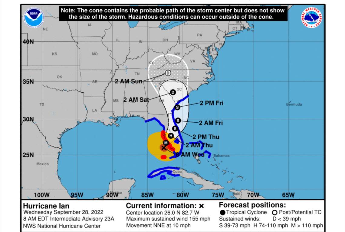
Hurricane Ian could start dumping heavy rain across central North Carolina as soon as Thursday night, swamping the Triangle with 7 inches of rain over the weekend.
But as the storm reaches Category 3 strength and moves toward Florida’s Gulf Coast, forecasters warn that its path north remains uncertain, heading anywhere from eastern Tennessee to coastal North Carolina.
“Still a pretty wide net,” said Aaron Swiggett, meteorologist with the National Weather Service on Tuesday.

Several days out, it’s too soon to say whether Ian will bring tropical force winds, but it’s certain to leave the Triangle a soggy mess by Sunday, or even Monday by the time it moves through.
“Think high-risk potential for flash flooding and maybe some river flooding,” Swiggett said.
In Raleigh, the city has already started lowering Lake Johnson to make room for storm runoff.
Today we proactively started lowering Lake Johnson ahead of potentially heavy rainfall later this week from Hurricane #Ian. Lowering the lake allows for us to store more water in the lake and helps reduce flooding concerns along Walnut Creek. @RaleighGov @Raleigh_Water #ncwx pic.twitter.com/zuz2t0iHLt
— Ethan Clark wx (@EthanClarkWX) September 26, 2022
With flooding the greatest concern, North Carolina emergency officials urge residents in low-lying areas to make an evacuation plan ahead of time, warning against driving through standing water.
Tuesday, organizers with the International Bluegrass Music Association announced its annual World of Bluegrass festival would relocate indoors. The street festival in Downtown Raleigh is typically held along Fayetteville Street with headline acts at the Red Hat Amphitheater.
Instead, the Main Stage performances planned for Red Hat are moving to Raleigh Memorial Auditorium at the Duke Energy Center for the Performing Arts, according to a statement from Judy McDonough, an IBMA spokesperson.
All scheduled performances at the five free Street Stages and all the scheduled vendors are moving to the Raleigh Convention Center.
Stormy weather from Hurricane Joaquin forced the event indoors in 2015.
Staff writer Colleen Hammond contributed to this report.
