Lansing area could see strong thunderstorms, hail, possible tornado Wednesday
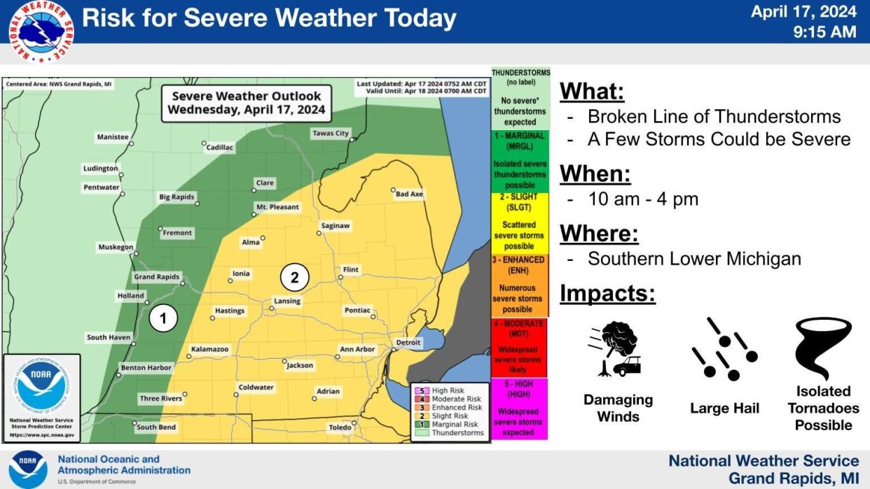
LANSING — The Lansing area is likely to see severe thunderstorms early this afternoon with the potential for high winds, hail and maybe even an isolated tornado.
The National Weather Service in Grand Rapids said a low pressure system and strong cold front moving in from the west, combined with mild temperatures today over mid-Michigan will lead to a broken line of storms moving quickly through the state today.
NWS meteorologist Janis Laurens said forecasts predict storms that have formed in the Chicago and Milwaukee areas moving across Lake Michigan and then strengthening as they reach the Lansing area, likely around 2 p.m. or 3 p.m.
Laurens said the storms will bring strong wind gusts — reaching 65 to 70 mph — as well as hail. Isolated tornadoes also are possible.
MORE:Man at center of Friday manhunt in Lansing area arrested in Jackson
"Any time you have temperatures as mild and a low pressure and cold front from the west it sets the stage for severe weather," Laurens said.
While the storms will bring heavy rain, Laurens said they will move through quickly so flooding shouldn't be an issue.
This article originally appeared on Lansing State Journal: Lansing area could see strong thunderstorms, hail, possible tornado
