Lansing area could see severe storms late this afternoon bringing hail, tornadoes
GRAND RAPIDS — The Lansing area could see strong to severe thunderstorms late this afternoon or evening, according to the National Weather Service.
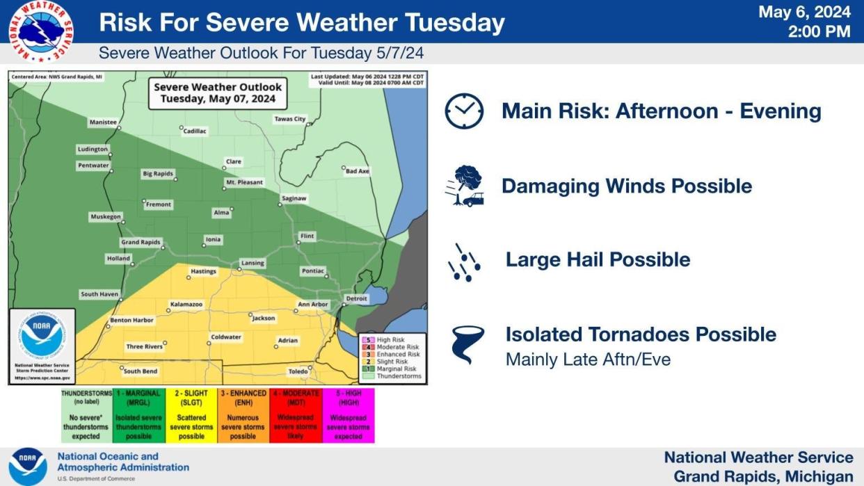
While fair weather should remain in place most of the day, showers and thunderstorms are expected later Tuesday and some severe weather is possible in the afternoon and evening with potential for damaging wind gusts, large hail, and isolated tornadoes, the NWS Grand Rapids office said.
The best chance for severe weather will be late in the afternoon and evening.
The risk is highest — scattered severe storms — in the southern Lower Peninsula from about Benton Harbor to Hastings and then toward Monroe.
Lansing has a marginal risk of isolated severe storms while areas north of a line from Clare, Saginaw and Port Huron will see only weak or nor thunderstorms.
This article originally appeared on Lansing State Journal: Lansing-area storms could bring hail, tornadoes late Tuesday
