Ian to shift into Central Florida. Here’s what to expect before the storm reaches the area
As Hurricane Ian zips through Florida’s west coast, the storm is now heading to its next destination: central and north central Florida.
Ian, a monstrous Category 4 storm, made landfall near Punta Gorda Wednesday afternoon with 150 mph winds that slightly weakened to 145 mph. The storm has caused catastrophic storm surge, winds and flooding in southwest Florida, only the beginning of its destructive path.
Ian is expected to shift over into Central Florida by Wednesday night before heading into the western Atlantic as a tropical storm by late Thursday.
Here’s what to know about potential impacts on central and north central Florida ahead of the storm’s arrival.
Brace for rain, floods
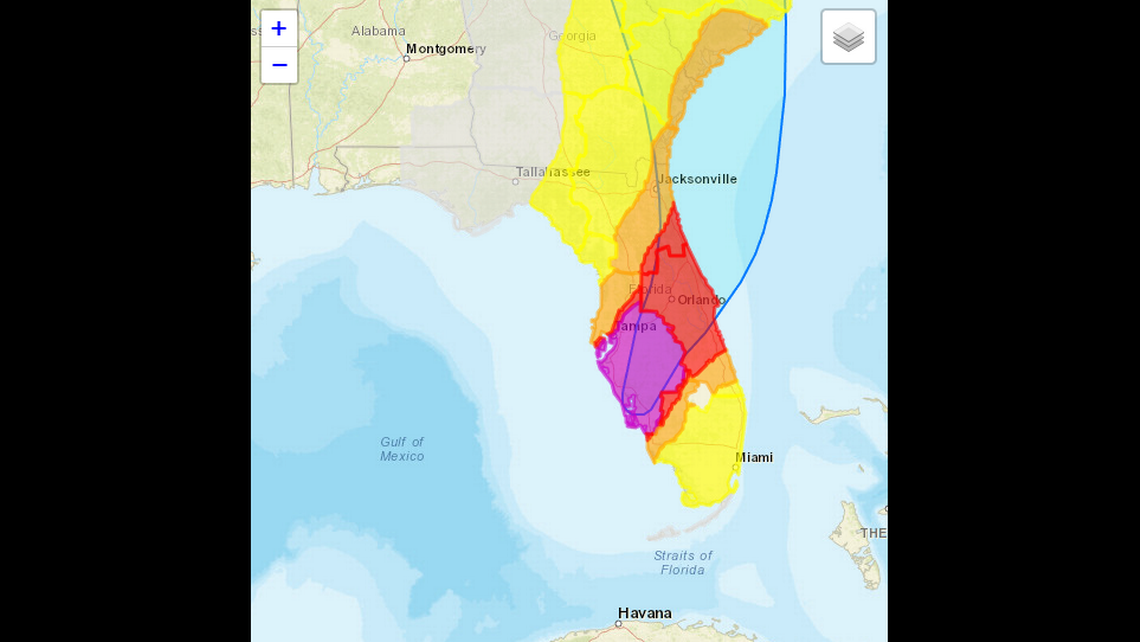
Much of the region, from Orlando to Gainesville, is at high risk of excessive rainfall from Wednesday through Thursday night, according to the National Weather Service. It is Orlando’s first high-risk designation in five years.
There is a HIGH RISK of excessive rainfall from Hurricane #Ian Today through Thursday Night in central and northeast Florida, the first High Risk in five years for Tampa, Orlando, and Jacksonville metro areas. Explore latest ERO on our interactive page: https://t.co/cfgBoWyKla pic.twitter.com/aqWV3ymMoN
— NWS Weather Prediction Center (@NWSWPC) September 28, 2022
The NWS predicts that the region will see anywhere from 10 to 15 inches of rain. Central and northeastern Florida may see 12 to 20 inches, with a maximum of 30 inches.
Widespread and life-threatening flash flooding is expected to continue across Central Florida. The Suwannee River, which flows through north and north central Florida, may experience 3 to 5 feet of storm surge.
READ MORE: What is storm surge? What are its impacts? Is Florida at risk? Your questions answered
Most of the region has a high probability — from 60% to 90% — of experiencing tropical-storm-force winds as Ian crosses through and travels north. Orlando and neighboring cities can see winds ranging from 74 to 110 mph. Meanwhile, Gainesville and other nearby areas could see winds from 39 to 57 mph.
READ MORE: Hurricane Ian’s strong winds are menacing Florida. Check the threat in your area
The NWS also warns that tornadoes may form across east Central Florida on Wednesday night.
Central and north Central Florida are not as hurricane prone as other parts of the state. The area was previously hit by Hurricanes Charley (2004), Frances (2004), Jeanne (2004) and Irma (2017).
For tourist-filled Orlando, Ian crossing over the area meant closures for Walt Disney World, Universal Orlando Resort and SeaWorld. Orlando International Airport is closed until Friday.
The University of Florida also canceled classes for the rest of the week.
Across the inner portions of the state, counties have urged residents living in low-lying areas and mobile homes to evacuate. For more information, visit your county’s website or the Florida Division of Emergency Management’s page.
