Hurricane Larry churns into a Category 3 storm making it third major cyclone to form in Atlantic this season
Just days after Hurricane Ida left a disaster in its wake from Louisiana to New York, meteorologists are keeping a watchful eye at Hurricane Larry as it develops into a Category 3 storm in the Atlantic Ocean.
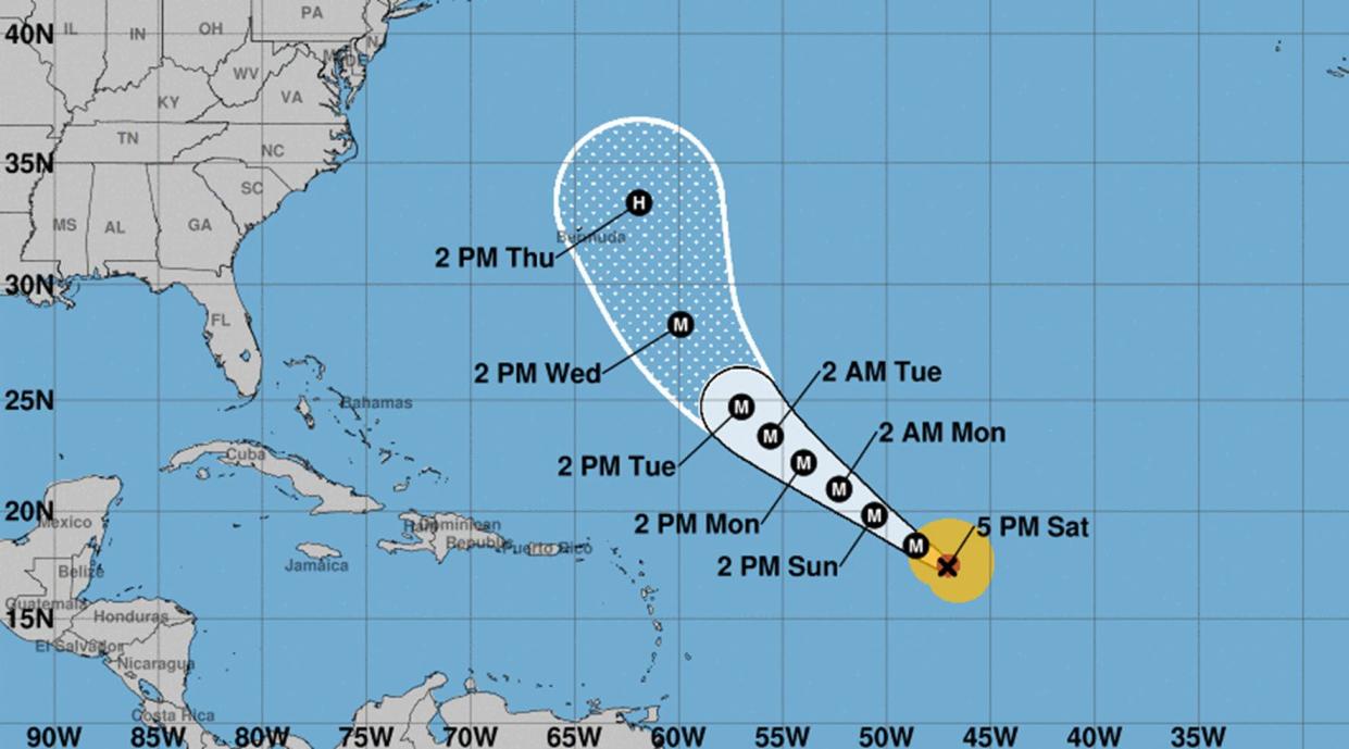
The National Hurricane Center on Friday said that the hurricane—the twelfth named storm of the season—became a major storm with maximum sustained winds of 115 mph and gusts reaching as high as 125 mph.
Just days after Hurricane Ida left a disaster in its wake from Louisiana to New York, meteorologists are keeping a watchful eye at Hurricane Larry as it develops into a Category 3 storm in the Atlantic Ocean.
Meteorologists are preparing for the reality that Larry could become a Category 4 storm with maximum winds of 140 mph later this weekend, according to CNN.
Thankfully for those still picking up the pieces of what has been a tumultuous storm season, Larry is tracking north and is not expected to be a threat to the U.S.
Shortly after Labor Day, Larry is expected to turn northwest, potentially making landfall in Bermuda. On the East Coast of the United States, Larry will do nothing more than create tall waves and harmful rip currents along the shore.
“Significant swells will likely reach the eastern United States coastline after Labor Day. These swells are likely to cause life-threatening surf and rip current conditions,” the National Hurricane Center said.
