‘Hurricane Ian is at our door’: Cooper warns NC residents to stay off the roads
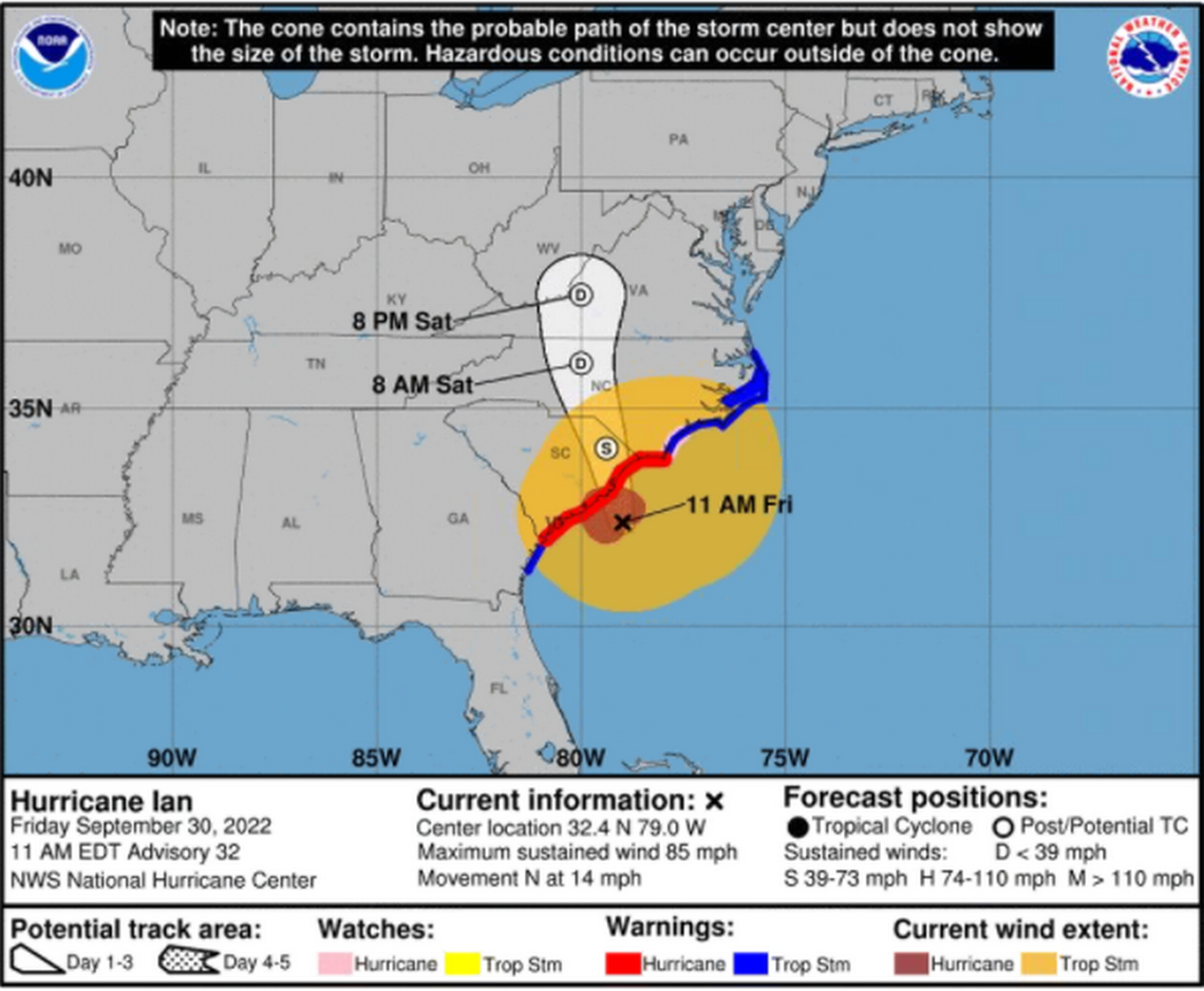
Hurricane Ian churned toward North Carolina on Friday as a Category 1 storm, kicking up coastal surf and threatening to swamp the Triangle with 50-mph winds and a full weekend’s rain.
With all 100 counties under flood or tornado alerts, the Triangle braced for up to 6 inches of rain through Sunday and possible flooding throughout.
Gov. Roy Cooper said the storm had shifted further east than expected, meaning the Triangle could expect a heavier blow.
“Hurricane Ian is at our door,” he said from a Friday news conference. “Be smart. Be safe. Stay off the roads if you possibly can.”
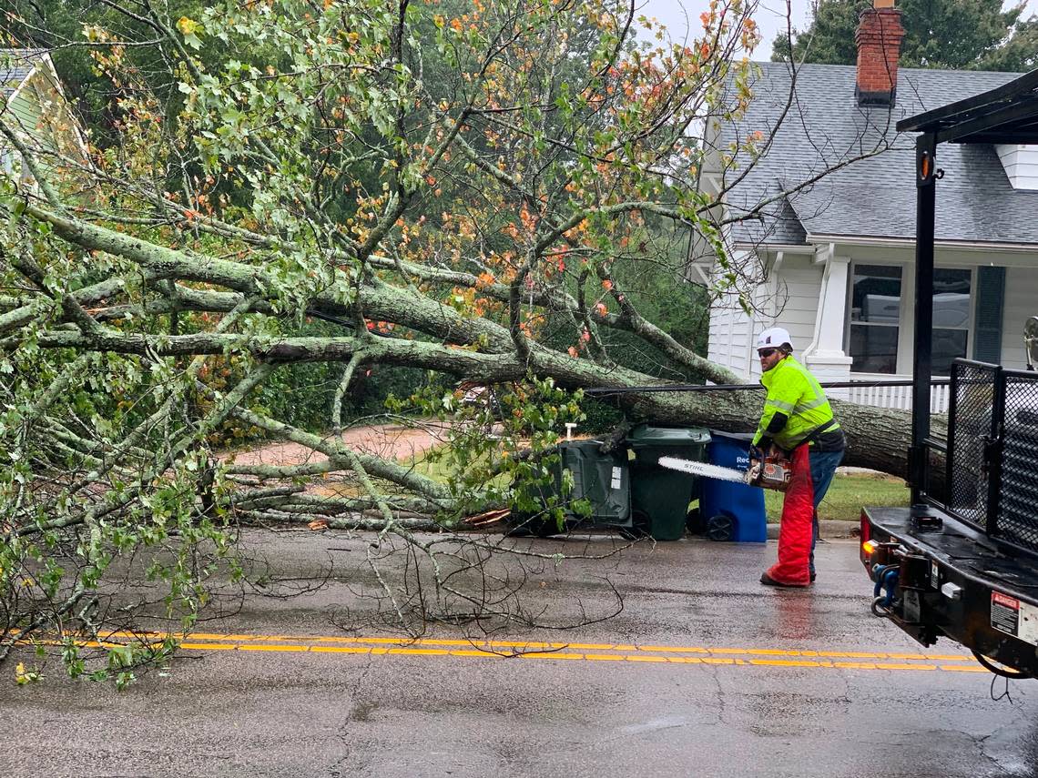
An inch of rain had already fallen around Raleigh by 1 p.m. Friday, and winds had gusted as high as 40 mph. Louisburg Mayor Christopher Neal reported on Twitter “the entire town experiencing a widespread power outage” due to trees falling on power lines.
Those will only pick up speed now that Ian made its second U.S. landfall, this time in Georgetown, S.C., south of Myrtle Beach.
“We’re just in the mode now where it’s moving across us,” said ABC11 Chief Meteorologist Don “Big Weather” Schwenneker, who noted he had lost power at his home.
On the coast, Brunswick County remained under a tornado warning, meaning radar had detected a twister.
Misty Vining spent much of Friday driving around Oak Island taking photos and video of the effects of Hurricane Ian so other people wouldn’t have to.
The island is very busy right now,” she said during a break in her rounds. Outside, she said, the wind was gusting at 42 mph. “All the businesses are closed, but there is a lot of sight-seeing.”
By late afternoon, she said, low-lying points on the island had flooded as they usually do in major storms; the west end of the south-facing island was closed because of water over the road, and homes were flooded around 14th Place NE.
But the biggest loss from Hurricane Ian, Vining said, appeared to be the sand that was placed on the beach this past spring, completing a two-year, $29 million renourishment project.
“We’ve got about a 4-foot cliff on the beach right now,” she said.
News footage from WECT at Carolina Beach showed flooding along Canal Drive, deep enough to carry an overturned waste bin.
Residents in Wrightsville Beach showed cars moving through oceanfront puddles high enough to cover half their tires.
Ian’s force is expected to intensify as it moves north, with the heaviest rainfall hitting between Friday night and Saturday morning.
Cooper said both National Guard and Department of Transportation crews have mobilized, along with multiple search and rescue teams stationed across the state.
Across the state, Duke Energy reported more than 76,000 power outages in the storm’s early hours.
Radar Update: The center of Hurricane Ian is located 60 miles east-southeast of Charleston, SC and continues to push rain bands up through central NC. Expect rainfall intensity and maximum winds to continue to increase as Ian's circulation moves into NC later this evening. #NCwx pic.twitter.com/OpZsDFbtbF
— NWS Raleigh (@NWSRaleigh) September 30, 2022