Hurricane Earl is stronger and a new system is in the forecast at peak of storm season
The peak of hurricane season arrives Saturday — and the Atlantic is bustling with activity.
The National Hurricane Center on Friday is watching Hurricane Earl, which is forecast to turn into a powerful post-tropical cyclone in the Atlantic on Saturday.
Earl’s swells are likely to cause life-threatening surf and rip current conditions across portions of the U.S. East Coast, Bermuda, Nova Scotia and Newfoundland through the weekend, the hurricane center said. A tropical storm warning for Bermuda was discontinued Friday morning.
READ NEXT: Will hurricane swells hit Florida’s coast this weekend? What to know about Earl’s impact
Forecasters were watching three disturbances, which has since dwindled to one by Friday night.
None are a threat to Florida.
Here’s your forecast:
Hurricane Earl
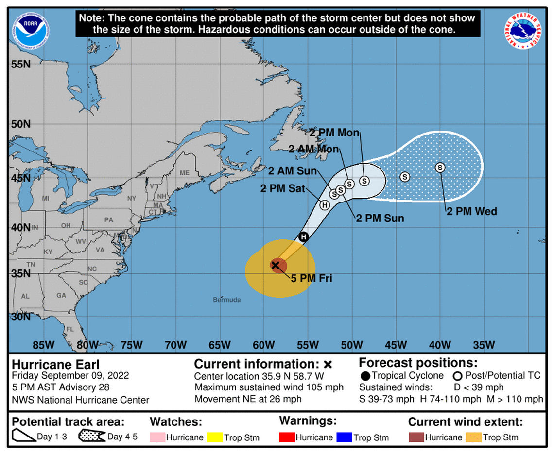
Hurricane Earl was about 430 miles northeast of Bermuda on Friday. The Category 2 storm is rushing quickly northeast at 26 mph and is forecast to go a little faster later Friday before slowing considerably over the weekend in the Atlantic.
Earl’s maximum sustained winds increased Friday to near 105 mph with higher gusts, with hurricane-force winds extending up to 80 miles from the center, and tropical-storm-force winds extending up to 275 miles.
Forecasters expect Earl’s strength will fluctuate though it should retain its Category 2 status for most of Friday. The forecast no longer shows it nearing Category 3 strength.
“Earl has a few more hours before it begins extratropical transition and some very short-term further intensification can’t be completely ruled out.,” the hurricane center said in its 5 p.m. advisory.
“Earl is expected to complete its transition to a powerful hurricane-force extratropical low on Saturday and then gradually weaken through early Monday,” the hurricane center said.
Disturbance near African coast
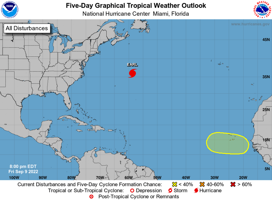
The National Hurricane Center is no longer tracking two of three disturbances it had an eye on Friday.
One of the two potentially had a chance of becoming the Atlantic’s next tropical storm but met heavy resistance from strong winds.
The disturbance currently being tracked is on the African coast, according to the hurricane center’s 8 p.m. advisory.
It could see some gradual development once it moves into the Atlantic early next week and starts heading west. It has a 20% chance of formation through the next five days.
When is the peak of hurricane season?
Saturday is the “climatological peak” of the Atlantic hurricane season and is when “conditions are most optimal for tropical storms and hurricanes over the largest area,” according to the Weather Channel. The next storm name on the list is Fiona.
