Hurricane Earl forecast to turn into a Cat 3 and Tropical Storm Fiona could form soon
UPDATE 9/9/2022: The peak of hurricane season arrives Saturday — and the Atlantic is bustling with activity. The National Hurricane Center on Friday is watching Hurricane Earl and two disturbances, one which has a chance of turning into a “short-lived tropical cyclone.”
Read the original article below:
Hurricane Earl is forecast to turn into a major storm Friday night, as tropical storm conditions have started to affect Bermuda.
Swells caused by the Category 2 hurricane are also building near Bermuda and are expected to reach the U.S. east coast later Thursday. They are likely to cause life-threatening surf and rip current conditions through the weekend, according to the National Hurricane Center.
Additionally, forecasters are watching two disturbances in the Atlantic, one of which has a high chance of turning into a “short-lived tropical storm in the next day or so.” As for Danielle, it’s a post-tropical cyclone and is no longer being tracked by the National Hurricane Center.
At the moment, none of the systems threaten Florida.
Here’s the forecast breakdown:
Hurricane Earl to be major hurricane
Tropical storm force gusts are hitting Bermuda as Earl’s outer rainbands reach the island, according to the hurricane center’s 11 p.m. advisory.
The forecast shows Earl turning into a Category 3 hurricane after it has passed Bermuda Friday night, but no longer shows the hurricane becoming a Category 4.
Earl is forecast to see maximum sustained winds as high as 115 mph after turning into a Category 3 in the open water. It is then forecast to become a powerful post-tropical low by Saturday.
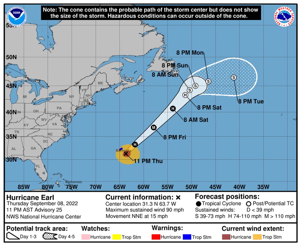
Bermuda has discontinued the hurricane watch, but a tropical storm warning is still in effect. The island could see one to three inches of rain through Friday.
Earl was about 95 miles southeast of Bermuda, with maximum sustained winds near 90 mph with higher gusts, according to forecasters. The hurricane is moving north-northeast at 16 mph. Its hurricane-force winds extend outward up to 60 miles from its center, with tropical-storm-force winds extending outward up to 185 miles.
READ MORE: Will hurricane swells hit Florida’s coast this weekend? What to know about Earl’s impact
Two disturbances, one could be a depression or storm
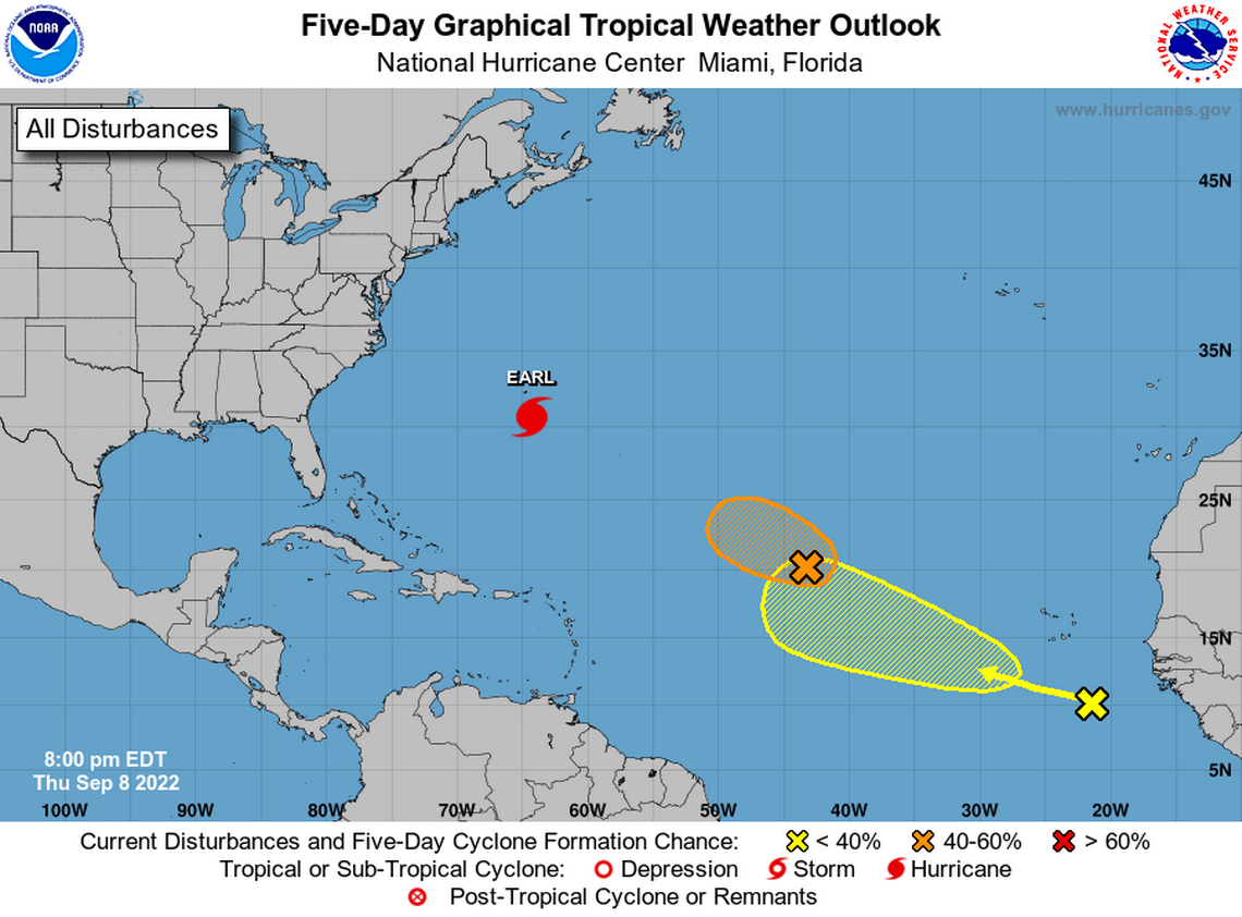
A disturbance about 1,300 miles east of the northern Leeward Islands could turn into a “short-lived tropical cyclone in the next day or so” if it sees a small increase in organization as it moves quickly west to west-northwest over the central Atlantic, forecasters said in the 8 p.m. advisory.
“By this weekend, environmental conditions are forecast to become less conducive for development,” the hurricane center said.
The hurricane center is giving it a 60% chance of formation through the next two to five days. If the system were to turn into a tropical storm, it would be named Fiona.
The other disturbance forecasters are watching was several hundred miles south-southeast of the Cabo Verde Islands and could see some gradual development as it moves west-northwest over the eastern Atlantic.
It has no chance of formation in the next 48 hours and a low 30% chance of formation through the next five days.
Danielle
The hurricane center shortly before 11 a.m. Thursday issued its final advisory for Danielle, announcing that it had turned into a post-tropical cyclone about 715 miles north-northwest of the Azores.
It has maximum sustained winds near 65 mph with higher gusts and is still producing rough seas in the central northern Atlantic, with its tropical-storm-force winds extending outward up to 230 miles from its center.
“Danielle is forecast to remain a large post-tropical cyclone over the north Atlantic for the next several days, even as its peak winds slowly decrease,” the hurricane center said.
The system has begun to make its long awaited counterclockwise loop, which should take 36 to 48 hours to complete and will then move southeast to east-southeast through the weekend, toward western Europe, forecasters said.
