A Hiker's Path: Charlestown State Park's landscape is steeped in history
I recently made a trip down to hike in southern Indiana. My destination for the day was Charlestown State Park. This park first opened in 1996 and contains 5,100 acres.
The park was once a part of the huge 15,000-acre Indiana Army Ammunition plant, which used to occupy the land. The park is located 8 miles east of Interstate-65, off of Ind. 62. With scenic vistas of the Fourteen Mile Creek valley and of the Ohio River, the park has much to offer with its rugged hills and deep ravines.
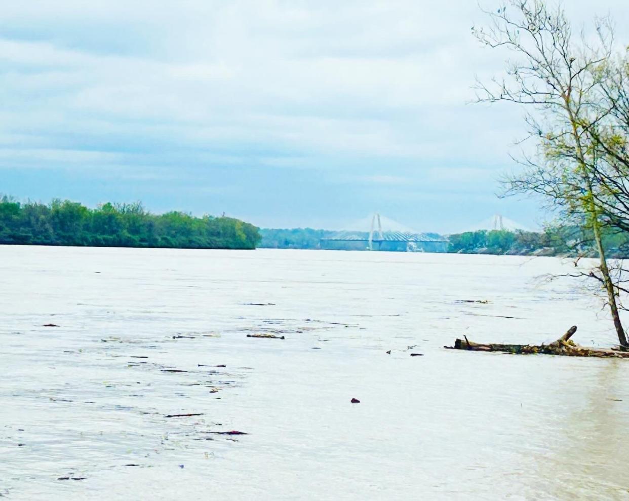
The south end of the park sits on the banks of the Ohio River. The birth of the Ohio River, one of the primary features of the park, began in the Ice Age when glaciers and periodic natural damming began to form the river. Historically, the river was shallow enough to walk across in the hot summer months, but in the late 1800s construction started on a series of man-made dams that made the river what it is today.
Currently, the river is 981 miles in length and it eventually flows into the Mighty Mississippi River.
The land where the park sits is steeped in history. Back in 2006, workers at the park were building a new boat ramp when a Native American cooking area was found that dated back to 2000 BC. Artifacts were found and construction was halted until a full excavation was done by archaeologists. Afterwards, the new boat ramp was finished.
There used to be a wonderful old amusement park located there. Back in 1886, the Louisville and Jeffersonville Ferry Company purchased 118 acres of property along the Ohio River. The company built a picnic area on the property and named it "Fern Grove."
An entrepreneur by the name of David B.G. Rose purchased the property and renamed it "Rose Island." The peninsula of land was not a true island, but had the appearance of one due to the way that Fourteen Mile Creek, which runs through the property, cut back on itself.
The amusement park and resort became a major attraction in the area and boasted of 150,000 visitors a year. Later, in 1937, there was a devastating flood that affected the entire Ohio River Valley region and it wiped out the Rose Island park. The remnants of this place can still be seen today in the Charlestown State Park.
I had chosen to hike trail 6. The trail is 2.3 miles in length and is considered rugged in ease of hiking. This scenic trail starts across the road from the Ohio Riverside Overlook and runs along the top of the river bluff. The bluff offers glimpses of the Ohio River and overlooks the boat ramp.
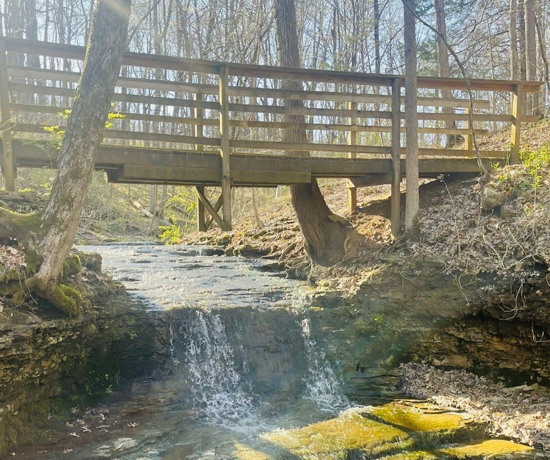
A bridge crosses a natural waterfalls and descends to the Old Charlestown Landing, where locals used to send and receive goods by boat pre-1949. From there, it is a stroll back along the bottom of the bluff.
It was a chilly day in early April when I hiked at this park. I drove down to the trailhead parking lot, which was on the banks of the river and found the trailhead for trail 6. I was excited because I had not hiked this particular trail before. Even the partly cloudy sky could not dampen my enthusiasm.
I took off on the path and after just a few minutes, I found myself ascending a rocky trail to the top of a small bluff. There were beautiful rock formations that were weathered by time and the elements as evidenced by pitting marking in the limestone. The rocks were moss covered and had an archaic look about them, as if I had stepped back into some prehistoric land.
Yes, I must admit, my imagination works overtime when I am hiking a trail.
I followed the bluff for a while through the woods and enjoyed occasional views of the river. I finally came to a small wooden bridge that passed over a creek. Here I found a beautiful, seasonal waterfall. It was flowing well with the recent rains in the area. Moss covered logs were present and many spring wildflowers scattered around the forest floor just added to the scenery. This was definitely a trail that I would do again.
I soon descended off the bluff and onto an asphalt surface below which led back to where I had started. It had been a good hike! Definitely a great park to visit!
There’s a seasonal fee to get into the park at the front gate or you can use your Annual Park Pass.
To find this place: Take Interstate 65 south to exit 19, Ind. 160, turn left and stay on 160 until you run into Ind. 62. Turn left on 62, drive 1.2 miles. You've arrived. Address: 12500 Indiana 62, Charlestown, Indiana.
A quote for your week: “In rivers, the water that you touch is the last of what has passed, and the first of that which comes, so with present time.” — Leonardo de Vinci, Italian polymath, artist, sculptor, architect, scientist, engineer, 1452-1519
Until the next trail,Susan
This article originally appeared on The Herald-Times: Hiker visits the rugged hills of Charlestown State Park
