How high was Hurricane Ian’s storm surge? These scientists hunt down the answer
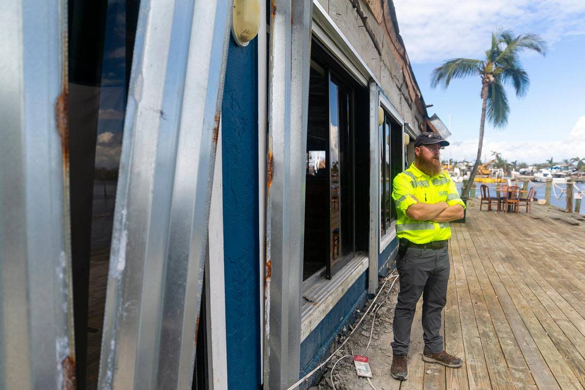
The first thing James Fountain looks at in a hurricane-ravaged building is the ceiling fans.
If the blades are pointing toward the floor, it’s a good sign the storm surge inside the building was high enough to touch the ceiling. That’s valuable information for Fountain, a hydrographer with the U.S. Geological Survey tasked with figuring out where Hurricane Ian’s storm surge reached — and how high it rose.
Inside the Nauti Parrot Dock Bar in Fort Myers Beach, the fan blades were still firmly in proper position. But Fountain, 40, quickly spotted a watery haze across one of the TV screens mounted behind the bar. That blur, coupled with a dirt and leaf-specked line of debris on the wall behind it, was good evidence that Hurricane Ian had filled this bar with at least eight feet of water.
“You can see all the clues,” he said, pointing toward the missing chunks of Sheetrock that fell out of the wall.
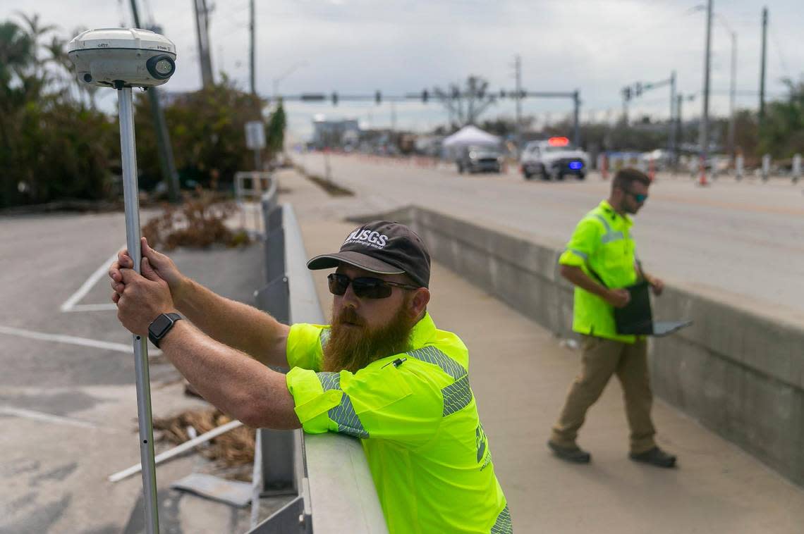
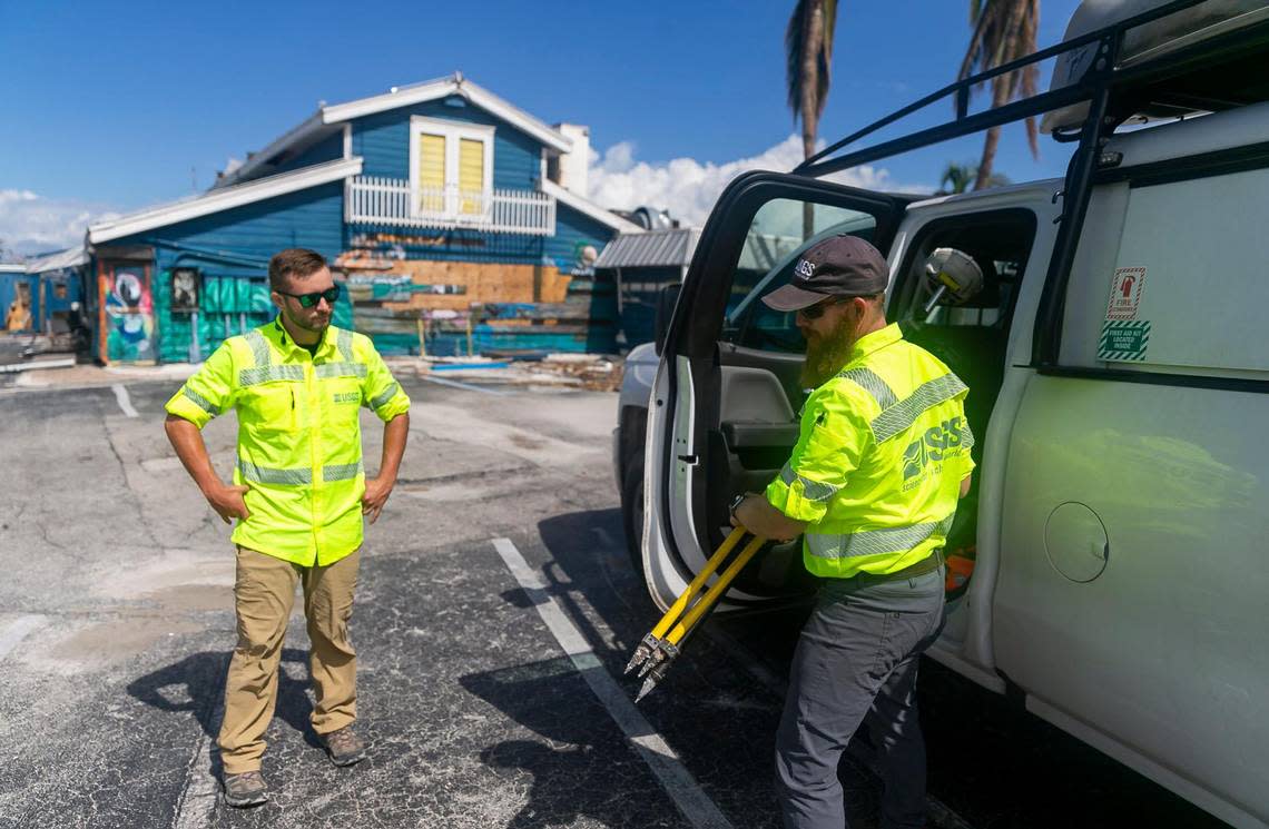
Fountain and his partner David Hough, 30, are one of several USGS teams from across the nation deployed to Southwest Florida after Hurricane Ian savaged the region. Their mission is to scan those lines of mud on the wall — known as seed lines — and uncover where Ian’s storm surge went, and how high it reached.
So far, they’ve found evidence of alarmingly high storm surge, confirmation of the dire predictions the National Hurricane Center warned of as the Category 4 hurricane closed in on Florida’s coast. Just before landfall, the hurricane center said hard-hit areas could see up to 18 feet of water above land, but that the storm surge could also flood a large swath of the coast.
According to early records, they were mostly right. And one sobering finding, the damage was delivered by a peak surge that may have been a few feet lower than projected — but when it’s as extreme as Ian, that doesn’t matter.
Ian’s powerful waves reached far along the coast, from a peak of over 13 feet of surge in Times Square in north Fort Myers Beach and Tarpon Bay Beach Park in Sanibel, just south of where the storm made landfall, to more than seven feet as far south as Marco Island.
They also stretched inland for miles. The front door of a home in Fort Myers Shores, miles from the ocean, had a clean line of mud and seaweed just past the doorknob. In Collier County’s North Port Bay, water levels surged over five feet.
And those are just the already-confirmed marks. The numbers won’t be finalized for weeks, but preliminary data collected by USGS suggest water rose as high as 15 feet in some spots, like in north Fort Myers Beach.
The power of surge
In Bonita Beach, a barrier island just south of the worst of the devastation, 66-year-old Heidi Christianson found sand and storm surge debris on the second story of her house. The surge blew three feet of sand into her front yard, ripped up her screen porch and filled her pool with flounder and minnows that were still swimming nearly two weeks after landfall.
Luckily she and her husband were safely out of town before the storm even formed, but Christianson said she always knows to evacuate when forecasters start talking about how high the water could get.
“When we hear storm surge, we’re out,” she said.
While her elevated, 2018-built home fared well in the storm — minus the porch screen and the new inhabitants in her pool — Christianson’s other rental house in Fort Myers didn’t do as well. At least one story of water slammed into the house, breaking walls, cracking windows and spilling insulation everywhere. Her white Range Rover was blown 300 feet from the house and into a tree.
But funny enough, her collection of antique chintz glassware that took her 10 years to accumulate, stored in a box on the lowest level of the home, was in perfect condition, minus a little sand.

“Not even a chip,” Christianson marveled.
But the real power of storm surge was visible in the lots on her street formerly occupied by older built homes. After the storm, the only things left sticking out of the sand were the beach chairs, boats and pieces of walls from neighboring homes.
Better data, better decisions
Before the storm, USGS teams scattered sensors around the area to measure water heights and barometric pressure. Data from that sparse network, at least, of the sensors that didn’t blow away, is already registered.
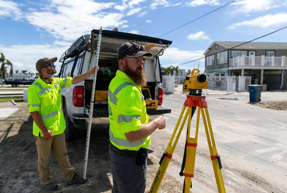
But as soon as the winds died down, USGS staffers fanned out to fill in the gaps. They marked where and how high the water rose, using black markers to slash the salt-stained scraps of drywall and concrete left behind, or, ideally, protected inner areas like stairwells and elevator shafts. After Ian, those teams made more than 300 high water marks.
Then it was Fountain’s turn. Teams like his raced to turn those marker slashes into usable data before the debris is cleared away or buildings are gutted. But they also needed to wait for cell service, which returns slowly to the hardest-hit areas.
Without cell service, Fountain said it could take up to four hours to record a survey mark on their electronic equipment. With cell service, that time drops to nine minutes.
“There’s not enough hours in a day to do 4-hour collections,” he said. “We get one shot to collect it. And we have to collect more than we think we need.”
Fountain and his colleagues are meticulous with their data. They measure multiple times using mobile GPS equipment that locks in their location via satellite, and they bookend each day of measurement by checking in with the nearest permanent elevation mark set by state or federal agencies.
All the data collected by teams like Fountain’s is used to build computer models that better reflect the risk of storm surge, but FEMA, which pays USGS to collect this data, also uses it to adjust its flood maps, which guide building code decisions across the country.
The hurricane center also uses this data in its post-storm report, published a few months after a hurricane hits.
“Our entire organization is built around high-quality, repeatable, understandable data,” Fountain said. “If those numbers aren’t correct, they could be the basis of bad decisions.”
