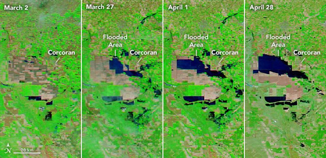
The growing Tulare Lake now is visible from outer space. See NASA’s latest satellite images
Within a matter of a few months, this winter’s series of atmospheric river storms that drenched central California and the spring snowmelt from the southern Sierra Nevada range are fueling the re-emergence of the usually-dry Tulare Lake in Kings and Tulare counties — to the point where it is now plainly visible from space.
Images from NASA satellites orbiting the earth clearly show the stark changes in the lake between Feb. 1, when only a few patches of land had been filled with storm runoff, and April 30, by which time large stretches of acreage within the lakebed had been flooded.
Tulare Lake was once the largest freshwater lake west of the Mississippi River, encompassing as much as 790 square miles in what is now Kings and Tulare counties. But by the late 1800s it had been pretty much dried up as water from major rivers that fed it was diverted for farming uses and the lakebed was increasingly reclaimed for agriculture.
But the ancient low-lying land has remained susceptible to periodic resurrection from floods during wet years of the 20th century and into the 21st century.
Tulare Lake fed by a record Sierra Nevada snowpack
Record snowfall in the southern Sierra Nevada will continue to send water from the mountains into the Valley’s major rivers — the San Joaquin, Kings, Kaweah, Tule and Kern rivers, producing more runoff than dams will likely be able to manage and contributing to flooding on parts of the Valley floor, including Tulare Lake.
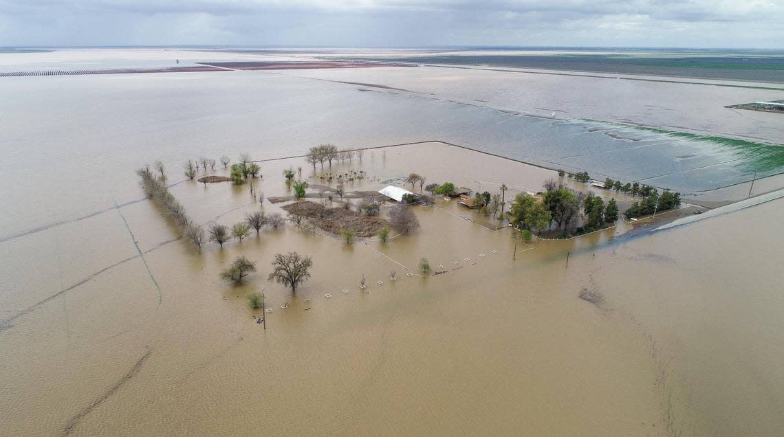
“Flooding in the lakebed is likely to continue into 2024, which will affect residents and farmers in the area, as well as some of the most productive cropland in the Central Valley,” NASA reported on its Earth Observatory website. “The lakebed contains farms that produced cotton, tomatoes, dairy, safflower, pistachios, wheat, and almonds.”
The last time there was major flooding in the Tulare Lake basin, after a very wet winter of 1982-83, the drying-out process in the lakebed took about two years.
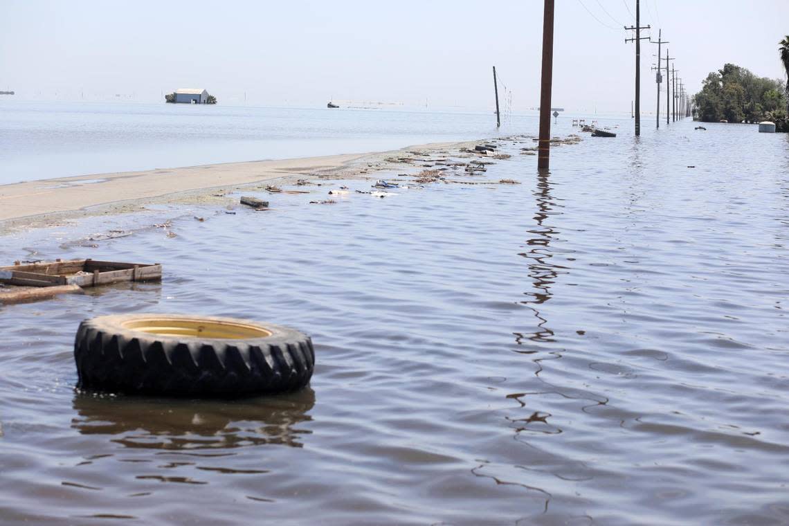
As of last week, large swaths of acreage west and south of the city of Corcoran were under water; so too were large plots of land in the southern end of the lakebed.
A warm spell in late April accelerated the snowmelt, adding more water to the flow of the rivers — the Kings, Kaweah and Tule rivers — that historically fed Tulare Lake. But despite a cooldown last week, the snowmelt is expected to eventually pick up steam throughout the spring and summer.
“This snowpack is still enormous, and perhaps 20 to 25% of it has now melted, but that means that in all likelihood at least 75% of the snow water is still up there,” Daniel Swain, a climate scientist at UCLA, said in a video blog last week. “So in other words, the significant majority of what was up there at its peak Is still there even as we head into May, even in the wake of major heat waves, so this melt really is just getting started.”
“The peak is probably yet to come,” Swain added.