It’s getting moist in the tropics. What does that mean for Florida’s weekend weather?
We haven’t seen too much rain the last few days — just record-setting unyielding heat.
But that’s about to change.
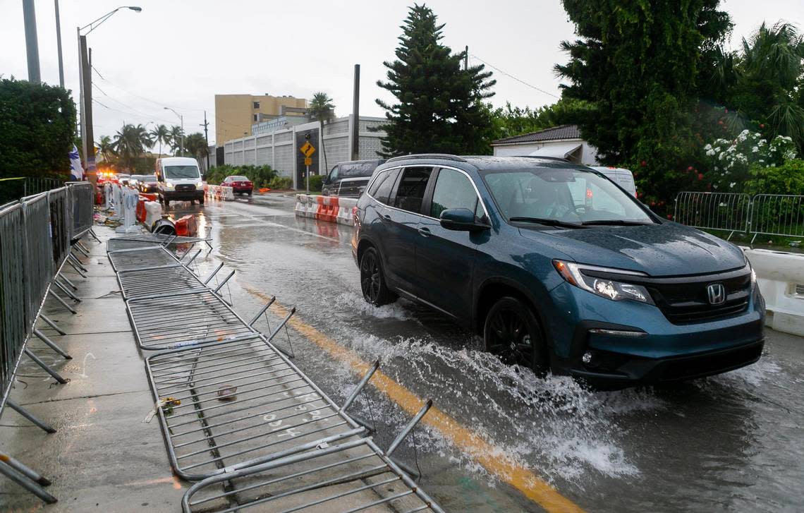
You’ll feel plenty of moisture this weekend in South Florida to go along with the moisture from the sweat pooling “in all the wrong places” on your body as a Miami Herald columnist teased this week.
According to meteorologist Larry Kelly of the National Weather Service in Miami, plenty of rain will move into South Florida, starting Friday afternoon and especially Saturday and peaking with Sunday’s 80% chance.
Increased tropical moisture is moving into these parts, the service said in its hazardous weather outlook. For some of us, when we hear “tropical moisture” in August, we have thoughts of hurricanes.
Blow those fears away. Yes, there’s a disturbance out in the Caribbean Sea, with another just behind, but these are far away and have nothing to do with the tropical moisture heading our way, Kelly said Friday.
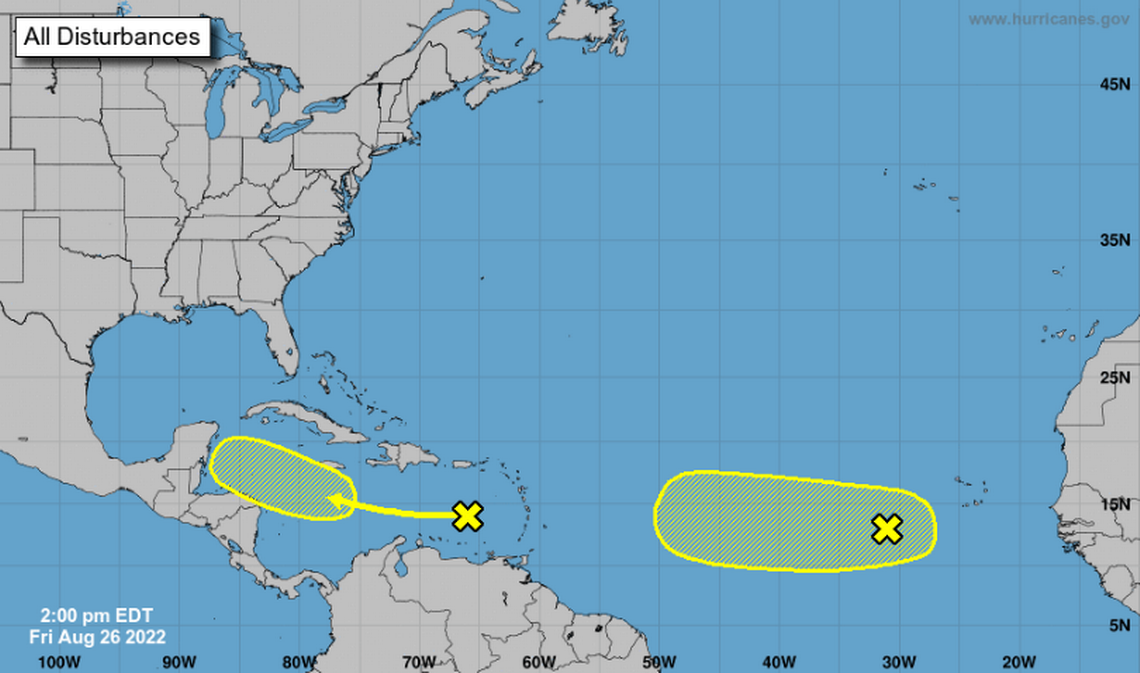
“We do get a more southerly wave component so we’re getting some moisture from the Caribbean that moves in across the area, an upper level trough that is going to be in the vicinity of the Florida peninsula. So just increased moisture,” he said. “That moisture is just coming from the tropics, that’s why we call it tropical moisture but it doesn’t have anything to do with any of the disturbances or anything like that.”
Our @MiamiDolphins take on the Eagles tomorrow at @HardRockStadium at 7PM You can watch the game only on @CBSMiami Official Home of the #MiamiDolphins It will be warm around kick-off with mid 80s. #Finson4 #CBS4 pic.twitter.com/rBF1OxpgsM
— Lissette Gonzalez (@LissetteCBS4) August 26, 2022
When will the rain get here?
READ NEXT: Farmers’ Almanac has forecast weather for the next year for Florida.
But South Florida is still looking pretty wet, the forecaster said.
“Definitely higher coverage than we’ve had in previous days. Mainly the East Coast. Morning showers and early afternoon for those showers and moving on to the interior and west coast. Overall, a higher coverage of showers and storms.”
Saturday has a 60% chance; Sunday and Monday, 80%; Tuesday, 60%. That rain plans to hover next week because the weather service has continued those 60% odds into Thursday.
Orlando in Central Florida can expect the same — “torrential downpours,” the service in Melbourne said.
Wind gusts could hit 40 mph in some of these storms, along with possible waterspouts, and localized flooding is possible, too.
Isolated thunderstorms are also forecast for the Florida Keys, with lightning and gusty winds possible on a straight 40% chance starting Saturday through Thursday, according to the weather service.
Good morning, Florida Keys! High-level cirrus clouds helped make for a colorful sunrise sky.
Your Friday island chain forecast:
30% chance of showers, slight chance of t'storms
Highs in the lower 90s
E-SE 5-10 mph#flwx #FLKeys #FloridaKeys #KeyWest #MarathonFL #KeyLargo pic.twitter.com/1nMGpe2iOI— NWS Key West (@NWSKeyWest) August 26, 2022
What about the heat?
Our @MiamiDolphins take on the Eagles tomorrow at @HardRockStadium at 7PM You can watch the game only on @CBSMiami Official Home of the #MiamiDolphins It will be warm around kick-off with mid 80s. #Finson4 #CBS4 pic.twitter.com/rBF1OxpgsM
— Lissette Gonzalez (@LissetteCBS4) August 26, 2022
It will be plenty hot for Saturday’s Miami Dolphins-Eagles game at Miami Gardens’ Hard Rock Stadium, says Lissette Gonzalez, a meteorologist with Miami Herald news partner CBS Miami. At 7 p.m. kickoff Saturday it will be 85 degrees but feel like 95 in the stands.
“The cloud cover may help a little bit,” the weather service’s Kelly said, but “for the weekend we’re still looking at temperatures in the low 90s. The humidity is not going anywhere so heat indices in the low 100s.”