Fresno County braces for storm conditions ‘that we’ve never experienced before’
Emergency coordinators in Fresno County have issued evacuation warnings for foothill and mountain communities in advance of a storm that is expected to drop as much as six to eight inches of rain over the coming week.
The atmospheric river storm, expected to arrive Thursday, will be warmer than previous systems that over recent weeks have had snowfall measured in feet in the Sierra Nevada, including to elevations as low as 3,000 feet on the east side of Fresno County. Much, if not all, of that lower-elevation snow is likely to be melted away by the rainfall, creating the potential for flooded or washed-out roads in the mountains and possible flooding in communities on the floor of the San Joaquin Valley that are already prone to problems.
The evacuation warning went into effect at 1 p.m. Tuesday, said Fresno County Sheriff’s Lt. Brandon Pursell, who added that the warning is not an order for people to leave their homes.
“The warning is letting people know there is potential to have to evacuate,” Pursell said. “We want to give people as much advance notice as we could, so people in the mountains can prepare for what they need.” With a day or two before the storm arrives, he added, residents in mountain communities have an opportunity to head down to the Valley floor and stock up on supplies in case they are forced to hunker down and shelter in place.
Kristian Mattarochia of the National Weather Service office in Hanford said the coming storm “will be unlike any other weather event so far this season.”
How much rain is expected during this week’s big storm in the central San Joaquin Valley?
“We just want everyone to be prepared for impacts that have never been experienced before,” Mattarochia said. “What has happened over the past week is we’ve seen heavy snow at low-elevation foothills around 3,000 feet. And in less than a week, we’re going to put six to eight inches of rain on top of that.”
“The amount of rain we’re receiving, considering what’s already fallen, is unprecedented,” he added. “It doesn’t matter if you’re in the mountains, if you’re in the city of Fresno, if you’re in the western half of the county near Coalinga; we are expecting water problems to really affect everyone’s life.”
“We want everyone to be prepared for conditions we’ve never experienced before,” Mattarochia said.
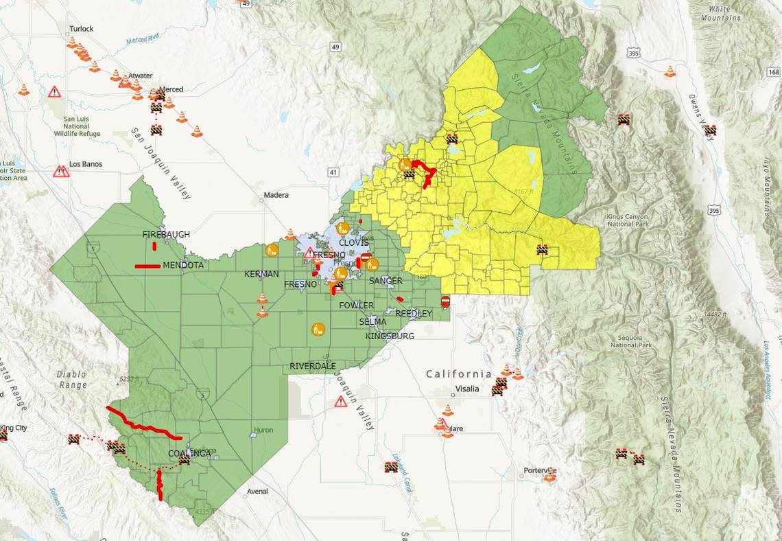
The county has set up a website, fresnocountyemergency.org, where residents can find information about emergency preparations and warnings, sandbag locations, and an interactive map of road closures and areas under evacuation warnings.
Officials are also urging residents to avoid travel to the mountains, even through there are hopes to reopen some of the snow-clogged roadways in the coming days. “This is not the time to think about going to enjoy a nice trip with the family up to the mountains,” said California Highway Patrol Officer Mike Salas. “It’s still a recovery area in Shaver Lake and higher elevations,” and numerous snow-removal vehicles are traveling up and down mountain highways continuing to clear snow from roads.
“If you don’t have to head up to the hills, just don’t,” Pursell said. “If you get stuck, you’re going to be pulling resources from the Highway Patrol and the Sheriff’s Office (and) from people in those communities that are really going to need them.”
Declaring a local emergency
Members of the Fresno County Board of Supervisors voted unanimously on Tuesday to adopt a declaration of a local emergency, based not only on the massive snowfall from last week’s heavy winter storm, but in anticipation of the havoc that this week’s warmer storm could produce by melting much of the snow at elevations between 3,000 and 5,000 feet.
“We know how weather works. Things could change,” said District 2 Supervisor Steve Brandau, whose district is largely bounded on the north by the San Joaquin River. “But there’s an 85% chance that we’re going to have one of those atmospheric river storms (that’s) going to dump a lot of fresh water on the Valley.”
While much of the focus of concern has been on the snow-stricken mountain communities, “we’re also interested in the folks who live along the San Joaquin River,” he added. “There’s going to be a lot of water coming down the San Joaquin River, and when we get those types of flows, things can change in a moment’s notice.”
“You never know if this storm pans out or not,” he added,” but we’re expecting it will.”
These Fresno County areas are under evacuation warnings as strong storm heads toward region
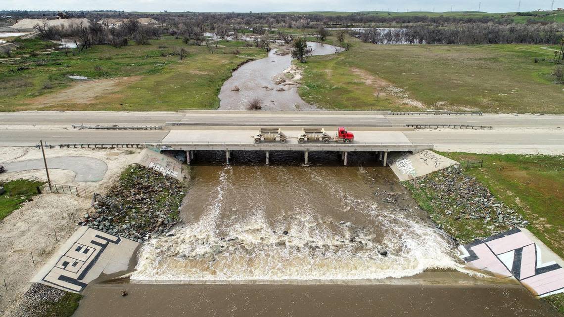
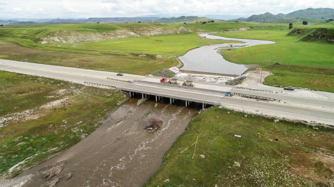
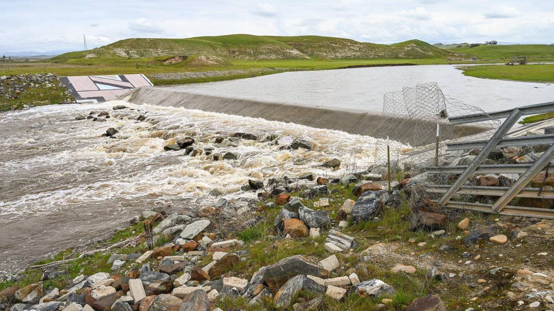
Downstream flooding concerns
“There will be heavy rain on the Valley floor, too,” meteorologist Mattarochia said. There are areas that will flood that normally do flood during heavy rain events. But there are also going to be areas that normally would not flood, just because of the nature of the weather cycle and the amount of storms we have received so far this season.”
That’s why Fresno County’s emergency teams are putting teams into position across the county ahead of the storm, “to be able to respond quickly to road washouts and other problems caused by flooding,” said Terri Mejorado, the county’s emergency services manager.
Mejorado said those resources include not only public works crews and equipment, but also the sheriff’s office rescue teams.
“There are pre-identified areas that we know during just a normal rainstorm are going to flood,” Mejorado said, “and that’s why we are already pre-positioning sandbags and sand on the west side, knowing that the Mendota-Tranquillity area usually gets water across the roads.”
Fresno County is closely coordinating with the U.S. Bureau of Reclamation, which operates Friant Dam along the San Joaquin River, and the U.S. Army Corps of Engineers, which operates Pine Flat Dam on the Kings River, keeping tabs on those agencies’ releases of water from the reservoirs behind the dams to make room for more rain and snow runoff higher in the two watersheds.
There is concern for some communities near the rivers, said Pursell, and Tuesday’s evacuation warning includes the areas of Piedra and Centerville near the Kings River downstream from Pine Flat Dam.
“What comes out of the dams is controlled a little bit,” Pursell said. “We do have concerns, especially along the Kings River, because we have some natural creeks that flow into the Kings River” downstream of the dam, including Hughes and Mill creeks.
Pursell said evacuations are typically based on how much water is flowing in a river channel. “The Kings River has a certain capacity, and if we start reaching above that capacity with uncontrolled flows, that’s when we start to worry more,” he said. “It’s not because Pine Flat is dumping water out of the dam, but because we have the uncontrolled flows coming in” from creeks and streams downriver from the dam.
No evacuation warnings are in place along the San Joaquin River, but Pursell said “we are incredibly concerned” because of the potential for roadway washouts and possible rescue situations in the western part of Fresno County in the areas of Mendota, Firebaugh and Tranquillity.
“That’s exactly why we’re putting rescue personnel out to the west” as well as in the mountains, Pursell said.
The Kings River Water Association echoed Pursell’s worries about the uncontrolled creeks. “Mill Creek and the other foothill streams that enter the (Kings River) downstream from Pine Flat Dam are our biggest concern right now,” said Steve Haugen, the association’s watermaster. “There is no way to control or store the flows in those streams.”
Forecasts for the storm indicate that Mill Creek, the largest of the creeks, could see flows from 4,500 cubic feet per second to as much as 14,500 cfs.
Releasing water from big reservoirs
Tyler Stalker, a spokesperson for the U.S. Army Corps of Engineers in Sacramento, told The Fresno Bee that the corps has steadily increased the amount of water it’s releasing from behind Pine Flat Dam for flood control in anticipation of the coming storms to make room for more water.
“We were at 2,000 cubic feet per second (on Monday), and we’re at 3,000 cfs (Tuesday),” he said. Between the flood releases and what’s being delivered for agricultural irrigation, releases totaled about 4,500 cfs.
“Our target is to get to 5,500 to 6,500 cfs over the next week or so, so we’re making space now ahead of the storm,” Stalker said.
Pine Flat Reservoir holds about 1 million acre feet of water. As of Tuesday, the lake was at about 56% of its capacity. “We’re not overly concerned,” Stalker said. “We still want to, if we can, make a little more room” behind the dam.
Millerton Lake behind Friant Dam has a capacity of about 520,000 acre-feet, and was about 43% full as of Monday night.
How much can Fresno storm drains handle?
In the city of Fresno, engineers with the Fresno Metropolitan Flood Control District said they’re pumping out their storm drains across the city to create more capacity for stormwater runoff.
“When we have a lot of time between storms, we try to get the basins pumped down as much as we can,” said Brent Sunamoto, the flood district’s assistant manager. Depending on a basin’s location, that water gets shunted off to other basins in the interconnected system before ultimately being sent into the Fresno Irrigation District’s canal system that provides water to farmers west of Fresno.
“All of our pipeline systems are designed for a two-year event, to handle a half-inch of rainfall per hour,” Sunamoto said. But if a storm dumps more rain than the type of downpour that typically occurs every other year, “that’s when water starts to back up into the streets.”
While the storm drain pipes may be temporarily overwhelmed by the volume of water, “eventually the system catches up and drains the street,” he said.
If a basin does fill up with water that cannot be pumped fast enough into other basins or into the irrigation system, Sunamoto said, some neighborhoods near the basins may experience flooding that takes longer to subside.