Flooding highlights outline of 400-year-old historic site

Sometime between 1643 and 1645, British general Oliver Cromwell's forces gathered at the riverbanks east of Earith, a town in Cambridgeshire, England, to build what historians would call one of "the most elaborate fortifications" to have survived from the English Civil Wars.
Nearly 400 years later, floodwaters highlighted the Earith Bulwark after heavy rainfall on Tuesday, a spectacle that was captured in aerial footage shot from above the historic site by Terry Harris, a photojournalist based in Peterborough, England.
The flooding preceded Storm Christoph, which moved across the British Isles Tuesday and Tuesday night with two more storms following into the end of the week.
England's Environmental Agency had issued flood warnings and alerts across the nation after days of heavy rain.
From Jan. 12-16, the area had received 1.65 inches of rainfall, with the majority of it falling on Jan. 14 and Jan. 16. Those two days accounted for 1.31 inches of rainfall, with just under an inch of that falling on Jan. 14, according to AccuWeather Senior Meteorologist Jason Nicholls.
He added that one thing that may have helped lead to flooding was that the area had received about 165% of the normal rainfall in December.
"It's a low-lying area, so it's prone to flooding, especially for areas along the River Cam," Nicholls, who leads AccuWeather's international forecasting team, said.
While they were there they rescued a young child who became stuck when they couldn't cross the strong current back to safety 😧
⚠It might look scenic and seem like fun, BUT there are so many hidden dangers beneath the surface.
2/3 pic.twitter.com/XPZBEXa5zk— Cambridgeshire Fire and Rescue Service (@cambsfrs) January 18, 2021
The earthwork stands as a reminder of a tumultuous moment in English history. By 1642, tensions had snapped between the English Parliament and the Stuart monarch Charles I -- and on a larger scale between England, Scotland and Ireland -- over issues of governance and religious freedom, sparking the first of the three English Civil Wars.
Based in Oxford, King Charles found support in the northern and western areas of England, along with Wales and even Ireland after 1643. The southern and eastern regions of England supported the Parliamentarians, or those who sided with the English Parliament's House of Commons, with their base in London. Scotland would later intervene during the first English Civil War on the side of the Parliamentarians.
East of Earith sometime during the first English Civil War, Cromwell's forces chose a narrow strip of land separating the Old and New Bedford Rivers. At the western end of the fen causeway, linking Huntingdon to the Isle of Ely, which would allow the Parlimentarians to both control an important river crossing and control traffic on the River Great Ouse and the Old Bedford River as the Royalists attempted to push their way toward London.
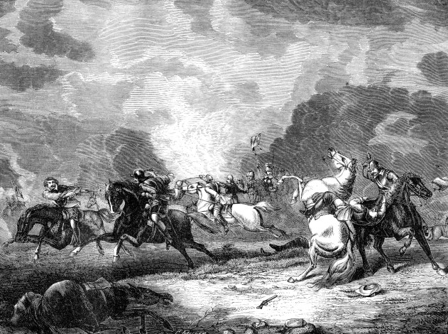 |
An engraved illustration image of the Battle of Naseby during the English Civil War, from a Victorian book dated 1868 that is no longer in copyright, |
The Parliamentarians would go on to win the first English Civil War in 1647; however, a second (1648) and the third civil war (1650-51) soon followed but with the Scottish supporting the Royalists behind Charles II.
The turmoil over the years would see Charles I executed in January 1649, the rise of Oliver Cromwell as Lord Protector of England, Scotland and Ireland until his death in 1658 and the eventual restoration of the monarchy in 1660 with the coronation of Charles II after Cromwell's son Richard abdicated.
Centuries later during World War II, British forces used the same site as a defensive gun emplacement.
