Flood watch includes Fresno waterway as California braces for atmospheric river storm
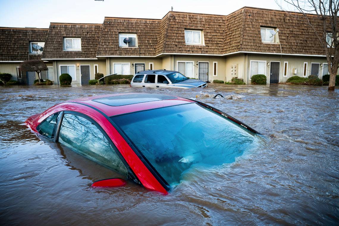
A couple of major waterways in Fresno and the San Joaquin Valley were expected to reach flooding levels and rank high on the watch list this weekend, state officials said Friday.
Both the San Joaquin River in the Fresno area and Bear Creek, which runs through Merced, are being monitored and are forecast to exceed the flood stage, according to Nancy Ward, director of the California Governor’s Office of Emergency Services.
“Let me emphasize: We are not out of the woods yet,” she said Friday in an update on recent storms. “The threat to communities remains and waters will continue to rise even after the storms have passed. The impacts of these storms have been significant.”
An atmospheric river has produced storms that have pummeled the state since New Year’s Eve, destroying homes, flooding cities and killing at least 17 people.
Earlier this week about 35 miles south of Fresno, a man driving a truck and a motorcycle rider were killed in a series of crashes on Highway 99 in Goshen after lightning struck a eucalyptus tree, which caught fire and fell on the highway early Tuesday morning.
Other parts of the state recorded deaths from floodwaters and crashes.
And more storms are expected throughout Saturday, according to the National Weather Service in Hanford.
Much of the Valley is forecast for at least a half-inch of precipitation and some areas, like Fresno, could get as much as 1.5 inches, the service said.
— County of Fresno (@FresnoCountyCA) January 13, 2023
Snow levels are expected to start at around 6,000 feet Saturday before dropping to about 5,000 feet that night, the service said.
Fresno County has listed a slew of road closures and asked residents to limit travel, especially in the foothills, because the rain increases the likelihood off flooding and mudslides.
Fresno County has already ready seen flooding and smaller communities in Merced County were hit particularly hard. Residents of the unincorporated community of about 5,000 in Planada were ordered to leave early in the week as waters rose.
The banks of Bear Creek were breached Monday, and it’s on officials’ radar again.
FEMA Administrator Deanne Criswell said she spoke with President Joe Biden on Wednesday about the damage weather has done and plans to revisit the subject again with him after she looks at it herself.
“The president’s message to me is the same with any of these events is to make sure that I am leaning forward as much as I possibly can, and I’m making sure that Director Ward and all of California has the resources they need to continue these life saving, life sustaining missions,” she said. “He’s very focused on making sure that there are no barriers and that we don’t let bureaucracy get in the way.”
Fresno County road and park closures
Highway 168 (four-lane) into Shaver - Partially closed. Expect delays.
Anchor Avenue (Adams Ave and Clayton Ave) - Orange Cove
Auberry road (Completely closed at Alder Springs, but other areas are for local traffic only) - Auberry
Belmont Avenue (San Diego to Fairfax) - Mendota
Copper Avenue (East of Armstrong)
Bullard Avenue (Washoe Ave to Douglas Ave) - Firebaugh
Coalinga-Mendota Road (Highway 33 to Interstate 5)
Coalinga Mineral Springs Road (at Highway 198)
Douglas Avenue (Shaw to Bullard) - Firebaugh
Frame Avenue (Highway 198) - near Coalinga
Huntington Lake Road (Highway 168 to Big Creek)
Hume Road (Highway 180 to Hume Lake)
Italian Bar Road (four miles north of Jose Basin Road)
Jerrold Avenue (Nees to Herndon)
Los Gatos Road (Derrick to County Line)
Mt. Whitney Road (Sonoma to Highway 33) - Coalinga
Parkfield Grade (From Highway 198 to county line) - near Coalinga
Shaw Avenue (Washoe to Douglas) - Firebaugh
Sumner Avenue (Wakefield Ave and Hill Ave) - Orange Cove
Lost Lake Recreation Area
Choinumni Park

