Flood watch expires in Tarrant County; dozens of water emergency calls in Fort Worth
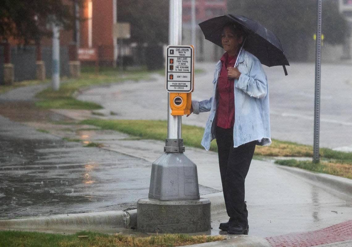
A near-record amount of rain fell over 24 hours in North Texas, as calls from stranded drivers poured in to Fort Worth-area police and firefighters and first responders evacuated some homes in Tarrant County.
There was a 40% chance of more showers and thunderstorms in the Fort Worth area Monday night, according to the National Weather Service, a 40% chance on Tuesday and 30% on Wednesday. New rainfall amounts between a tenth and quarter of an inch are forecast Tuesday, except for higher amounts possible in thunderstorms. A flood watch in the region expired at 8 p.m. Monday.
As of Monday afternoon, Dallas-Fort Worth Airport had recorded 9.19 inches of rain, according to the weather service. The 24-hour rain totals as of 1 p.m. ranged from 15.16 inches in east Dallas to just 0.82 inches at the McKinney airport, just 25 miles away, the weather service said.
The rainfall measured at DFW Airport made it the second wettest 24-hour period on record, only 0.38 inch shy of the record amount set in 1932, the weather service said. The rain total broke the daily records for Aug. 21 and 22, and brought DFW closer to the record for the wettest August. As of 2 p.m. Monday, 10.08 inches of rain had fallen, just short of the 10.33 inches measured in August 1915.
Shortly before 10 a.m. Monday, the weather service office in Fort Worth reported it was “seeing an intensification of the heavy rain across Tarrant County and this will move east across (the) heart of the DFW Metroplex,” causing dangerous flash flooding. Forecasters warned against driving through flooded roads.
In an update about 1 p.m., the weather service said the heaviest rainfall was shifting into Central Texas. “Flooding is beginning to recede across North Texas, but there will still be issues for a few more hours,” the weather service tweeted. “Stay vigilant when on the road, and check road conditions before you do any traveling.”
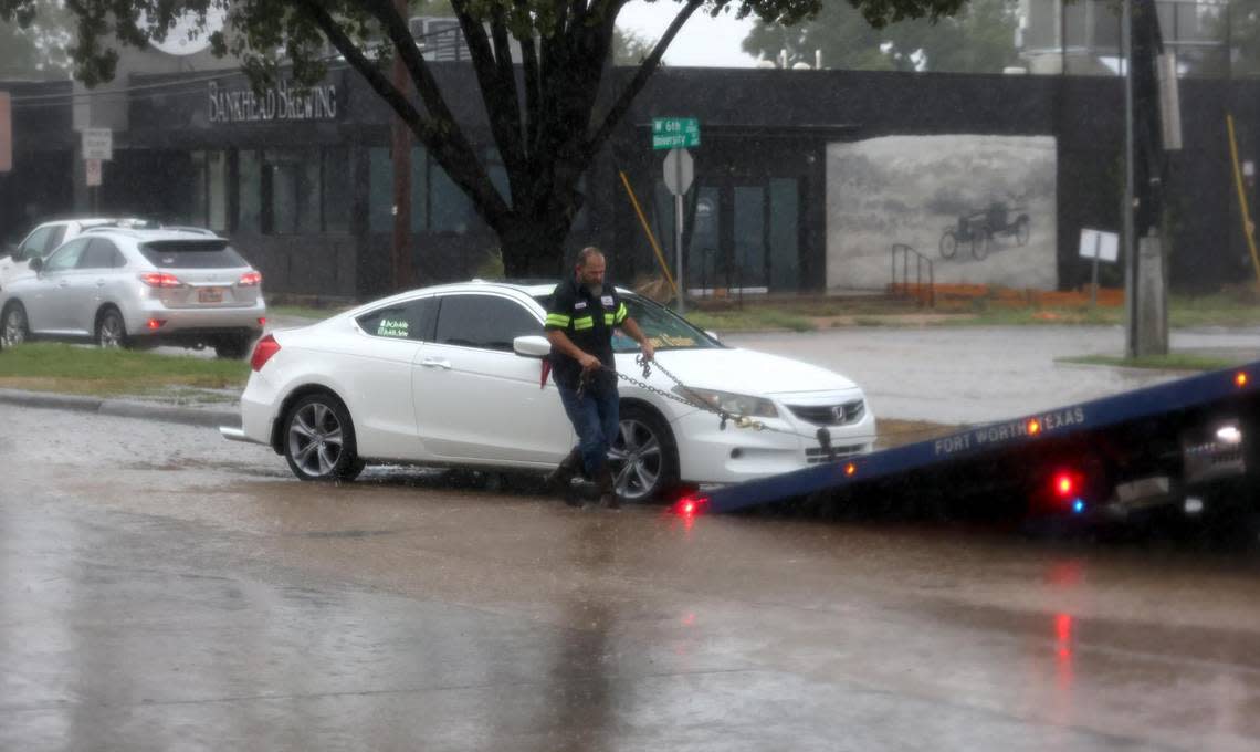
From about 10 p.m. Sunday to 11:25 a.m. Monday, Fort Worth firefighters responded to 133 high water calls throughout the city, according to fire department reports, and those reports continued to come in Monday afternoon. No serious injuries or deaths had been reported on those calls.
Here are the active High Water / Rescue calls in Fort Worth as of 10:25am. Keep in mind these are the only active ones. There have been dozens since the rain started last night. pic.twitter.com/ysvwqsTkBg
— DFW Scanner (@DFWscanner) August 22, 2022
A section of Hulen Street between Interstate 30 and Donnelly Avenue looked like a river around 11 a.m. Monday, and Fort Worth police reported similar conditions in the 1500 block of East Rosedale Street.
Fort Worth police also told residents to avoid driving on Forest Park Boulevard from I-30 to Weatherford Street because the Trinity River was overflowing onto the road.

1500 block of E. Rosedale looks like a river.
Please be careful and don’t attempt to drive through high water.#FortWorthFlood pic.twitter.com/6I6ebCnVOf— Fort Worth Police (@fortworthpd) August 22, 2022
The thunderstorms kept Fort Worth police busy. From 8 p.m. Sunday until 5 a.m. Monday, patrol officers responded to 53 calls related to water emergencies.
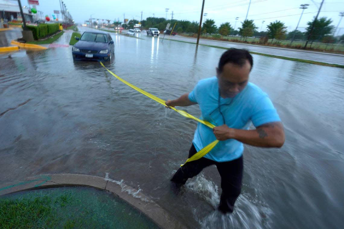
As of about 2 p.m.., MedStar crews had responded to 34 crashes since the rain began Sunday evening. One patient from a vehicle stuck in water was taken to John Peter Smith for treatment, a MedStar official said.
Significant flooding also has been reported in other parts of Tarrant County, including Arlington, Keller, Haltom City, Grand Prairie and Everman, as well as Dallas County.
At least 10 homes were evacuated in Haltom City during to rising water from Little Fossil Creek, according to the fire department.
Photos on social media from Everman also showed water encroaching into homes there.
We’ve reached whitewater rapid stage over here at Keller Town Hall. Please stay safe and avoid high water - whether on the roads or on the trail system. #dfwwx #dfwtraffic pic.twitter.com/3ZbWhqayUu
— City of Keller, TX (@cityofkellertx) August 22, 2022
Residential flooding on Christie Avenue in Everman. pic.twitter.com/CVQ9stNJHE
— DFW Scanner (@DFWscanner) August 22, 2022
A handful of our local roads are currently closed due to high water. Please see the below thread for the full list. #ArlingtonTX https://t.co/tT2vqD6TLA
— Arlington, TX Police (@ArlingtonPD) August 22, 2022
Flooding in Grand Prairie Belt Line & Skyline water about 2 Feet deep on Belt Line @DFWscanner #dfwwx pic.twitter.com/UWmTDZAYRx
— Andrew M (@AndrewM1125) August 22, 2022
MedStar offered these tips for being cautious while driving in the rain:
Please give first responders room to work. If you approach a crash scene, move over one full lane, if possible; if not, slow down to 20 mph under the posted speed limit.
Be especially careful when approaching school buses and bus stops.
If you see a crash scene with yellow caution tape over the vehicles, it means the scene has already been assessed by first responders, and there’s no need to call them again.
Rain continues to fall with dangerous flash flooding currently ongoing across Dallas County! AVOID getting out on the roads if possible! #dfwwx https://t.co/XzTXcqtKQY
— NWS Fort Worth (@NWSFortWorth) August 22, 2022
The rain this week also has cooled down temperatures in the region.
The high on Monday was around 81. Highs are expected to remain in the 80s through at least Thursday.
3-Day Storm Outlook
This map shows the 3-day weather outlook for storms by the National Weather Service's Storm Prediction Center. Sources: National Weather Service, Esri.
