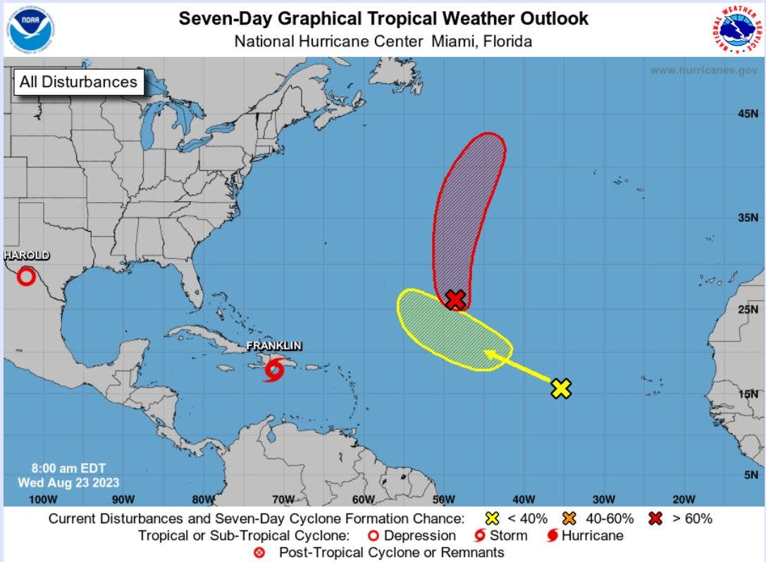
National Hurricane Center watching three areas but only Franklin is anywhere near Florida
The tropics broke a record this week with four named storms bursting onto the scene during a 39-hour period, but Florida has remained far from the fray.
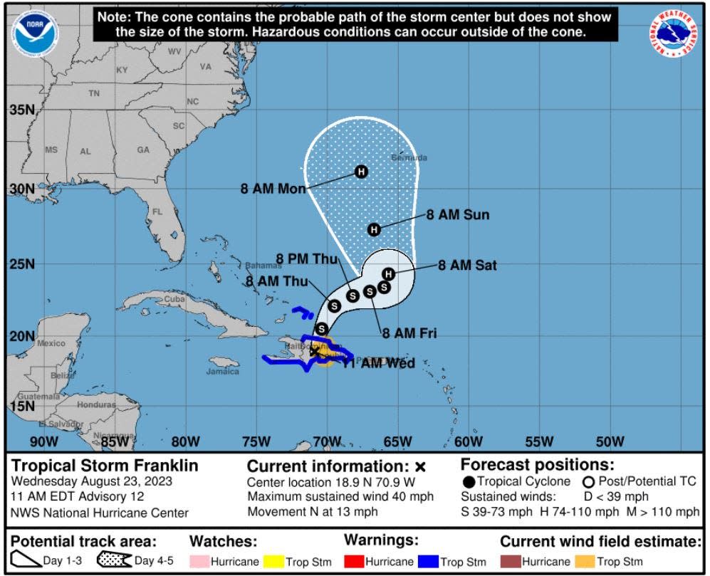
The closest tropical system to the Sunshine State is Franklin, which made landfall Wednesday morning on the southern coast of the Dominican Republic as a tropical storm with 50 mph sustained winds.
Franklin was expected to run into trouble as it meets the mountains of Hispaniola, but it will rebuild north of the island, reaching hurricane-force on Saturday, according to National Hurricane Center forecasts.
Although Franklin eventually will take a route likely to parallel the Florida Peninsula, its center is forecast to stay at least 1,000 miles offshore with little to no impact to the Sunshine State.
Will Redman, a meteorologist with the National Weather Service in Miami, said there is no indication of threats to South Florida at this point.
“Surf heights off the Palm Beaches could see a slight increase but not major,” Redman said. “It just doesn’t look like it will have that big of an impact.”
2023 hurricane season: Fear rain as much as storm surge as climate change increases threat
Franklin’s path is being guided by a trough of low pressure stretching over the eastern coast of the United States and into the southwest Atlantic, forcing it to make a sharp right and then move to the northeast.
It is expected to face robust wind shear, but also enjoy unusually warm water temperatures of up to 88 degrees. By Sunday, the forecast calls for it to be a 90 mph Category 1 hurricane. If it reaches hurricane strength, Franklin will be the second hurricane of the season following Don.
“Bermuda will need to monitor the potential threat from Franklin early next week,” said meteorologist and storm expert Bob Henson in his Eye on the Storm column for Yale Climate Connections.
Elsewhere in the tropics, the far-away remnants of Tropical Storm Emily were given a 70% chance of regenerating into a tropical depression or storm over the next seven days. A tropical wave, dubbed Invest 92 has a 30% chance of formation over seven days. It was several hundred miles west of the Cabo Verde Islands moving west-northwest.
Brian McNoldy, a hurricane and climate researcher at the University of Miami, said in a social media post that there could be a lull in tropical activity through the rest of the month after this week's overachievement.
But if forecasts calling for a series of tropical waves to leave the coast of Africa are true, "the switch could turn abruptly back on Sept. 1," McNoldy said.
The next names on the 2023 hurricane list are Idalia, Jose and Katia.
Kimberly Miller is a veteran journalist for The Palm Beach Post, part of the USA Today Network of Florida. She covers real estate and how growth affects South Florida's environment. Subscribe to The Dirt for a weekly real estate roundup. If you have news tips, please send them to kmiller@pbpost.com. Help support our local journalism, subscribe today.
This article originally appeared on Palm Beach Post: Tropical Atlantic broke records this week with 4 named storms in 39 hours
