What are El Niño and La Niña, and how do they change the weather?

The El Niño weather phase, which began in summer 2023, has now come to an end, the Australian Bureau of Meteorology says.
It helped to boost global temperatures to record levels in recent months, on top of the long-term warming caused by humans.
What is El Niño?
El Niño is part of the natural climate phenomenon called the El Niño Southern Oscillation (ENSO).
It has two opposite states: El Niño and La Niña, both of which significantly alter global weather.
El Niño can be identified by a number of different measurements, including:
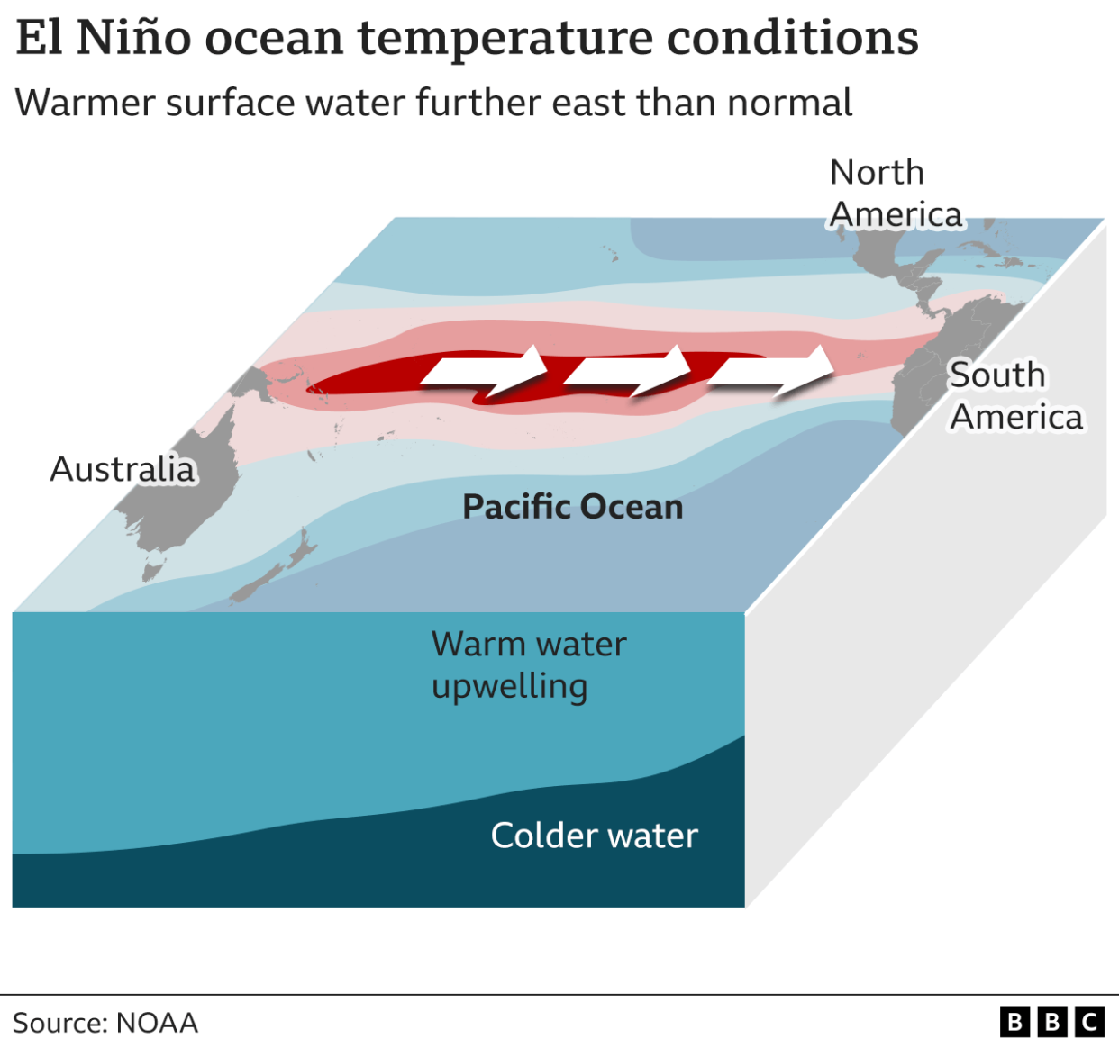
warmer-than-usual sea surface temperatures in the tropical eastern Pacific
above-normal atmospheric pressure at Darwin, Australia (western Pacific), and below-normal atmospheric pressure at Tahiti, French Polynesia (central Pacific)
![Four maps showing different stages of El Niño and La Niña. La Niña (October 2022) is marked by cool waters in the Pacific. El Niño conditions were emerging by May 2023 with warm waters in the East Pacific, and El Niño had strengthened by October 2023 as warm waters spread. In March 2024, waters had begun to cool as El Niño weakened. [April 2024]](https://s.yimg.com/ny/api/res/1.2/COWKey2MTBlMAEqDOa.y6A--/YXBwaWQ9aGlnaGxhbmRlcjt3PTEyNDI7aD0xODE2/https://media.zenfs.com/en/aol_bbc_articles_618/8cd0d5dc837e51a5b442e00a0c5db533)
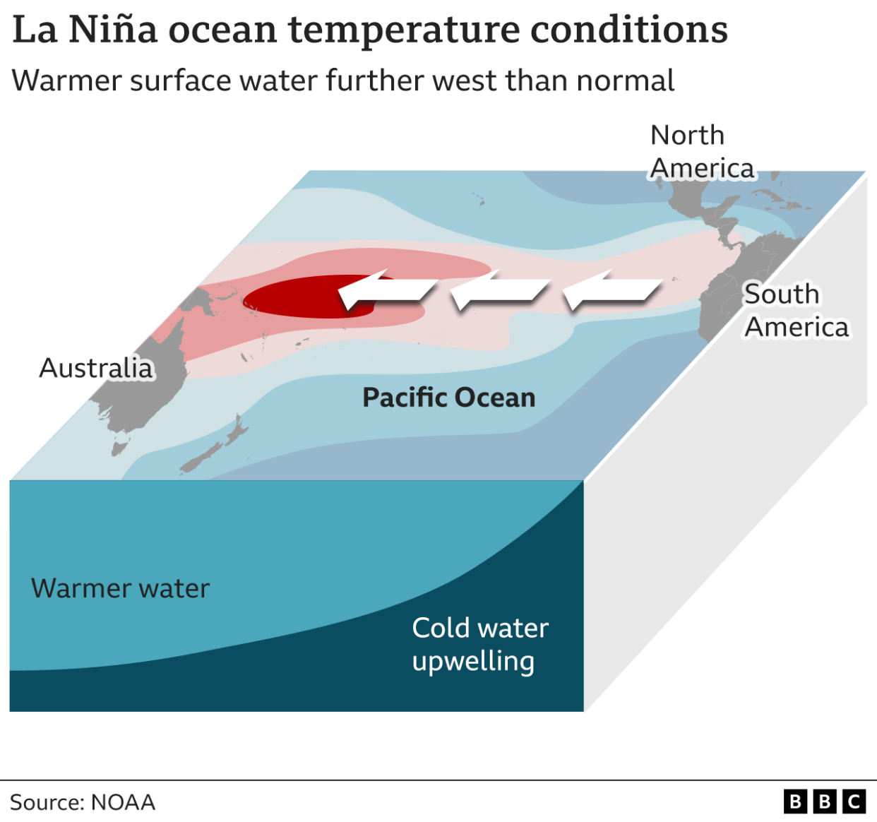
In "neutral" conditions, surface water in the Pacific Ocean is cooler in the east and warmer in the west.
The "trade winds" tend to blow east-to-west, and heat from the Sun progressively warms the waters as they move in this direction.
During El Niño events, these winds weaken or reverse, sending warm surface waters eastwards instead.
In La Niña periods, the normal east-to-west winds become stronger, pushing warmer waters further west.
This causes cold water to rise up - or "upwell" - from the depths of the ocean, meaning sea surface temperatures are cooler than usual in the east Pacific.
The phenomenon was first observed by Peruvian fisherman in the 1600s, who noticed that warm waters seemed to peak near the Americas in December.
They nicknamed it "El Niño de Navidad" - Christ Child in Spanish.
How do El Niño and La Niña change the weather?
Not every event is the same, and the consequences vary from region to region.
However, scientists have observed some common effects:
Temperatures
Global temperatures typically increase during an El Niño episode, and fall during La Niña.
El Niño means warmer water spreads further, and stays closer to the surface. This releases more heat into the atmosphere, creating wetter and warmer air.
But the regional effects are complicated, and some places may be both warmer and cooler than expected at different points in the year.
The hottest year on record, 2023, was boosted by El Niño conditions, on top of long-term human-caused climate change, and that warmth continued into 2024.
![Typical effects of El Nino events on temperature patterns for each region. Key trends include warming in South America, southeast Asia and southern Africa. Cooling in parts of North America. [June 2023]](https://s.yimg.com/ny/api/res/1.2/Qw__fyzutvh6V4V.g5jGaA--/YXBwaWQ9aGlnaGxhbmRlcjt3PTEyNDI7aD05Mzk-/https://media.zenfs.com/en/aol_bbc_articles_618/acb5a4d8e6bafcd7b752ba8ecb050316)
Between 2020 and 2022, the world experienced an unusually long period of La Niña conditions, which helped keep a lid on global temperatures.
How UK and Western European temperatures respond to El Niño is complicated and uncertain. It could mean colder than average winters, for example, but that depends how El Niño unfolds.
Changes to rainfall
During El Niño events, the warmer water pushes the Pacific jet stream's strong air currents further to the south and the east.
This brings wetter weather to southern USA and the Gulf of Mexico.
Tropical regions like southeast Asia, Australia and central Africa typically experience drier conditions.
Under La Niña, the effect is reversed.
![Typical effects of El Nino events on precipitation patterns for each region. Key trends are drying in many equatorial regions (northern South America, central Africa, southeast Asia and Australia). Southern USA generally becomes wetter than normal. [June 2023]](https://s.yimg.com/ny/api/res/1.2/ToTlVlcQjpnKl3OqBeqynA--/YXBwaWQ9aGlnaGxhbmRlcjt3PTEyNDI7aD05Mzk-/https://media.zenfs.com/en/aol_bbc_articles_618/fed288a531429fadfdaf750cef37f689)
Tropical storms
El Niño also affects atmospheric circulation patterns, which means there are generally more tropical storms in the tropical Pacific, but fewer in the tropical Atlantic, including the southern US.
During La Niña, the reverse is typically true.
Carbon dioxide (CO2) levels
Scientists have also observed that CO2 levels in the atmosphere increase during El Niño events, possibly as a result of warmer and drier conditions in tropical regions.
If plants grow less quickly due to drought, they absorb less CO2, while more wildfires in places like South Asia mean more CO2 is released.
Why do the El Niño and La Niña climate patterns matter?
The extreme weather events worsened by El Niño and La Niña affect infrastructure, food and energy systems around the world.
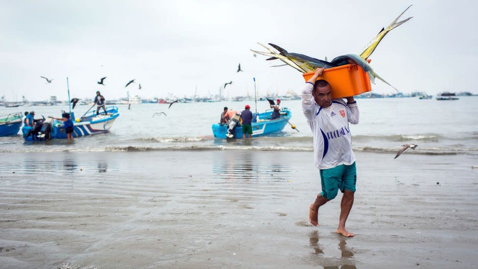
For example, when less cold water comes to the surface off the west coast of South America during El Niño events, fewer nutrients rise from the bottom of the ocean.
That means there is less food available for marine species like squid and salmon, in turn reducing stocks for South American fishing communities.
The droughts and flooding caused by the extreme 2015-16 El Niño event affected the food security of more than 60 million people, according to the UN Food and Agricultural Organisation.
A recent study suggested that El Niño events significantly reduce global economic growth, an effect which could intensify in the future.
How often do El Niño and La Niña episodes happen?
El Niño and La Niña episodes typically occur every two to seven years, and usually last nine to 12 months.
They don't necessarily alternate: La Niña events are less common than El Niño episodes.
Is climate change affecting El Niño/La Niña?
In 2021, the UN's climate scientists, the IPCC, said the ENSO events which have occurred since 1950 are stronger than those observed between 1850 and 1950.
But it also said that tree rings and other historical evidence show there have been variations in the frequency and strength of these episodes since the 1400s.
The IPCC concluded there is no clear evidence that climate change has affected these events.
Some climate models suggest that El Niño events will become more frequent and more intense as a result of global warming - potentially boosting temperatures further - but this is not certain.
Graphics by Visual Journalism team.
