Eastern KY will remain prone to flooding. Why the state isn’t doing enough to adapt
Historically devastating flash floods and mudslides across swaths of East Kentucky this week again highlight how geographically vulnerable the region is to the impact of increased precipitation amid a changing climate.
“There are a lot of people in Eastern Kentucky on top of roofs, waiting to be rescued,” Gov. Andy Beshear said in a Thursday morning news conference. Saying he expects deaths to reach double digits, the governor called it among the “worst, most devastating flooding events in Kentucky’s history.”
These floods serve as a reminder that, though flooding is Kentucky’s most common and costliest natural disaster, there is no comprehensive statewide mitigation plan for communities to rely on. There’s also no uniform funding model for at-risk communities, where resiliency studies and infrastructure to offset the severity of these natural disasters are dire needs.
“We’ve got to invest in more infrastructure (and) resiliency,” Beshear said Thursday.
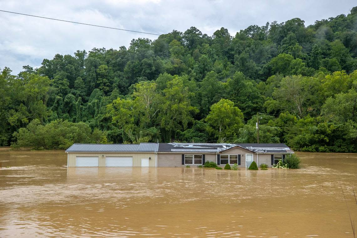
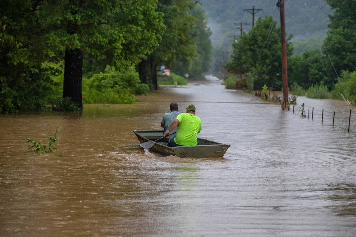
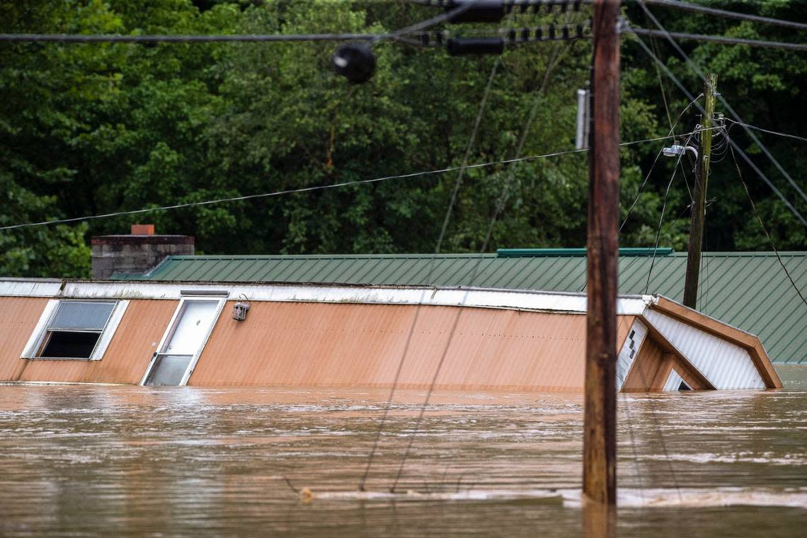
Heavy rainfall Wednesday evening into Thursday morning swelled rivers and streams across Eastern Kentucky, pooling in valleys and surging over roadways and across parking lots. Many residents were marooned in their homes, some left to scramble to roofs and hillsides to avoid the still-rising water through the morning. Emergency responders took to boats as many roads were made impassable.
Flooding has long been a part of life in this region, where many towns and cities were built in tight valleys between rolling hills and mountains with steep ridgelines — topography that, when saturated with rain, functions like a clay bowl, filling up from the bottom and draining off hillsides that increasingly slough off into landslides.
“You have so little flat ground. It’s steep terrain. The valleys are fairly narrow. When it rains heavily, there’s a lot of runoff quickly,” said Dr. Bill Haneberg, the state geologist of Kentucky and Director of the Kentucky Geological Survey. “About the only places to build have been in valleys, and so much of those are in floodplains. It’s just a matter of not being able to get out of the way.”
“When people talk about risk reduction, one of the first things we always say is, ‘avoid the problem,’” said Haneberg, who’s also a professor of earth sciences at the University of Kentucky. “But we’re in a situation where you can’t, because where do you go?”
This impact is exacerbated by a lack of flooding mitigation infrastructure. In many small former coal towns where municipal governments already have limited operating budgets, installing enhanced drainage systems or investing in resilience studies are prohibitively expensive.
These damaging floods are happening more often, but it takes months, sometimes years, for counties to see full reimbursements from the Federal Emergency Management Agency. In the meantime, county governments often pull from their own coffers for repairs, leaving little to no extra money to prepare for future floods.
Floyd County Judge Executive Robbie Williams had to pull money from his budget in March 2021 to front the cost of more immediate repairs from a flood that caused $3.5 million in damage while he waited for FEMA’s reimbursement.
“That tapped us,” he told the Herald-Leader in January. In anticipation of the next big storm, “we had to take out a line of credit.”
Gutted by industry and economic loss, many communities also contend with a low social resiliency, as the FEMA defines it, which is yet another obstacle in a community’s recovery from a damaging flood.
As the climate continues warming it will bring more rainfall to Kentucky, increasing the frequency and scale of flooding in a dangerously vulnerable region. Many of the counties that flooded in Kentucky on Wednesday and Thursday — Letcher, Owsley, Breathitt, Leslie, Floyd, Perry, Knott, Pike and Magoffin — already rank as some of the most at-risk for severe rainfall-induced flooding in the country, according to First Street Foundation, a nonprofit flood research and communications group that tracks property-level flood risks. Most of the counties that face the biggest risk have no significant mitigation measures in place.
In Perry County, half of the roughly 10,500 residential homes are at “extreme risk” of flooding over the next 30 years, according to the group. Nearly 65% of the county’s near-1,200 miles of road are at extreme risk of becoming impassable from flooding. That threat is even higher in adjacent Breathitt County, where 65% of all homes and 71% of roadways face the highest known risk.
In 2018, Kentucky released a Risk Assessment and Hazard Mitigation Plan superficially outlining risks at the community level, but there’s no comprehensive statewide guidebook for how counties should adapt to this growing threat, or where they can look for resources, leaving individual counties to mostly fend for themselves.
Haneberg is part of a team drafting an updated version of that plan, set to be released sometime this year. He’s also part of a research group tasked by FEMA to use airborne laser scanning and study topography across the Big Sandy Area Development District — Pike, Magoffin, Johnson, Floyd and Martin counties — to map landslide susceptibility and gauge where the greatest threats are to residents and community infrastructure. The goal is to use those findings to help Big Sandy draft a localized disaster mitigation plan, Haneberg said.
This research, while helpful, is piecemeal. That’s in part because Kentucky and its public universities haven’t concertedly invested in climate research or adaptive solutions.
“We don’t really have climate people. You look around in Kentucky, and we don’t really have those assets in the public sphere,” Haneberg said of public university researchers. “We don’t have anyone here doing state-of-the-art flood modeling. That, to me, is a big weakness.”