Storms are coming to Knoxville and East Tennessee. When we might see hail or tornadoes
The severe weather risk for East Tennessee has been upgraded to "enhanced," which means residents could face more persistent and widespread bad weather, as well as a few intense storms, starting this afternoon.
"Severe weather and flash flooding are expected across the region this afternoon and tonight," The National Weather Service's Morristown office posted. "The risk of flash flooding has also been on the increase, and a Flood watch has been issued."
The Morristown office posted weather maps that show much of the region as far east as Johnson City under a 30-44% chance of severe wind, over 58 mph. Knoxville faces a similar probability of severe hail of more than an inch in diameter.
The likelihood of a tornado in the area, meanwhile, is rated at 5-9% as of this morning.
What is the timing of the storms in Knoxville and East Tennessee?
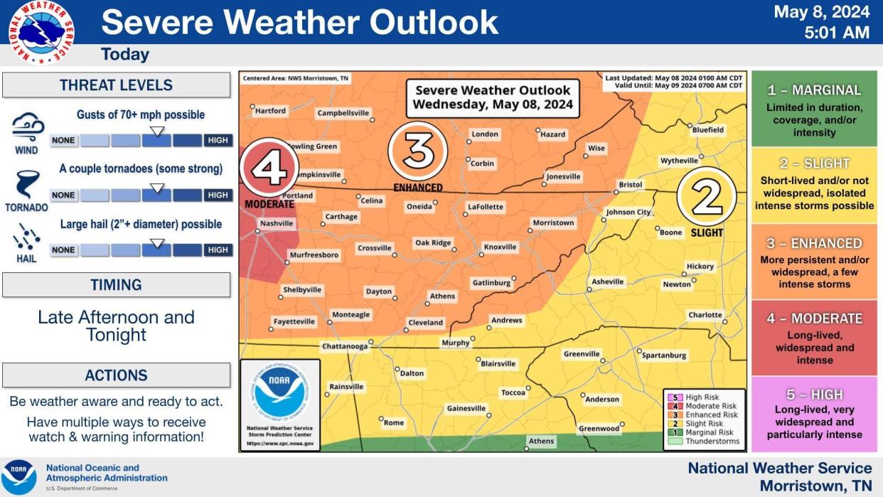
The most severe weather is expected to hit as early as 1 p.m. in Sunbright (which was hit by serious tornado damage in April) and LaFollette, with a 2 p.m. start to the south of that in a swath from Kingston to Kingsport.
The brunt of the stormy weather is likely to hit between 7 p.m. and 1 a.m. in Knoxville, the weather service said. It should be clearing the region by 5 a.m.
A flood watch is in effect from 2 p.m. through the morning of May 9. Flooding caused by excessive rainfall is possible, particularly in poor drainage and urban areas, the weather service said.
East Tennessee residents could see tornadoes overnight
The severe thunderstorms will be capable of producing damaging winds and tornadoes, the weather service warned.
"Remain vigilant and aware of any current watches," the weather service posted, offering tips that included creating a communication plan for family members and mapping an evacuation route.
During this storm, any potential tornadoes could crop up long after residents have gone to bed. That's not unusual for East Tennessee, meteorologists say.
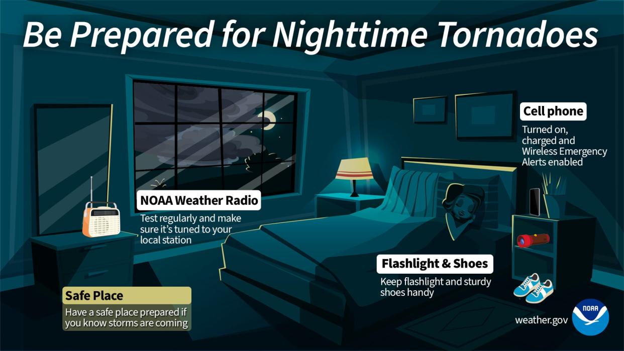
To stay current on tornado warnings, buy a digital weather radio. Also, sign up for the county's emergency warning system, which sends alerts by text, email or voice phone call. Users can choose the locations for alerts, such as a home or work address.
To register for the emergency warning service, sign up for the system by going to https://knoxcounty.org/alert/index.php. You can also sign up by calling 311 or 865-215-4311.
Knoxville weather radar

Liz Kellar is a Tennessee Connect reporter. Email liz.kellar@knoxnews.com.
Support strong local journalism by subscribing at knoxnews.com/subscribe.
This article originally appeared on Knoxville News Sentinel: Knoxville area weather: Severe storm, flash flooding risk increases
