These Coventry trails are perfect paths to get back into spring hiking season
The weather is warming up, the trails have dried out and the trees are filling in.
If you haven’t spent much time outdoors yet, now is the perfect time to start the spring hiking season.
Here are a couple of short trails in Coventry to get you going. Though they’re distinctly different, both include walks on well-marked paths through pine and hardwood forests to wonderful water views.
Enjoy!
Whipple Conservation Area
The Merrill S. Whipple Conservation Area is a natural sanctuary of wooded paths and fields surrounded by busy commercial strips and houses. One bonus in the preserve is 1,400 contiguous feet of waterfront along the Pawtuxet River, still running high with all the rain this spring.
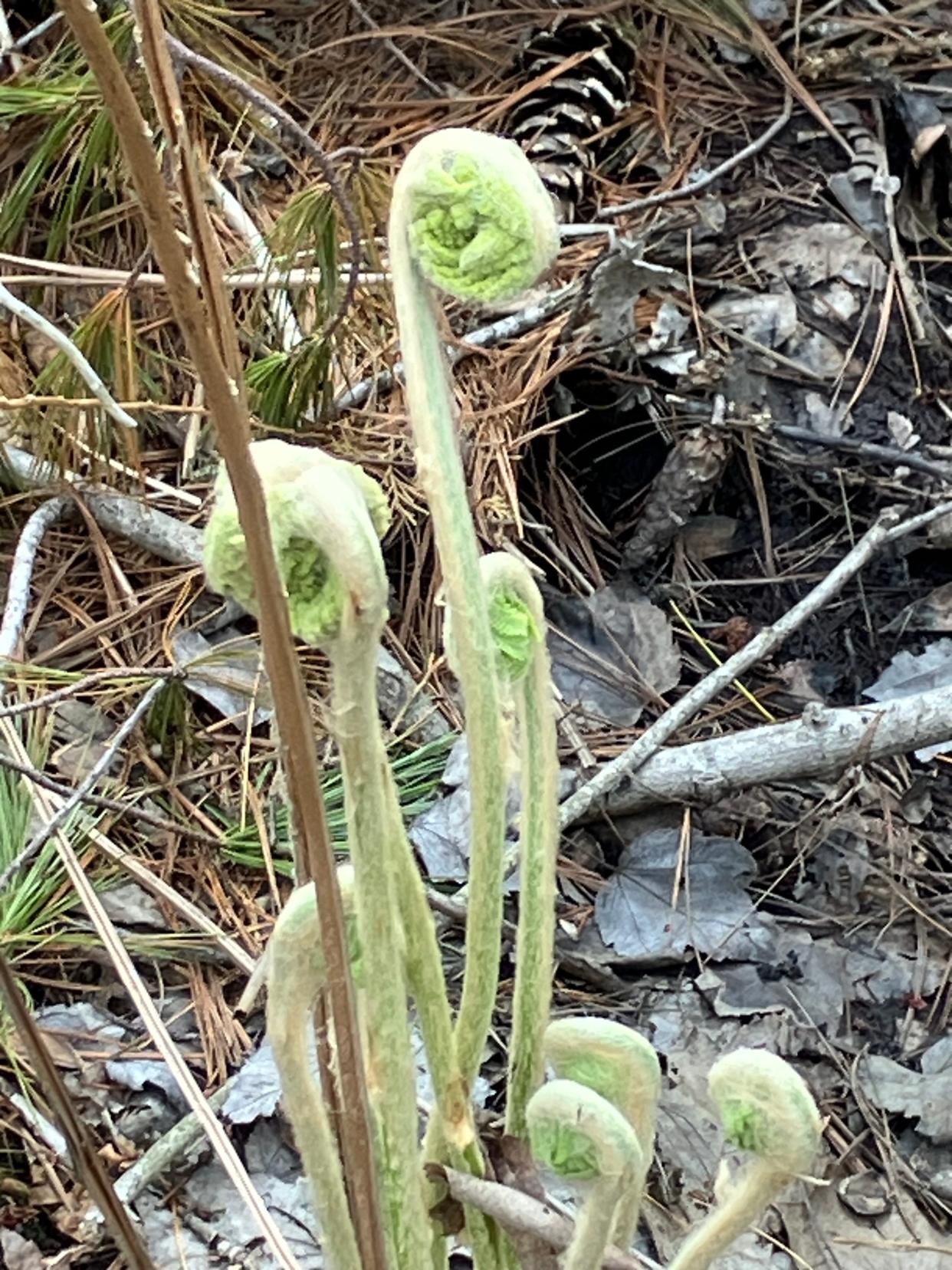
A good look at the river comes at an overlook at the end of a long, wooden-slat boardwalk that crosses wetlands spotted with fiddlehead ferns and bright-green skunk cabbage and runs through thickets filled with tweets from songbirds.
The 56-acre preserve is made up of three parcels, including 29 acres once owned by the Whipples, a prominent Coventry family, and the first acquisition of the Coventry Land Trust, established in 1999. The other land includes the former Hope Tutsch property, once owned by another well-known local family, and an area to the west called Sandy Acres.
I set out from the trailhead off Route 117, walked by a wood-post fence and followed a grassy corridor with buildings on both sides. At a short bridge over a stream, I turned left into what’s called Hope Meadow and spotted a huge historical cemetery on a hillside. Several members of the Whipple family, whose roots in Coventry date to the 1700s, are buried there.
After inspecting the headstones, I walked south and crossed a large field that may have once been a farm pasture and is dotted with cedar trees. The path then ran through an oak and pine forest and soon reached the banks of the Pawtuxet River, which was meandering east. I took a right and followed a yellow-blazed trail covered with wood chips that passed several vernal pools, and shallow depressions in the earth that fill with water and serve as breeding grounds for salamanders, other amphibians and aquatic insects.
The trail entered the western portion of the preserve, which is covered with wetlands, and passed by a red maple swamp and Atlantic white cedar trees.
“These are sensitive and seasonally flooded habitats that are uncommon,” said Jenna O'del, an associate wildlife biologist and vice chair of the Coventry Land Trust. “White cedar is rare, and prefers acidic environments that many other plants cannot survive in.”
The trail took me to a 3½-foot-wide boardwalk built by the Coventry Department of Parks and Recreation. The ADA-compliant walkway rises several feet above the wetlands and is supported by wooden beams on concrete anchors. It’s an impressive structure.
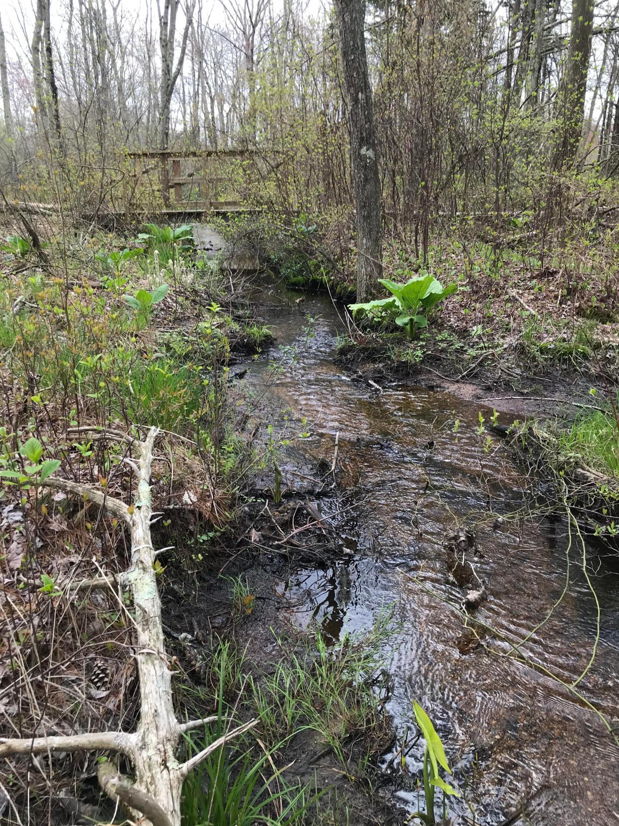
The boardwalk crosses a bridge over a stream that flows to the river and runs to another trailhead and parking lot at Sandy Bottom Road.
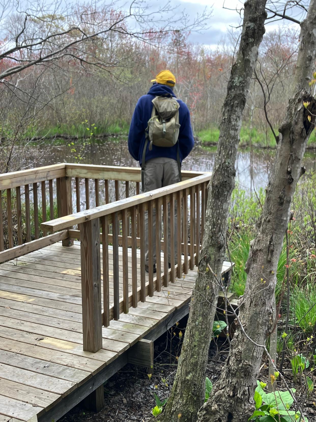
Turning around, I retraced my steps and took a right on a section of the boardwalk that led to an overlook with a wooden railing and benches. I rested and watched the southern branch of the Pawtuxet River, which flows east for about 15 miles before emptying into Narragansett Bay at Pawtuxet Village.
After studying the river, I returned to the main boardwalk and noted bird boxes hung from the trees.
When the walkway ended, I went east on a wide, soft path lined with pine cones. The river was on the right.
The path crossed a stream on a bridge with the words “Best Buddy Bridge” carved in the wood. Small metal plates on the bridge bear names of pets who have visited, such as Bella, Sadie and Miley.
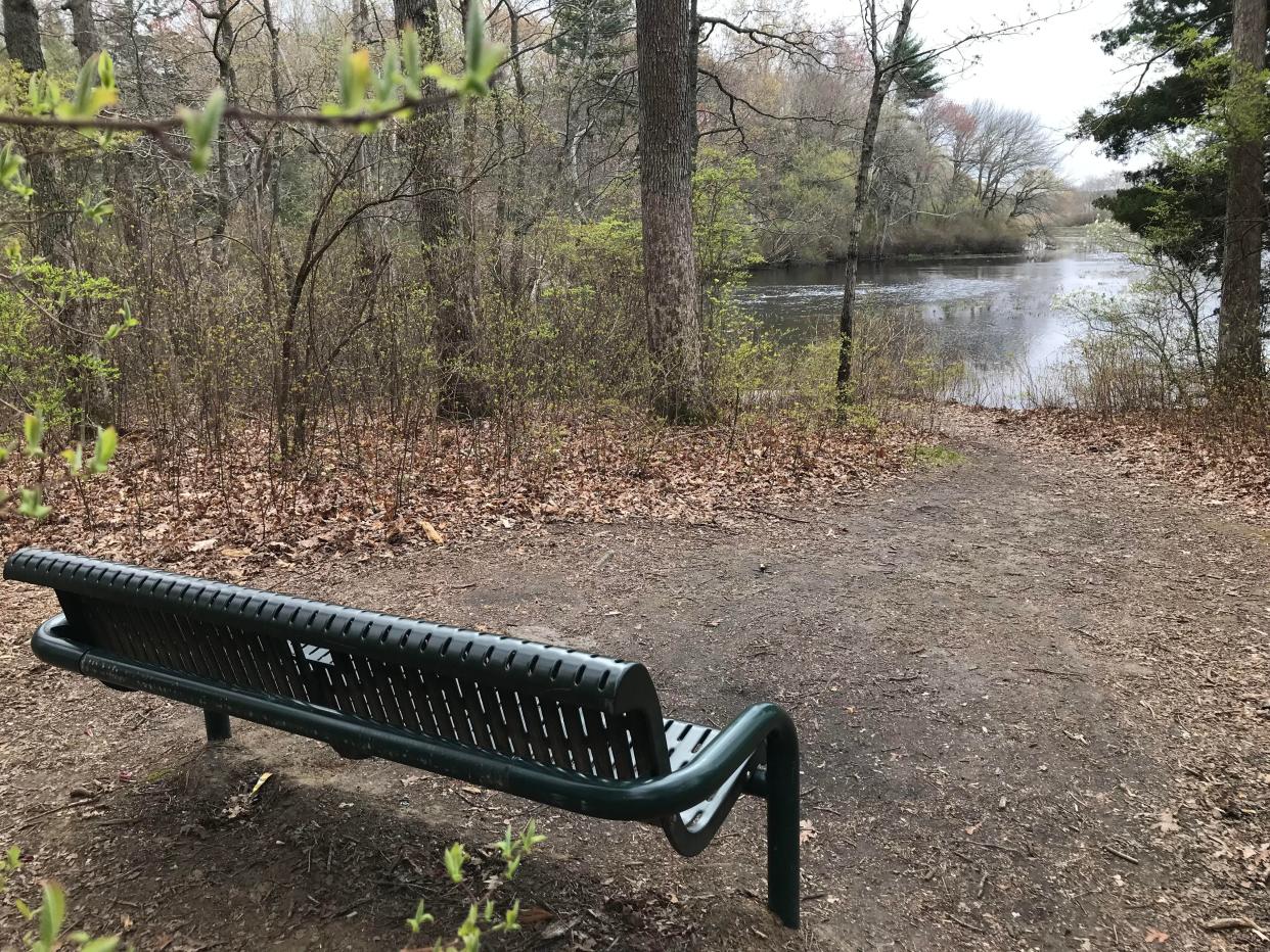
Continuing on, I took a side spur on the right to a metal bench on the riverbank and then followed the trail as it turned inland and north, with water on the right. I saw ducks and a pair of swans on the water. A flock of geese honked overhead.
The path led to an opening to the paved Coventry Greenway, also called the Trestle Trail. Several cyclists, dog walkers and joggers passed by.
I turned around and after a few steps took a right at a large outcropping stenciled with red paint in the shape of a devil. The trail ran down an old dirt road with some mounds used for jumps by dirt bike riders. I passed by a large, cleared area with the remains of a campfire and log benches around it. I walked back to the field I had passed earlier and returned to the trailhead.
In all, I walked 2 miles over 90 minutes.
The interconnected trails in the Whipple Preserve allow for short walks or longer hikes. But whatever you choose, don’t miss the boardwalk over the wetlands. It’s a great place to relax and take a good long look at the river.
Access: Off Route 117 heading west, the trailhead is on the left just after the overpass for the bike path but before the intersection with Sandy Bottom Road.
Parking: Available in a small lot off Route 117 or in a paved lot off Sandy Bottom Road.
Difficulty: Easy
Dogs: Allowed but must be leashed.
GPS Coordinates: 41.70115, -71.55848
Stella Hall Conservation Area
Stands of yellow birch and small, bright green pine trees line a sandy path that hugs the east bank of Stump Pond in the Stella Hall Conservation Area.
At breaks in the trees, there are glimpses of the pond, dotted with the mossy green tops of dozens of stumps just offshore. A wider look at the pond comes at the end of a footpath on a peninsula at the northern end of the 71-acre property, which was acquired by the Coventry Land Trust in 2007. George and Stella Hall, members of a prominent Coventry family, once owned the land.
I set out by walking by a kiosk with a map and other information and stepped around a chain strung between two concrete blocks. I followed the yellow-blazed trail on a wide, old road slightly uphill on a ridge lined with dense pine and hardwood trees. There were lowlands below the trail on both sides of the road.
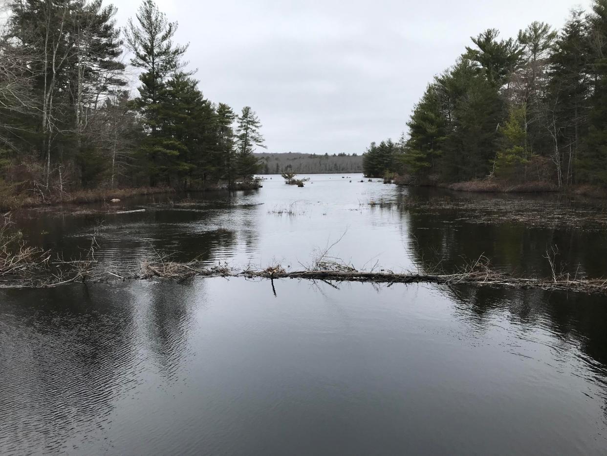
After a short distance, a side road on the left breaks downhill and I took it to a large, flat clearing at the edge of a waterway that feeds the pond. Beavers have gnawed to a point many trees on the shore and used the logs and branches to build two dams that have caused flooding upstream.
Just off the road in the wetlands is an Atlantic white cedar swamp.
Returning to the main trail, the road passes a pine barren made up of a mix of pitch pine, white pine and scrub oak trees.
Hikers have also identified on the forest floor of pine needles, leaves and small plants a unique, large patch of Icelandic lichen. The large size of the lichen indicates it’s been growing there for quite a while.
The trail narrowed, turned to white sand and continued for a distance along the shoreline of Stump Pond. Locals say the pond may have been dredged years ago for iron ore and the dredged material was dumped on shore, creating the sandy terrain.
Several openings in the trees lead to fishing spots. I paused for a good look at the lily pads and stumps in the shallow water and spotted a small, tree-covered island not far offshore.
When the blazed trail ended, I took a footpath that ran through some thick brambles to the northern point of a peninsula that stretches into the water. I scanned the undeveloped, tree-lined far bank and also saw some cottages on a hillside on the northeast end of the pond.
To the east is a large, undisturbed natural area – called a shrub swamp – with a thick organic layer interspersed with shrubs on mossy tussocks. The thickness of the shrubs gives cover for prey animals, while the vegetation provides forage.
As I studied the landscape, a hawk swooped overhead.
After studying the pond and listening to some tweets from birds in the bushes, I turned and retraced my steps with Stump Pond now on my right. I took some time on my way back to note the variety of trees in the preserve – maples, oaks, pitch pines, red cedars, hemlocks and beeches.
After I passed the sideroad that led to the beaver activity, I took a path on the right that started as a road and turned into a footpath. It looped over a wooded ridge and returned to the main trail, just a few feet from where I started.
In all, I walked 1.4 miles for 45 minutes.
I hope to return to the preserve to take a closer look at the rare trees, vegetation and habitat and also to check on what the beavers are up to.
Access: From Phillips Hill Road headed south, the trailhead is on the right.
Parking: Available in a turnout just south of the trailhead.
Dogs: Allowed but must be leashed.
Difficulty: Easy on wide roads and footpaths.
GPS Coordinates: 41.68738, -71.63718:
Walking Rhode Island book events
John Kostrzewa’s book, “Walking Rhode Island: 40 Hikes for Nature and History Lovers with Pictures, GPS Coordinates and Trail Maps,” is available at local booksellers and at Amazon.com. He’ll sell and sign books after the following presentations:
Wednesday, May 15: Walking for Your Health, with Dr. Michael Fine, William Hall Library, Cranston, 6:30 p.m. Register here: https://events.cranstonlibrary.org/event/12186694
Thursday, May 23: Greene Public Library, Coventry, 6:30 p.m.
Thursday, June 13: Rhode Island Night, with Martin Podskoch, author of “Rhode Island Civilian Conservation Corps Camps,” sponsored by the Association of Rhode Island Authors at Borealis Coffee Company, Bristol, 7 p.m. to 9 p.m.
Tuesday, June 18: North Kingstown Free Library, 6:30 p.m.
This article originally appeared on The Providence Journal: Walking RI: Coventry offers a pair of short hikes perfect for spring
