Cool front for Palm Beach County preceded by winds gusting to 40 mph
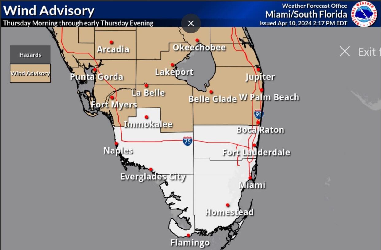
The National Weather Service in Miami has issued a wind advisory for Thursday as an approaching cool front could spur 40-mph gusts in Palm Beach County and push temperatures to near 90 degrees.
The advisory, which is in effect from 10 a.m. to 8 p.m. Thursday, warns of the potential for downed tree limbs and power outages with the strongest gales. Sustained winds are forecast to reach up to 25 mph. Tropical storm-strength winds start at a sustained 39 mph.
Will Redman, a meteorologist with the NWS in Miami, said the winds will be out of the south, pumping in warm tropical air that will make it feel more like deep summer than April.
2024 hurricane season: More storms expected as La Niña and warm waters combine
The official prediction for Palm Beach International Airport is a 90-degree high Thursday. That's eight degrees above normal but unlikely to break the 95-degree record holder for April 11, which was set in 1953.
There is also a high surf advisory and a high risk of rip currents at Palm Beach County beaches through Thursday evening.
An area of low pressure over the northern Gulf of Mexico moving swiftly toward the Great Lakes is the cause of the late-season front, which Redman said could be partially attributed to a waning El Niño keeping storm tracks at southerly latitudes.

North and Central Florida could experience severe weather from the front, but it is expected to be mostly tamed by the time it reaches South Florida overnight Thursday.
Already this month there was a 92-degree day on April 3 ahead of a cool front. In March two 90-degree days also preceded a cool front that dropped overnight lows into the upper 50s.
Hurricane lingo you should know: What’s an invest and why do they keep saying tropical cyclone?
"It's not officially wet season yet so it's also still possible to see these types of fronts," Redman said.
Rainy season in South Florida begins May 15 and runs through Oct. 15.
Redman said there won't be much of a cool-down following this week's front. Friday is forecast to reach a high of 83 degrees with an overnight low of 64, both of which are about normal for this time of year.
There will, however, be a push of drier air as the winds turn out of the north early Friday, and that could last through the weekend.
Kimberly Miller is a veteran journalist for The Palm Beach Post, part of the USA Today Network of Florida. She covers real estate and how growth affects South Florida's environment. Subscribe to The Dirt for a weekly real estate roundup. If you have news tips, please send them to kmiller@pbpost.com. Help support our local journalism, subscribe today.
This article originally appeared on Palm Beach Post: Cold front reaches Palm Beach County overnight Thursday bringing in drier air
